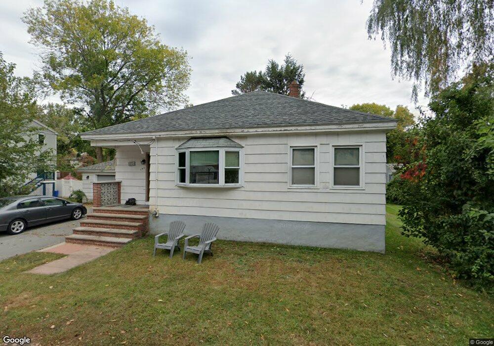
190 Merrimack Rd Methuen, MA 01844
The East End NeighborhoodEstimated Value: $470,000 - $525,000
3
Beds
1
Bath
1,134
Sq Ft
$443/Sq Ft
Est. Value
About This Home
This home is located at 190 Merrimack Rd, Methuen, MA 01844 and is currently estimated at $502,083, approximately $442 per square foot. 190 Merrimack Rd is a home located in Essex County with nearby schools including Timony Grammar School, Methuen High School, and Community Day Charter Public School - Gateway.
Ownership History
Date
Name
Owned For
Owner Type
Purchase Details
Closed on
Aug 3, 2004
Sold by
Cormier James and Cormier Rosa
Bought by
Cormier Rosa
Current Estimated Value
Purchase Details
Closed on
Nov 13, 2001
Sold by
Ganley John A and Ganley Linda
Bought by
Cormier Rosa and Cormier James
Create a Home Valuation Report for This Property
The Home Valuation Report is an in-depth analysis detailing your home's value as well as a comparison with similar homes in the area
Home Values in the Area
Average Home Value in this Area
Purchase History
| Date | Buyer | Sale Price | Title Company |
|---|---|---|---|
| Cormier Rosa | -- | -- | |
| Cormier Rosa | -- | -- | |
| Cormier Rosa | $196,000 | -- | |
| Cormier Rosa | $196,000 | -- |
Source: Public Records
Mortgage History
| Date | Status | Borrower | Loan Amount |
|---|---|---|---|
| Open | Cormier Rosa | $178,300 | |
| Previous Owner | Cormier Rosa | $173,000 |
Source: Public Records
Tax History
| Year | Tax Paid | Tax Assessment Tax Assessment Total Assessment is a certain percentage of the fair market value that is determined by local assessors to be the total taxable value of land and additions on the property. | Land | Improvement |
|---|---|---|---|---|
| 2025 | $4,571 | $432,000 | $206,000 | $226,000 |
| 2024 | $4,495 | $413,900 | $187,900 | $226,000 |
| 2023 | $4,260 | $364,100 | $167,000 | $197,100 |
| 2022 | $4,079 | $312,600 | $139,200 | $173,400 |
| 2021 | $3,828 | $290,200 | $132,200 | $158,000 |
| 2020 | $3,820 | $284,200 | $132,200 | $152,000 |
| 2019 | $3,567 | $251,400 | $118,300 | $133,100 |
| 2018 | $3,486 | $244,300 | $118,300 | $126,000 |
| 2017 | $3,387 | $231,200 | $118,300 | $112,900 |
| 2016 | $3,235 | $218,400 | $111,400 | $107,000 |
| 2015 | $3,138 | $214,900 | $111,400 | $103,500 |
Source: Public Records
Map
Nearby Homes
- 1 Riverview Blvd Unit 8-203
- 1 Riverview Blvd Unit 3-8
- 3 Thissell St
- 21 Oak St Unit A
- 264 E Haverhill St Unit 2
- 106 Leroy Ave
- 18 Erhardt Terrace
- 68 Ashford St
- 2 Leslie St
- 80 Ferry St Unit 80A
- 12 Annette St
- 39 Swan Ave
- 144 Ferry St
- 27 Woodland Ct
- 86 Comet Rd
- 0 Great Pond Rd
- 60 Ames St
- 385 Sutton St
- 19-21 Pleasant Terrace
- 52 Howard St
- 186 Merrimack Rd
- 185 Merrimack Rd Unit 187
- 185 Merrimack Rd Unit B
- 185 Merrimack Rd
- 185 Merrimack Rd Unit 1
- 185 Merrimack Rd Unit A
- 185 Merrimack Rd Unit B
- 191 Merrimack Rd
- 193 Merrimack Rd
- 191 Merrimack Rd Unit 191
- 191 Merrimack Rd Unit 2
- 191 Merrimack Rd Unit 1
- 187 Merrimack Rd
- 187 Merrimack Rd Unit B
- 184 Merrimack Rd
- 163 Bay State Rd
- 195 Merrimack Rd
- 21 Riverview Blvd
- 183 Bay State Rd
- 125 Merrimack Rd
Your Personal Tour Guide
Ask me questions while you tour the home.