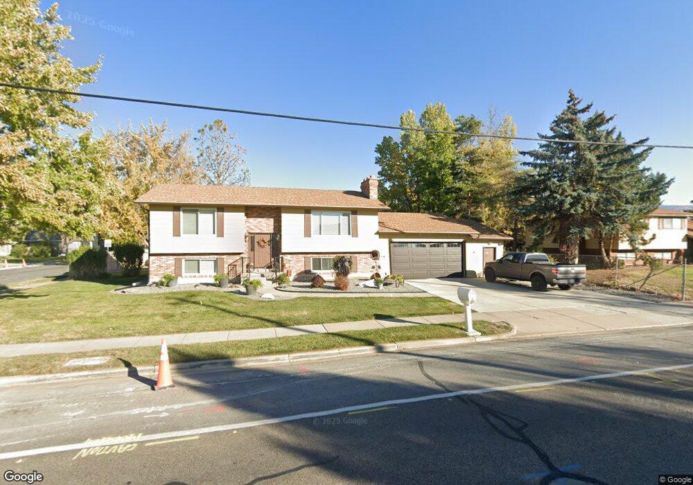
190 N 1100 W West Bountiful, UT 84087
Estimated Value: $517,000 - $537,464
4
Beds
2
Baths
2,400
Sq Ft
$221/Sq Ft
Est. Value
About This Home
This home is located at 190 N 1100 W, West Bountiful, UT 84087 and is currently estimated at $530,116, approximately $220 per square foot. 190 N 1100 W is a home located in Davis County with nearby schools including West Bountiful Elementary School, Bountiful Junior High School, and Viewmont High School.
Ownership History
Date
Name
Owned For
Owner Type
Purchase Details
Closed on
Jan 28, 2016
Sold by
Derr Amber C
Bought by
Holly Ferining & Marketing Co Woods Cros
Current Estimated Value
Purchase Details
Closed on
Oct 30, 2003
Sold by
Derr Amber C
Bought by
Derr Amber C and Mcclellan Jeffrey S
Home Financials for this Owner
Home Financials are based on the most recent Mortgage that was taken out on this home.
Original Mortgage
$108,200
Interest Rate
5.98%
Mortgage Type
Purchase Money Mortgage
Purchase Details
Closed on
Oct 27, 2003
Sold by
Winn Kathryn J and Winn Thomas E
Bought by
Derr Amber C
Home Financials for this Owner
Home Financials are based on the most recent Mortgage that was taken out on this home.
Original Mortgage
$108,200
Interest Rate
5.98%
Mortgage Type
Purchase Money Mortgage
Purchase Details
Closed on
Oct 18, 2002
Sold by
Winn Thomas E and Winn Kathryn J
Bought by
Winn Kathryn J and Winn Thomas E
Create a Home Valuation Report for This Property
The Home Valuation Report is an in-depth analysis detailing your home's value as well as a comparison with similar homes in the area
Home Values in the Area
Average Home Value in this Area
Purchase History
| Date | Buyer | Sale Price | Title Company |
|---|---|---|---|
| Holly Ferining & Marketing Co Woods Cros | -- | Northwest Title | |
| Derr Amber C | -- | First American Title Co | |
| Derr Amber C | -- | First American Title Co | |
| Winn Kathryn J | -- | -- |
Source: Public Records
Mortgage History
| Date | Status | Borrower | Loan Amount |
|---|---|---|---|
| Previous Owner | Derr Amber C | $108,200 |
Source: Public Records
Tax History Compared to Growth
Tax History
| Year | Tax Paid | Tax Assessment Tax Assessment Total Assessment is a certain percentage of the fair market value that is determined by local assessors to be the total taxable value of land and additions on the property. | Land | Improvement |
|---|---|---|---|---|
| 2025 | $3,108 | $270,600 | $116,250 | $154,350 |
| 2024 | $3,049 | $272,799 | $95,499 | $177,300 |
| 2023 | $2,913 | $262,900 | $110,820 | $152,079 |
| 2022 | $2,873 | $479,000 | $174,632 | $304,368 |
| 2021 | $2,489 | $349,000 | $128,470 | $220,530 |
| 2020 | $2,216 | $307,000 | $120,065 | $186,935 |
| 2019 | $2,172 | $298,000 | $121,835 | $176,165 |
| 2018 | $2,027 | $274,000 | $123,084 | $150,916 |
| 2016 | $1,730 | $126,885 | $31,258 | $95,627 |
| 2015 | $1,682 | $117,370 | $31,258 | $86,112 |
| 2014 | $1,605 | $115,187 | $30,990 | $84,197 |
| 2013 | -- | $100,212 | $27,242 | $72,970 |
Source: Public Records
Map
Nearby Homes
- 280 N 1100 W
- 767 W 220 N
- Carson Plan at Amberly Place
- 2050 Farmhouse Plan at Amberly Place
- Pasadena (Inactive) Plan at Amberly Place
- Portland Plan at Amberly Place
- 1075 W Audrey Ln Unit 6
- 1067 W Audrey Ln Unit 8
- 1072 W Audrey Ln Unit 17
- 1064 W Audrey Ln Unit 15
- 1056 W Audrey Ln Unit 14
- 1069 W Linden Ln Unit 31
- 680 W 500 S Unit 22
- 680 W 500 S Unit 17
- 825 W 1320 N
- 1309 W 1200 S
- 1288 S 1050 W
- 758 W 1000 S
- 1334 W 1300 S
- 743 W 1000 S