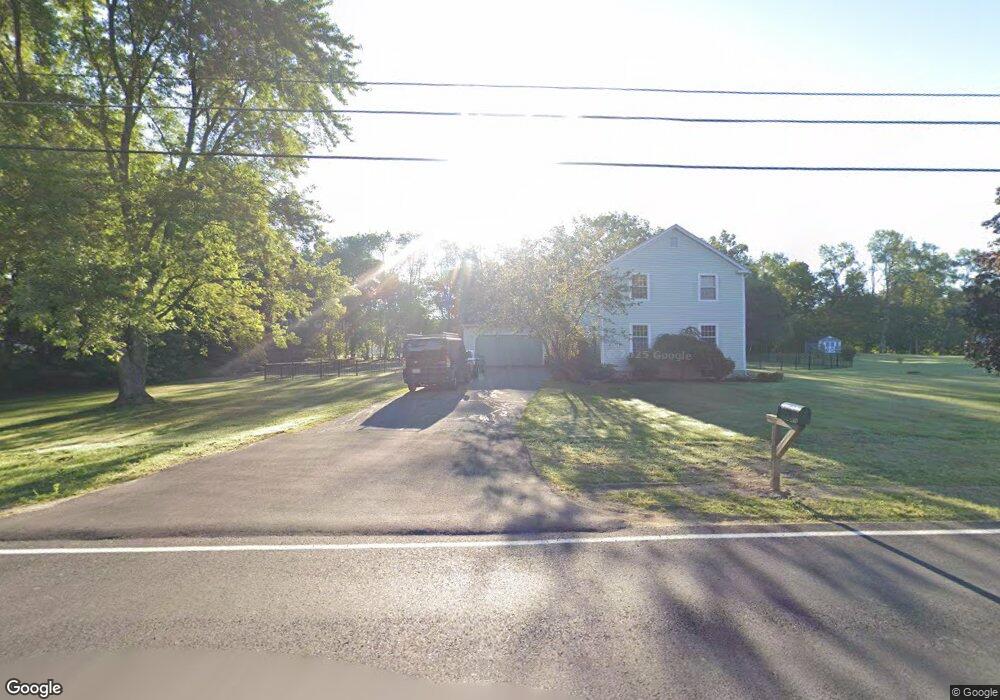
190 Orchard Rd Dalton, MA 01226
Estimated Value: $489,548 - $564,000
4
Beds
3
Baths
2,907
Sq Ft
$176/Sq Ft
Est. Value
About This Home
This home is located at 190 Orchard Rd, Dalton, MA 01226 and is currently estimated at $511,637, approximately $176 per square foot. 190 Orchard Rd is a home located in Berkshire County with nearby schools including Wahconah Regional High School and St. Agnes Academy.
Ownership History
Date
Name
Owned For
Owner Type
Purchase Details
Closed on
May 25, 2011
Sold by
Weinstock Leonard
Bought by
Leonard Weinstock Lt and Weinstock Leonard
Current Estimated Value
Purchase Details
Closed on
Apr 21, 1989
Sold by
Reeves Charles M
Bought by
Lussier Alan O
Home Financials for this Owner
Home Financials are based on the most recent Mortgage that was taken out on this home.
Original Mortgage
$110,000
Interest Rate
10.79%
Mortgage Type
Purchase Money Mortgage
Create a Home Valuation Report for This Property
The Home Valuation Report is an in-depth analysis detailing your home's value as well as a comparison with similar homes in the area
Home Values in the Area
Average Home Value in this Area
Purchase History
| Date | Buyer | Sale Price | Title Company |
|---|---|---|---|
| Leonard Weinstock Lt | -- | -- | |
| Lussier Alan O | $237,000 | -- |
Source: Public Records
Mortgage History
| Date | Status | Borrower | Loan Amount |
|---|---|---|---|
| Previous Owner | Lussier Alan O | $160,000 | |
| Previous Owner | Lussier Alan O | $110,000 |
Source: Public Records
Tax History Compared to Growth
Tax History
| Year | Tax Paid | Tax Assessment Tax Assessment Total Assessment is a certain percentage of the fair market value that is determined by local assessors to be the total taxable value of land and additions on the property. | Land | Improvement |
|---|---|---|---|---|
| 2025 | $8,753 | $482,800 | $71,300 | $411,500 |
| 2024 | $8,252 | $453,400 | $67,700 | $385,700 |
| 2023 | $7,502 | $389,900 | $63,200 | $326,700 |
| 2022 | $7,303 | $352,100 | $63,200 | $288,900 |
| 2021 | $311 | $346,500 | $59,900 | $286,600 |
| 2020 | $6,708 | $330,600 | $59,900 | $270,700 |
| 2019 | $286 | $340,600 | $62,600 | $278,000 |
| 2018 | $6,568 | $329,900 | $62,600 | $267,300 |
| 2017 | $306 | $337,000 | $62,600 | $274,400 |
| 2016 | $6,615 | $337,000 | $62,600 | $274,400 |
| 2015 | $6,460 | $331,800 | $62,600 | $269,200 |
Source: Public Records
Map
Nearby Homes
- 249 Orchard Rd
- 48 Mountain View Terrace
- 46 Falls Brook Terrace
- 301 North St
- 188 North St
- 60 Franklin St
- 60 North St Unit 4
- 224 East St
- 17 Sunnyside Dr
- 35 Sunnyside Dr
- 488 E Housatonic St Unit 8
- 774 Main St
- 750 Main St
- 65 Johnson Rd
- 164 Depot St
- 103 Sunnyside Dr
- 687 Main St
- 111 High St
- 190 Fox Rd
- 218 Johnson Rd
- 202 Orchard Rd
- 24 Diamond Terrace
- 172 Orchard Rd
- 181 Orchard Rd
- 191 Orchard Rd
- 210 Orchard Rd
- 18 Diamond Terrace
- 163 Orchard Rd
- 15 Appletree Ln
- 218 Orchard Rd
- 25 Diamond Terrace
- 12 Diamond Terrace
- 152 Orchard Rd
- 19 Diamond Terrace
- 226 Orchard Rd
- 33 Appletree Ln
- 6 Diamond Terrace
- 24 Ruby Terrace
- 13 Diamond Terrace
- 14 Appletree Ln