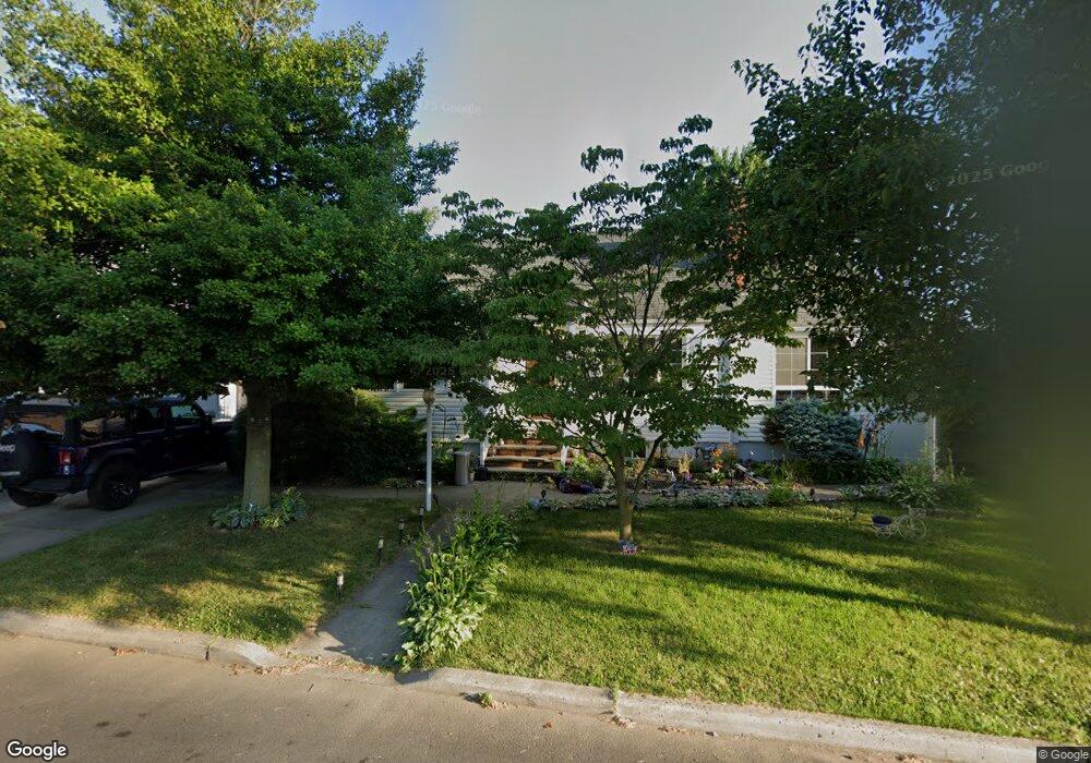
190 Parker St South Amboy, NJ 08879
Estimated Value: $488,000 - $514,000
4
Beds
2
Baths
--
Sq Ft
5,227
Sq Ft Lot
About This Home
This home is located at 190 Parker St, South Amboy, NJ 08879 and is currently estimated at $499,491. 190 Parker St is a home located in Middlesex County with nearby schools including Sayreville War Memorial High School, St. Mary Elementary School, and Cardinal Mccarrick High School.
Ownership History
Date
Name
Owned For
Owner Type
Purchase Details
Closed on
Sep 25, 2019
Sold by
Forsthoffer Christina and Forsthoffer Matthew W
Bought by
Forsthoffer Christina
Current Estimated Value
Home Financials for this Owner
Home Financials are based on the most recent Mortgage that was taken out on this home.
Original Mortgage
$279,000
Outstanding Balance
$244,418
Interest Rate
3.5%
Mortgage Type
New Conventional
Estimated Equity
$255,073
Purchase Details
Closed on
Aug 14, 2018
Sold by
Travinski Daniel and Travinski Donna
Bought by
Forsthoffer Christina and Forsthoffer Matthew W
Home Financials for this Owner
Home Financials are based on the most recent Mortgage that was taken out on this home.
Original Mortgage
$280,000
Interest Rate
4.5%
Mortgage Type
New Conventional
Purchase Details
Closed on
Feb 20, 1992
Bought by
Travinski Daniel and Travinski Donna
Create a Home Valuation Report for This Property
The Home Valuation Report is an in-depth analysis detailing your home's value as well as a comparison with similar homes in the area
Home Values in the Area
Average Home Value in this Area
Purchase History
| Date | Buyer | Sale Price | Title Company |
|---|---|---|---|
| Forsthoffer Christina | -- | None Available | |
| Forsthoffer Christina | $320,000 | Fidelity Natl Title Ins Co | |
| Travinski Daniel | $124,000 | -- |
Source: Public Records
Mortgage History
| Date | Status | Borrower | Loan Amount |
|---|---|---|---|
| Open | Forsthoffer Christina | $279,000 | |
| Closed | Forsthoffer Christina | $280,000 |
Source: Public Records
Tax History Compared to Growth
Tax History
| Year | Tax Paid | Tax Assessment Tax Assessment Total Assessment is a certain percentage of the fair market value that is determined by local assessors to be the total taxable value of land and additions on the property. | Land | Improvement |
|---|---|---|---|---|
| 2025 | $7,387 | $121,000 | $52,800 | $68,200 |
| 2024 | $7,183 | $121,000 | $52,800 | $68,200 |
| 2023 | $7,183 | $121,000 | $52,800 | $68,200 |
| 2022 | $6,709 | $121,000 | $52,800 | $68,200 |
| 2021 | $6,636 | $121,000 | $52,800 | $68,200 |
| 2020 | $6,467 | $121,000 | $52,800 | $68,200 |
| 2019 | $6,332 | $121,000 | $52,800 | $68,200 |
| 2018 | $6,218 | $121,000 | $52,800 | $68,200 |
| 2017 | $6,074 | $121,000 | $52,800 | $68,200 |
| 2016 | $5,912 | $121,000 | $52,800 | $68,200 |
| 2015 | $5,778 | $121,000 | $52,800 | $68,200 |
| 2014 | $5,623 | $121,000 | $52,800 | $68,200 |
Source: Public Records
Map
Nearby Homes
- 21 Luke St
- 179 Gabriel Terrace
- 158 Liberty St St
- 158 Liberty St
- 434 S Pine Ave
- 1200 Ernston Rd
- 21 Gordon Ave
- 10 Dolan Ave
- 37 Hoffman Ave
- 333 Midland Ave
- 466 Brook Ave
- 191 Wessco St
- 1511 Pebble Place
- 503 Woodland Ave
- 3014 Lighthouse Ln
- 3015 Lighthouse Ln
- 18 Grand St
- 1202 Harbor Club Dr
- 161 Manor St
- 1904 Bayhead Dr