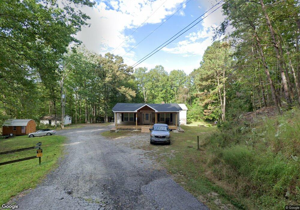
190 Robertson Ct Dawsonville, GA 30534
Dawson County NeighborhoodEstimated Value: $291,128 - $448,000
4
Beds
1
Bath
1,073
Sq Ft
$358/Sq Ft
Est. Value
About This Home
This home is located at 190 Robertson Ct, Dawsonville, GA 30534 and is currently estimated at $384,532, approximately $358 per square foot. 190 Robertson Ct is a home located in Dawson County with nearby schools including Kilough Elementary School, Dawson County Middle School, and Dawson County Junior High School.
Ownership History
Date
Name
Owned For
Owner Type
Purchase Details
Closed on
Jun 28, 2021
Sold by
Kee Lake Holdings Llc
Bought by
Sexton Lakeside Properties Llc
Current Estimated Value
Purchase Details
Closed on
Oct 1, 2014
Sold by
Sexton Tolbert P
Bought by
Sexton Lakeside Properties Llc
Purchase Details
Closed on
Sep 30, 2014
Sold by
Sexton Tolbert P Ball
Bought by
Sexton Tolbert P and Sexton James Anthony
Purchase Details
Closed on
Feb 18, 1993
Sold by
Jr and Jr Tolbert P
Bought by
Sexton Tolbert P
Purchase Details
Closed on
Oct 5, 1990
Sold by
Sexton Tolbert P
Bought by
Sexton Joyce R
Purchase Details
Closed on
Jul 17, 1985
Sold by
Joyce R
Bought by
Sexton Tolbert P
Purchase Details
Closed on
Dec 11, 1972
Bought by
Robertson Guy C
Create a Home Valuation Report for This Property
The Home Valuation Report is an in-depth analysis detailing your home's value as well as a comparison with similar homes in the area
Home Values in the Area
Average Home Value in this Area
Purchase History
| Date | Buyer | Sale Price | Title Company |
|---|---|---|---|
| Sexton Lakeside Properties Llc | -- | Donald W Hansford Pc | |
| Sexton Lakeside Properties Llc | -- | -- | |
| Sexton Tolbert P | -- | -- | |
| Sexton Tolbert P | -- | -- | |
| Sexton Joyce R | -- | -- | |
| Sexton Tolbert P | -- | -- | |
| Robertson Guy C | $1,000 | -- |
Source: Public Records
Tax History Compared to Growth
Tax History
| Year | Tax Paid | Tax Assessment Tax Assessment Total Assessment is a certain percentage of the fair market value that is determined by local assessors to be the total taxable value of land and additions on the property. | Land | Improvement |
|---|---|---|---|---|
| 2024 | $1,302 | $75,920 | $45,360 | $30,560 |
| 2023 | $1,235 | $82,200 | $50,040 | $32,160 |
| 2022 | $869 | $40,560 | $30,000 | $10,560 |
| 2021 | $719 | $31,760 | $22,640 | $9,120 |
| 2020 | $805 | $34,000 | $24,440 | $9,560 |
| 2019 | $776 | $32,520 | $24,440 | $8,080 |
| 2018 | $684 | $28,610 | $19,550 | $9,060 |
| 2017 | $684 | $28,610 | $16,744 | $11,866 |
| 2016 | $1,015 | $49,949 | $16,744 | $33,205 |
| 2015 | $1,196 | $48,440 | $15,235 | $33,205 |
| 2014 | $1,158 | $45,429 | $15,235 | $30,194 |
| 2013 | -- | $40,914 | $15,235 | $25,678 |
Source: Public Records
Map
Nearby Homes
- 347 Etowah Pkwy
- 518 Overlook Dr
- 427 Dawson Pointe Pkwy
- 1056 Overlook Dr
- 307 Robertson Rd
- 435 Robertson Rd
- 3 Henry Pirkle Dr
- 44 Eastview Dr
- 246 Overlook Cir
- 80 Eastview Dr
- 104 Waters Edge
- 61 View Point Dr
- 604 Oak Forest Dr
- 66 Chestnut Oak Ln
- 187 Oak Creek Dr
- 289 Chestatee View Dr
- 537 Chestatee View Dr
- 6462 Waterscape Ridge
- 204 Robertson Ct
- 204 Robertson Ct
- 188 Shadwood Place
- 105 Shadwood Place
- 108 Shadwood Place
- 96 Shadwood Place
- 160 Shadwood Place
- 118 Shadwood Place
- 88 Shadwood Place
- 146 Shadwood Place
- 78 Shadwood Place
- 16 Shadwood Place
- 26 Shadwood Place
- 50 Shadwood Place
- 331 Etowah Pkwy
- 348 Etowah Pkwy
- 326 Etowah Pkwy
- 338 Etowah Pkwy
- 312 Etowah Pkwy
- 114 Grand Hickory Way