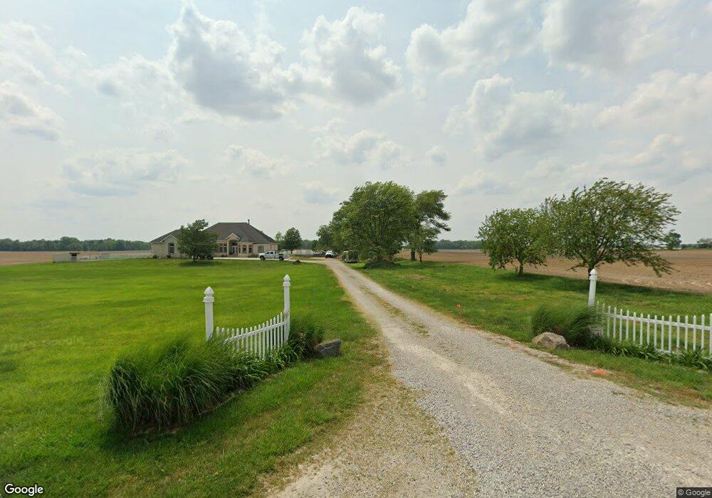
190 S 700 E Franklin, IN 46131
Estimated Value: $778,000 - $945,947
4
Beds
4
Baths
7,038
Sq Ft
$121/Sq Ft
Est. Value
About This Home
This home is located at 190 S 700 E, Franklin, IN 46131 and is currently estimated at $854,649, approximately $121 per square foot. 190 S 700 E is a home located in Johnson County with nearby schools including Needham Elementary School, Franklin Community Middle School, and Custer Baker Intermediate School.
Ownership History
Date
Name
Owned For
Owner Type
Purchase Details
Closed on
Aug 11, 2006
Sold by
Darrell Ray Custom Builder Inc
Bought by
Hensley Mark E and Hensley Mary Beth
Current Estimated Value
Home Financials for this Owner
Home Financials are based on the most recent Mortgage that was taken out on this home.
Original Mortgage
$512,000
Outstanding Balance
$307,731
Interest Rate
6.78%
Mortgage Type
New Conventional
Estimated Equity
$546,918
Purchase Details
Closed on
Jan 9, 2006
Sold by
Hensley Mark E and Hensley Mary Beth
Bought by
Darrell Ray Custom Builder Inc
Create a Home Valuation Report for This Property
The Home Valuation Report is an in-depth analysis detailing your home's value as well as a comparison with similar homes in the area
Home Values in the Area
Average Home Value in this Area
Purchase History
| Date | Buyer | Sale Price | Title Company |
|---|---|---|---|
| Hensley Mark E | -- | None Available | |
| Darrell Ray Custom Builder Inc | -- | None Available |
Source: Public Records
Mortgage History
| Date | Status | Borrower | Loan Amount |
|---|---|---|---|
| Open | Hensley Mark E | $512,000 |
Source: Public Records
Tax History Compared to Growth
Tax History
| Year | Tax Paid | Tax Assessment Tax Assessment Total Assessment is a certain percentage of the fair market value that is determined by local assessors to be the total taxable value of land and additions on the property. | Land | Improvement |
|---|---|---|---|---|
| 2025 | $8,253 | $930,800 | $52,700 | $878,100 |
| 2024 | $8,253 | $722,900 | $51,900 | $671,000 |
| 2023 | $8,258 | $725,700 | $46,800 | $678,900 |
| 2022 | $8,457 | $733,800 | $46,800 | $687,000 |
| 2021 | $7,396 | $644,100 | $40,500 | $603,600 |
| 2020 | $6,899 | $595,100 | $36,400 | $558,700 |
| 2019 | $6,786 | $587,300 | $38,200 | $549,100 |
| 2018 | $5,679 | $556,200 | $38,600 | $517,600 |
| 2017 | $5,680 | $554,900 | $40,100 | $514,800 |
| 2016 | $5,473 | $519,100 | $40,900 | $478,200 |
| 2014 | $5,373 | $522,600 | $41,400 | $481,200 |
| 2013 | $5,373 | $525,800 | $39,500 | $486,300 |
Source: Public Records
Map
Nearby Homes
- 7214 E 100 N
- 5991 Evelyn Ave
- W S 900 W
- 409 Paris Dr
- 863 S 450 E
- 1990 Red Oak Dr
- 150 E South St
- 1850 Longest Dr
- 1083 Beechtree Ln
- 1185 Beechtree Ln
- 1682 Millpond Ln
- 1646 Millpond Ln
- 1636 Millpond Ln
- 1679 Millpond Ln
- 1690 Millpond Ln
- 1642 Millpond Ln
- 1663 Millpond Ln
- 1640 Millpond Ln
- 1650 Millpond Ln
- 1654 Millpond Ln
- 151 S 700 E
- 98 S 700 E
- 334 S 700 E
- 285 S 700 E
- 00 S 700 E
- 0 S 700east Rd
- 0 S 700 E
- 0 S 700east Rd Unit 21431323
- 0 E 700 N Unit 2900400
- 0 E 700 N Unit 21110584
- 0 E 700 N Unit MBR2673444
- 0 E 700 N Unit MBR2613259
- 0 E 700 N Unit MBR2610401
- 0 E 700 N Unit MBR2610416
- 6950 E 50 S
- 6844 E 50 S
- 7294 E Division Rd
- 6546 E 50 S
- 7430 E Division Rd
- 6632 E 50 S