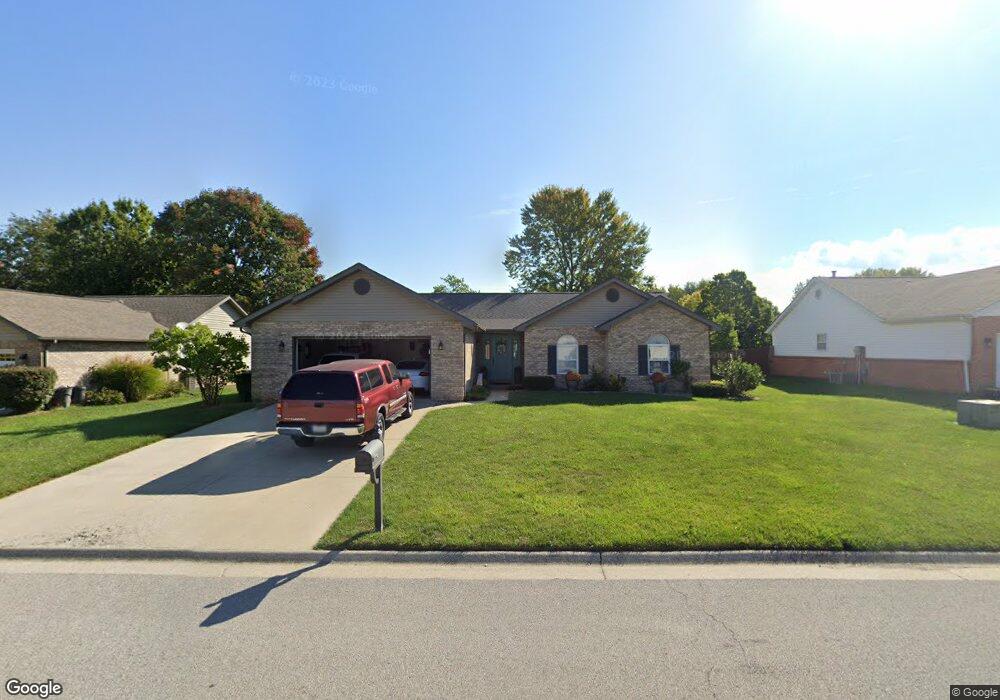
190 Saint Sabre Dr Belleville, IL 62226
Estimated Value: $234,733 - $296,000
Studio
--
Bath
1,685
Sq Ft
$157/Sq Ft
Est. Value
About This Home
This home is located at 190 Saint Sabre Dr, Belleville, IL 62226 and is currently estimated at $264,683, approximately $157 per square foot. 190 Saint Sabre Dr is a home located in St. Clair County with nearby schools including Wolf Branch Elementary School, Wolf Branch Middle School, and Elite Scholars STEAM Academy.
Ownership History
Date
Name
Owned For
Owner Type
Purchase Details
Closed on
Aug 30, 2002
Sold by
Crawford Bill D and Crawford Betty J
Bought by
Little Gary L and Little Stacey A
Current Estimated Value
Home Financials for this Owner
Home Financials are based on the most recent Mortgage that was taken out on this home.
Original Mortgage
$158,100
Outstanding Balance
$66,863
Interest Rate
6.41%
Mortgage Type
VA
Estimated Equity
$197,820
Create a Home Valuation Report for This Property
The Home Valuation Report is an in-depth analysis detailing your home's value as well as a comparison with similar homes in the area
Home Values in the Area
Average Home Value in this Area
Purchase History
| Date | Buyer | Sale Price | Title Company |
|---|---|---|---|
| Little Gary L | $155,000 | Chicago Title |
Source: Public Records
Mortgage History
| Date | Status | Borrower | Loan Amount |
|---|---|---|---|
| Open | Little Gary L | $158,100 |
Source: Public Records
Tax History
| Year | Tax Paid | Tax Assessment Tax Assessment Total Assessment is a certain percentage of the fair market value that is determined by local assessors to be the total taxable value of land and additions on the property. | Land | Improvement |
|---|---|---|---|---|
| 2024 | $4,877 | $66,679 | $9,138 | $57,541 |
| 2023 | $4,660 | $63,428 | $9,012 | $54,416 |
| 2022 | $4,324 | $57,767 | $8,208 | $49,559 |
| 2021 | $4,207 | $55,396 | $7,871 | $47,525 |
| 2020 | $4,075 | $51,589 | $7,330 | $44,259 |
| 2019 | $3,802 | $49,806 | $7,622 | $42,184 |
| 2018 | $3,694 | $48,534 | $7,427 | $41,107 |
| 2017 | $3,589 | $47,243 | $7,230 | $40,013 |
| 2016 | $3,561 | $45,615 | $6,981 | $38,634 |
| 2014 | $3,488 | $49,964 | $11,486 | $38,478 |
| 2013 | $3,501 | $49,964 | $11,486 | $38,478 |
Source: Public Records
Map
Nearby Homes
- 225 Saint Sabre Dr
- 147 Papillon Dr
- 3906 Benington Dr
- 41 Village Dr
- 505 Thistle Ln
- 802 Baron Dr
- 532 Homestead Ave
- 6 Mapleleaf Ln
- 55 Blanc Lee Dr
- 1716 Ambrose Terrace Dr
- 1709 Old Park Ln
- 1705 Old Park Ln
- 1737 Old Park Ln
- 3804 Tanbark Dr
- 1745 Old Park Ln
- 3928 Red Bird Ln
- 3924 Red Bird Ln
- 1749 Old Park Ln
- 1753 Old Park Ln
- 3920 Red Bird Ln
- 186 St Sabre
- 194 Saint Sabre Dr
- 186 Saint Sabre Dr
- 209 Bourdelais Dr
- 205 Bourdelais Dr
- 213 Bourdelais Dr
- 182 Saint Sabre Dr
- 191 Saint Sabre Dr
- 198 Saint Sabre Dr
- 185 Saint Sabre Dr
- 195 Saint Sabre Dr
- 201 Bourdelais Dr
- 217 Bourdelais Dr
- 199 St Sabre Dr
- 199 Saint Sabre Dr
- 181 Saint Sabre Dr
- 181 St Sabre
- 178 Saint Sabre Dr
- 208 Bourdelais Dr
- 221 Bourdelais Dr
Your Personal Tour Guide
Ask me questions while you tour the home.