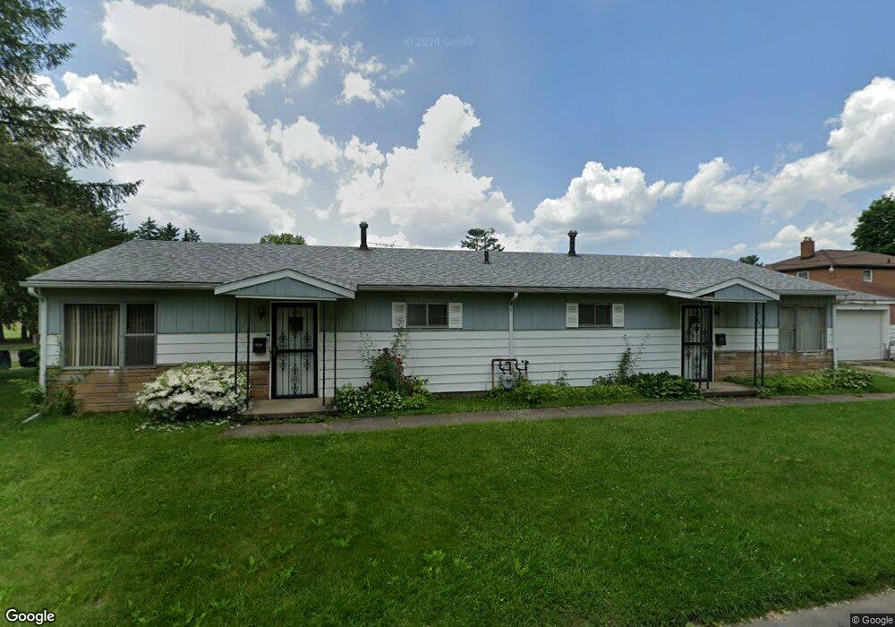
190 Stoddard Ave Unit 192 Akron, OH 44313
Northwest Akron NeighborhoodEstimated Value: $147,951 - $205,000
4
Beds
2
Baths
1,664
Sq Ft
$103/Sq Ft
Est. Value
About This Home
This home is located at 190 Stoddard Ave Unit 192, Akron, OH 44313 and is currently estimated at $170,988, approximately $102 per square foot. 190 Stoddard Ave Unit 192 is a home located in Summit County with nearby schools including Summit Academy School, Our Lady Of The Elms Elementary School, and St. Sebastian Parish School.
Ownership History
Date
Name
Owned For
Owner Type
Purchase Details
Closed on
Jan 7, 2003
Sold by
Schulz John H and Schulz Eva M
Bought by
Schulz John M
Current Estimated Value
Purchase Details
Closed on
Nov 3, 2002
Sold by
Schulz John H and Schulz Eva M
Bought by
Schulz John M
Create a Home Valuation Report for This Property
The Home Valuation Report is an in-depth analysis detailing your home's value as well as a comparison with similar homes in the area
Home Values in the Area
Average Home Value in this Area
Purchase History
| Date | Buyer | Sale Price | Title Company |
|---|---|---|---|
| Schulz John M | -- | -- | |
| Schulz John M | -- | -- |
Source: Public Records
Tax History Compared to Growth
Tax History
| Year | Tax Paid | Tax Assessment Tax Assessment Total Assessment is a certain percentage of the fair market value that is determined by local assessors to be the total taxable value of land and additions on the property. | Land | Improvement |
|---|---|---|---|---|
| 2025 | $2,435 | $37,065 | $8,071 | $28,994 |
| 2024 | $1,644 | $37,065 | $8,071 | $28,994 |
| 2023 | $2,435 | $37,065 | $8,071 | $28,994 |
| 2022 | $1,438 | $27,518 | $5,891 | $21,627 |
| 2021 | $1,439 | $27,518 | $5,891 | $21,627 |
| 2020 | $1,559 | $29,660 | $5,890 | $23,770 |
| 2019 | $2,182 | $36,480 | $7,750 | $28,730 |
| 2018 | $2,155 | $36,480 | $7,750 | $28,730 |
| 2017 | $2,085 | $36,480 | $7,750 | $28,730 |
| 2016 | $2,086 | $35,050 | $7,750 | $27,300 |
| 2015 | $2,085 | $35,050 | $7,750 | $27,300 |
| 2014 | $2,069 | $35,050 | $7,750 | $27,300 |
| 2013 | $2,366 | $39,880 | $7,750 | $32,130 |
Source: Public Records
Map
Nearby Homes
- 1725 Liberty Dr Unit 1727
- 1688 Tanglewood Dr Unit 1690
- 242 N Hawkins Ave
- 100 N Hawkins Ave
- 101 N Hawkins Ave
- 1883 Larchmont Rd
- 2040 Thurmont Rd
- 84 S Pershing Ave
- 1389 Bryden Dr
- 1785 Fairlawn Knolls Dr
- 2024 Braewick Dr
- 297 Harcourt Dr
- 2040 Braewick Dr
- 311 Goodhue Dr
- 325 Melbourne Ave
- 590 N Hawkins Ave
- 2113 Stabler Rd
- 0 White Pond Dr Unit 5156539
- 607 Treeside Dr
- 1804-1808 Cromwell Dr
- 1709 Shatto Ave Unit 1711
- 191 Stoddard Ave
- 1713 Shatto Ave Unit 1715
- 1713 Shatto Ave Unit 1713 Shatto Avenue
- 1715 Shatto Ave
- 204 Stoddard Ave Unit 208
- 1746 Liberty Dr Unit 1748
- 1689 Shatto Ave
- 1717 Shatto Ave Unit 1719
- 1730 Liberty Dr Unit 1732
- 1750 Liberty Dr Unit 1752
- 1758 Liberty Dr Unit up
- 1758 Liberty Dr
- 1756 Liberty Dr Unit 1758
- 1723 Shatto Ave Unit 1725
- 1726 Liberty Dr Unit 1728
- 1728 Liberty Dr
- 1681 Shatto Ave
- 222 Stoddard Ave
- 1760 Liberty Dr Unit 1762