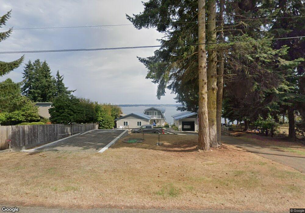
190 Tala Shore Dr Port Ludlow, WA 98365
Estimated Value: $375,000 - $655,000
3
Beds
2
Baths
1,536
Sq Ft
$353/Sq Ft
Est. Value
About This Home
This home is located at 190 Tala Shore Dr, Port Ludlow, WA 98365 and is currently estimated at $542,326, approximately $353 per square foot. 190 Tala Shore Dr is a home located in Jefferson County with nearby schools including Chimacum Creek Primary School, Chimacum School Pi Program, and Chimacum Elementary School.
Ownership History
Date
Name
Owned For
Owner Type
Purchase Details
Closed on
Oct 2, 2024
Sold by
Holm Richard P and Holm Cynthia A
Bought by
Richard And Cynthia Holm Living Trust and Holm
Current Estimated Value
Purchase Details
Closed on
Jun 4, 2019
Sold by
Lake Esther M
Bought by
Holm Richard P and Holm Cynthia A
Home Financials for this Owner
Home Financials are based on the most recent Mortgage that was taken out on this home.
Original Mortgage
$200,000
Interest Rate
4.2%
Mortgage Type
New Conventional
Create a Home Valuation Report for This Property
The Home Valuation Report is an in-depth analysis detailing your home's value as well as a comparison with similar homes in the area
Home Values in the Area
Average Home Value in this Area
Purchase History
| Date | Buyer | Sale Price | Title Company |
|---|---|---|---|
| Richard And Cynthia Holm Living Trust | $313 | None Listed On Document | |
| Holm Richard P | $250,000 | Frontier Title & Escrow |
Source: Public Records
Mortgage History
| Date | Status | Borrower | Loan Amount |
|---|---|---|---|
| Previous Owner | Holm Richard P | $200,000 |
Source: Public Records
Tax History Compared to Growth
Tax History
| Year | Tax Paid | Tax Assessment Tax Assessment Total Assessment is a certain percentage of the fair market value that is determined by local assessors to be the total taxable value of land and additions on the property. | Land | Improvement |
|---|---|---|---|---|
| 2024 | $3,752 | $498,673 | $245,700 | $252,973 |
| 2023 | $3,752 | $470,474 | $229,000 | $241,474 |
| 2022 | $3,545 | $465,474 | $224,000 | $241,474 |
| 2021 | $3,413 | $384,064 | $206,250 | $177,814 |
| 2020 | $3,379 | $347,807 | $189,750 | $158,057 |
| 2019 | $3,208 | $332,971 | $181,500 | $151,471 |
| 2018 | $3,374 | $318,135 | $173,250 | $144,885 |
| 2017 | $3,291 | $296,714 | $165,000 | $131,714 |
| 2016 | $3,096 | $296,714 | $165,000 | $131,714 |
| 2015 | $3,053 | $276,378 | $139,125 | $137,253 |
| 2014 | -- | $276,378 | $139,125 | $137,253 |
| 2013 | -- | $263,215 | $132,500 | $130,715 |
Source: Public Records
Map
Nearby Homes
- 0 xxx E Tala Shore Dr
- 0 Hill St
- 61 McCartney Peak Ln
- 90 Mccartney Ln
- 61 McCartney Peak Ln Unit 73
- 71 W Cedar St
- 63 Red Cedar Ln
- 3863 Paradise Bay Rd
- 73 Topside Ct
- 306 Crestview Dr
- 95 Martingale Place
- 23 Seaway Place
- 81 Windrose Dr
- 490 Mount Constance Way
- 152 Dogleg Ln
- 1291 E Ludlow Ridge Rd
- 15 White Rock Ln
- 51 Mariner Place
- 13 White Rock Ln
- 101 Highland Green Unit 5
- 212 Tala Shore Dr
- 234 Tala Shore Dr
- 140 Tala Shore Dr
- 250 Tala Shore Dr
- 100 Tala Shore Dr
- 270 Tala Shore Dr
- 153 Tala Shore Dr
- 177 Tala Shore Dr
- 80 Tala Shore Dr
- 290 Tala Shore Dr
- 231 Tala Shore Dr
- 103 Tala Shore Dr
- 310 Tala Shore Dr
- 60 Tala Shore Dr
- 301 Tala Shore Dr
- 320 Tala Shore Dr
- 48 Tala Shore Dr
- 50 Tala Shore Dr
- 50 Tala Shore Dr