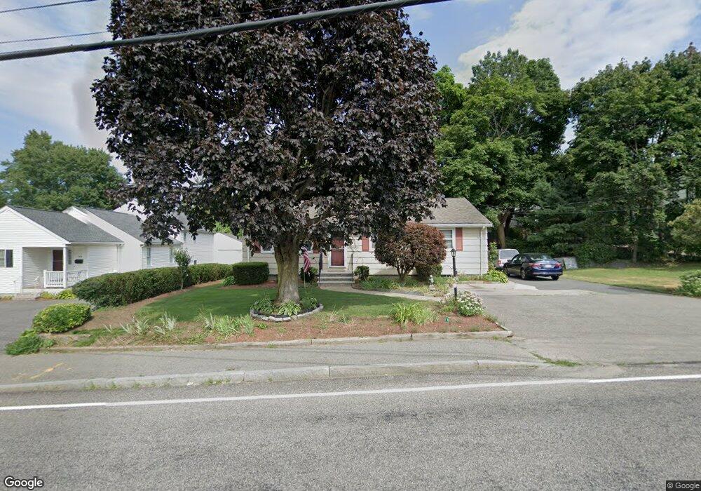
190 Webster St Needham Heights, MA 02494
Estimated Value: $1,141,000 - $1,442,000
4
Beds
3
Baths
1,428
Sq Ft
$900/Sq Ft
Est. Value
About This Home
This home is located at 190 Webster St, Needham Heights, MA 02494 and is currently estimated at $1,285,247, approximately $900 per square foot. 190 Webster St is a home located in Norfolk County with nearby schools including Eliot Elementary School, High Rock Middle School, and Pollard Middle School.
Ownership History
Date
Name
Owned For
Owner Type
Purchase Details
Closed on
Feb 19, 2025
Sold by
Arduino Ft and Arduino
Bought by
Ennio & Pia Arduino Ft and Arduino
Current Estimated Value
Purchase Details
Closed on
Feb 12, 1962
Bought by
Arduino Ft and Arduino, Pia
Create a Home Valuation Report for This Property
The Home Valuation Report is an in-depth analysis detailing your home's value as well as a comparison with similar homes in the area
Home Values in the Area
Average Home Value in this Area
Purchase History
| Date | Buyer | Sale Price | Title Company |
|---|---|---|---|
| Ennio & Pia Arduino Ft | -- | None Available | |
| Ennio & Pia Arduino Ft | -- | None Available | |
| Arduino Ft | -- | -- |
Source: Public Records
Tax History
| Year | Tax Paid | Tax Assessment Tax Assessment Total Assessment is a certain percentage of the fair market value that is determined by local assessors to be the total taxable value of land and additions on the property. | Land | Improvement |
|---|---|---|---|---|
| 2025 | $10,391 | $980,300 | $745,300 | $235,000 |
| 2024 | $9,247 | $738,600 | $480,800 | $257,800 |
| 2023 | $9,376 | $719,000 | $480,800 | $238,200 |
| 2022 | $8,796 | $657,900 | $429,300 | $228,600 |
| 2021 | $8,572 | $657,900 | $429,300 | $228,600 |
| 2020 | $8,335 | $667,300 | $429,300 | $238,000 |
| 2019 | $7,692 | $620,800 | $390,300 | $230,500 |
| 2018 | $7,375 | $620,800 | $390,300 | $230,500 |
| 2017 | $7,027 | $591,000 | $390,300 | $200,700 |
| 2016 | $6,846 | $593,200 | $390,300 | $202,900 |
| 2015 | $6,697 | $593,200 | $390,300 | $202,900 |
| 2014 | $6,087 | $522,900 | $325,300 | $197,600 |
Source: Public Records
Map
Nearby Homes
- 23 Harvard Cir
- 62 Evelyn Rd
- 4 Greenough St
- 5 Sachem Rd
- 100 Woodbine Cir
- 132 Hillside Ave
- 108 Woodbine Cir
- 134 Hillside Ave Unit 134
- 140 Hillside Ave
- 140 Hillside Ave Unit a
- 28 Mercer Rd
- 379 Hunnewell St Unit 379
- 218 Hillside Ave
- 345 Central Ave
- 5 Hazel Ln
- 10 Rosegate Rd
- 12 Hill St
- 212 Central Ave
- 7 West St
- 143 Hunting Rd
- 184 Webster St
- 194 Webster St
- 178 Webster St
- 198 Webster St
- 1234 Confidential
- 1111 Confidential
- 17 Evelyn Rd
- 14 Hillside Ave
- 7 Hillside Ave
- 216 Webster St
- 23 Evelyn Rd
- 179 Webster St
- 208 Webster St Unit .
- 168 Webster St
- 13 Hillside Ave
- 171 Webster St
- 207 Webster St
- 16 Evelyn Rd
- 22 Hillside Ave
- 29 Evelyn Rd
Your Personal Tour Guide
Ask me questions while you tour the home.