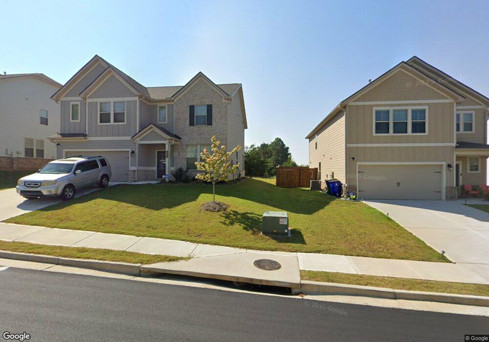
190 Whitney St Fayetteville, GA 30214
Estimated Value: $616,000
--
Bed
--
Bath
1,330
Sq Ft
$463/Sq Ft
Est. Value
About This Home
This home is located at 190 Whitney St, Fayetteville, GA 30214 and is currently priced at $616,000, approximately $463 per square foot. 190 Whitney St is a home with nearby schools including Spring Hill Elementary School, Bennett's Mill Middle School, and Fayette County High School.
Ownership History
Date
Name
Owned For
Owner Type
Purchase Details
Closed on
Aug 24, 2023
Sold by
Drb Group Georgia
Bought by
Williams Marissa
Current Estimated Value
Purchase Details
Closed on
Aug 9, 2023
Sold by
Drb Group Georgia
Bought by
Glass Heath and Glass Spanishia
Purchase Details
Closed on
Aug 1, 2023
Sold by
Dixon Farm Development Llc
Bought by
Drb Group Georgia
Purchase Details
Closed on
May 28, 2021
Sold by
Dixon James Harold
Bought by
Michael Stone & Associates Llc
Create a Home Valuation Report for This Property
The Home Valuation Report is an in-depth analysis detailing your home's value as well as a comparison with similar homes in the area
Home Values in the Area
Average Home Value in this Area
Purchase History
| Date | Buyer | Sale Price | Title Company |
|---|---|---|---|
| Williams Marissa | $365,300 | None Listed On Document | |
| Glass Heath | $532,700 | None Listed On Document | |
| Drb Group Georgia | $1,020,000 | None Listed On Document | |
| Michael Stone & Associates Llc | -- | -- | |
| Michael Stone & Associates Llc | $395,460 | -- | |
| Dixon Farm Development Llc | $1,010,500 | -- |
Source: Public Records
Tax History Compared to Growth
Tax History
| Year | Tax Paid | Tax Assessment Tax Assessment Total Assessment is a certain percentage of the fair market value that is determined by local assessors to be the total taxable value of land and additions on the property. | Land | Improvement |
|---|---|---|---|---|
| 2023 | $3,514 | $115,448 | $61,448 | $54,000 |
| 2022 | $3,200 | $105,312 | $54,192 | $51,120 |
| 2021 | $2,801 | $90,992 | $49,352 | $41,640 |
| 2020 | $2,365 | $76,504 | $39,984 | $36,520 |
| 2019 | $2,339 | $74,904 | $39,984 | $34,920 |
| 2018 | $2,147 | $68,036 | $35,636 | $32,400 |
| 2017 | $1,865 | $62,368 | $34,768 | $27,600 |
| 2016 | $1,802 | $58,968 | $34,768 | $24,200 |
| 2015 | $1,761 | $56,608 | $34,768 | $21,840 |
| 2014 | $1,715 | $54,128 | $34,768 | $19,360 |
| 2013 | -- | $54,048 | $0 | $0 |
Source: Public Records
Map
Nearby Homes
- 110 Lindsey Terrace
- 170 Woodstream Way Unit B
- 235 Woodstream Way
- 665 Beauregard Blvd
- 415 Williamsburg Way
- 430 Plainfield St
- 180 Plainfield St
- 155 Medford Dr
- 375 Plainfield St
- 315 Ivanhoe Dr
- 110 Sparrows Cove
- The Bradford Plan at Mitchell Estates
- The Mildred Plan at Mitchell Estates
- 315 Walker Ave
- 130 Thrushwood Dr
- 295 Cobalt Dr
- 315 Cobalt Dr
- 305 Cobalt Dr
- 145 Thrushwood Dr
- 175 Keaton Dr
- 2050 Carolyn Dixon Way
- 2060 Carolyn Dixon Way
- 2080 Carolyn Dixon Way
- 0 Carolyn Dixon Way Unit LOT 8 10158242
- 0 Carolyn Dixon Way Unit LOT 9 ZOEY 10157944
- 0 Carolyn Dixon Way Unit LOT 7 ABIGAIL
- 0 Carolyn Dixon Way Unit LOT 6 RADCLIFFE
- 0 Carolyn Dixon Way Unit LOT 10 RADCLIFFE
- 0 Carolyn Dixon Way
- 105 Summit Point Dr
- 0 Summit Point Dr Unit 8488118
- 0 Summit Point Dr Unit 8156710
- 0 Summit Point Dr Unit 7333089
- 0 Summit Point Dr Unit 7307860
- 0 Summit Point Dr Unit 7229114
- 0 Summit Point Dr Unit 7455668
- 0 Summit Point Dr Unit 7548764
- 0 Summit Point Dr Unit 7578223
- 0 Summit Point Dr Unit 7590160
- 0 Summit Point Dr Unit 8137983