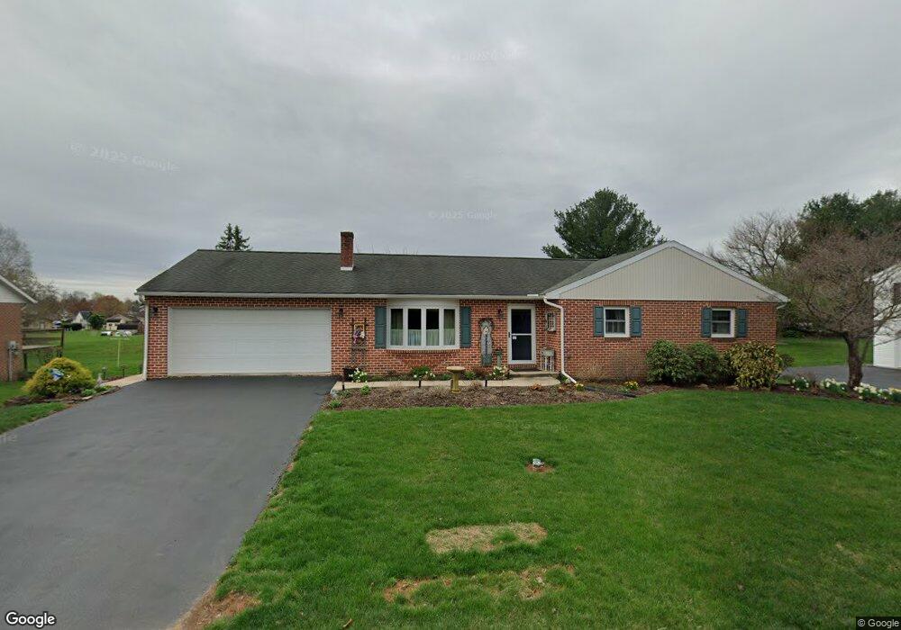
190 Woodchuck Dr Ephrata, PA 17522
Estimated Value: $353,770 - $386,000
3
Beds
2
Baths
1,352
Sq Ft
$272/Sq Ft
Est. Value
About This Home
This home is located at 190 Woodchuck Dr, Ephrata, PA 17522 and is currently estimated at $367,943, approximately $272 per square foot. 190 Woodchuck Dr is a home located in Lancaster County with nearby schools including Ephrata Intermediate School, Clay Elementary School, and Ephrata Senior High School.
Ownership History
Date
Name
Owned For
Owner Type
Purchase Details
Closed on
Feb 26, 2007
Sold by
Harman Randy A L and Harman Wendy E
Bought by
Ulrich William H and Ulrich Brenda J
Current Estimated Value
Home Financials for this Owner
Home Financials are based on the most recent Mortgage that was taken out on this home.
Original Mortgage
$65,000
Interest Rate
6.23%
Mortgage Type
Purchase Money Mortgage
Create a Home Valuation Report for This Property
The Home Valuation Report is an in-depth analysis detailing your home's value as well as a comparison with similar homes in the area
Home Values in the Area
Average Home Value in this Area
Purchase History
| Date | Buyer | Sale Price | Title Company |
|---|---|---|---|
| Ulrich William H | $219,000 | None Available |
Source: Public Records
Mortgage History
| Date | Status | Borrower | Loan Amount |
|---|---|---|---|
| Closed | Ulrich William H | $65,000 |
Source: Public Records
Tax History Compared to Growth
Tax History
| Year | Tax Paid | Tax Assessment Tax Assessment Total Assessment is a certain percentage of the fair market value that is determined by local assessors to be the total taxable value of land and additions on the property. | Land | Improvement |
|---|---|---|---|---|
| 2025 | $4,404 | $192,300 | $53,300 | $139,000 |
| 2024 | $4,404 | $192,300 | $53,300 | $139,000 |
| 2023 | $4,290 | $192,300 | $53,300 | $139,000 |
| 2022 | $4,192 | $192,300 | $53,300 | $139,000 |
| 2021 | $4,102 | $192,300 | $53,300 | $139,000 |
| 2020 | $4,102 | $192,300 | $53,300 | $139,000 |
| 2019 | $4,044 | $192,300 | $53,300 | $139,000 |
| 2018 | $3,132 | $192,300 | $53,300 | $139,000 |
| 2017 | $4,103 | $161,000 | $45,500 | $115,500 |
| 2016 | $4,103 | $161,000 | $45,500 | $115,500 |
| 2015 | $811 | $161,000 | $45,500 | $115,500 |
| 2014 | $3,028 | $161,000 | $45,500 | $115,500 |
Source: Public Records
Map
Nearby Homes
- 57 Perseverance Ln
- 124 Morning Dr
- 00 Morning Dr
- 131 Sunrise Ln
- 144 Sunrise Ln
- Amberbrook Plan at Wyndale
- Northfield Plan at Wyndale
- Logan Plan at Wyndale
- Stonecroft Plan at Wyndale
- Darien Plan at Wyndale
- Atworth Plan at Wyndale
- Magnolia Plan at Wyndale
- Baker Plan at Wyndale
- Huntington Plan at Wyndale
- Westbrooke Plan at Wyndale
- Perry Plan at Wyndale
- Charlotte Plan at Wyndale
- Kingston Plan at Wyndale
- Brookfield Plan at Wyndale
- Silverbrooke Plan at Wyndale
- 200 Woodchuck Dr
- 180 Woodchuck Dr
- 195 Woodchuck Dr
- 204 Woodchuck Dr
- 170 Woodchuck Dr
- 185 Woodchuck Dr
- 205 Woodchuck Dr
- 175 Woodchuck Dr
- 227 Blackberry Dr
- 210 Woodchuck Dr
- 160 Woodchuck Dr
- 165 Woodchuck Dr
- 222 Blackberry Dr
- 3 Madison Cir
- 237 Blackberry Dr
- 215 Woodchuck Dr
- 150 Woodchuck Dr
- 216 Woodchuck Dr
- 514 Countryside Dr
- 232 Blackberry Dr