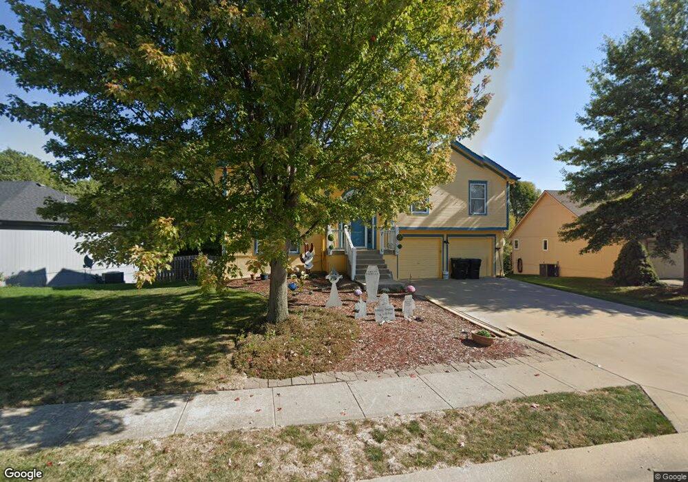
1900 Cypress Way Pleasant Hill, MO 64080
Estimated Value: $328,000 - $335,000
3
Beds
2
Baths
1,240
Sq Ft
$267/Sq Ft
Est. Value
About This Home
This home is located at 1900 Cypress Way, Pleasant Hill, MO 64080 and is currently estimated at $331,593, approximately $267 per square foot. 1900 Cypress Way is a home located in Cass County with nearby schools including Pleasant Hill Primary School, Pleasant Hill Elementary School, and Pleasant Hill Intermediate School.
Ownership History
Date
Name
Owned For
Owner Type
Purchase Details
Closed on
Feb 15, 2007
Sold by
Albin Kenneth L and Albin Mary A
Bought by
Beaman John W and Beaman Tricia A
Current Estimated Value
Home Financials for this Owner
Home Financials are based on the most recent Mortgage that was taken out on this home.
Original Mortgage
$122,400
Outstanding Balance
$73,190
Interest Rate
6.13%
Mortgage Type
New Conventional
Estimated Equity
$258,403
Create a Home Valuation Report for This Property
The Home Valuation Report is an in-depth analysis detailing your home's value as well as a comparison with similar homes in the area
Home Values in the Area
Average Home Value in this Area
Purchase History
| Date | Buyer | Sale Price | Title Company |
|---|---|---|---|
| Beaman John W | -- | -- |
Source: Public Records
Mortgage History
| Date | Status | Borrower | Loan Amount |
|---|---|---|---|
| Open | Beaman John W | $122,400 |
Source: Public Records
Tax History Compared to Growth
Tax History
| Year | Tax Paid | Tax Assessment Tax Assessment Total Assessment is a certain percentage of the fair market value that is determined by local assessors to be the total taxable value of land and additions on the property. | Land | Improvement |
|---|---|---|---|---|
| 2024 | $2,863 | $39,700 | $4,190 | $35,510 |
| 2023 | $2,842 | $39,700 | $4,190 | $35,510 |
| 2022 | $2,541 | $34,830 | $4,190 | $30,640 |
| 2021 | $2,471 | $34,830 | $4,190 | $30,640 |
| 2020 | $2,365 | $34,130 | $4,190 | $29,940 |
| 2019 | $2,333 | $34,130 | $4,190 | $29,940 |
| 2018 | $2,071 | $29,890 | $3,480 | $26,410 |
| 2017 | $1,971 | $29,890 | $3,480 | $26,410 |
| 2016 | $1,971 | $28,330 | $3,480 | $24,850 |
| 2015 | $1,996 | $28,330 | $3,480 | $24,850 |
| 2014 | $2,004 | $28,330 | $3,480 | $24,850 |
| 2013 | -- | $28,330 | $3,480 | $24,850 |
Source: Public Records
Map
Nearby Homes
- 1202 Morgan Dr
- 1202 Ashford St
- 1309 Pinoak Ct
- 2004 Owen Dr
- 1918 Owen Dr
- 1908 Owen Dr
- 1307 Deena St
- 1923 Fairground Dr
- 1405 E State Route Vv
- 1507 Trail Ridge Dr
- 29 Acres E State Route Vv
- 25.8+/- Acres E 163rd St
- 0 E 163rd St Unit HMS2499275
- 1004 Wright St
- 704 Terry Dr
- 1807 Mystery Hill Dr
- 631 Terry Dr
- 1310 Sycamore St
- 1003 Truman St
- 1215 Maple Ln
- 1902 Cypress Way
- 1812 Cypress Way
- 1904 Cypress Way
- 1903 Cypress Way
- 1901 Cypress Way
- 1306 Ashford St
- 1906 Cypress Way
- 1304 Ashford St
- 1211 Ashford St
- 1301 White Oak Place
- 1301 Ashford St
- 1907 Ridge Tree Dr
- 1905 Ridge Tree Dr
- 1303 White Oak Place
- 1908 Cypress Way
- 1302 Ashford St
- 1909 Ridge Tree Dr
- 1903 Ridge Tree Dr
- 1209 Ashford St
- 1714 Russell Rd