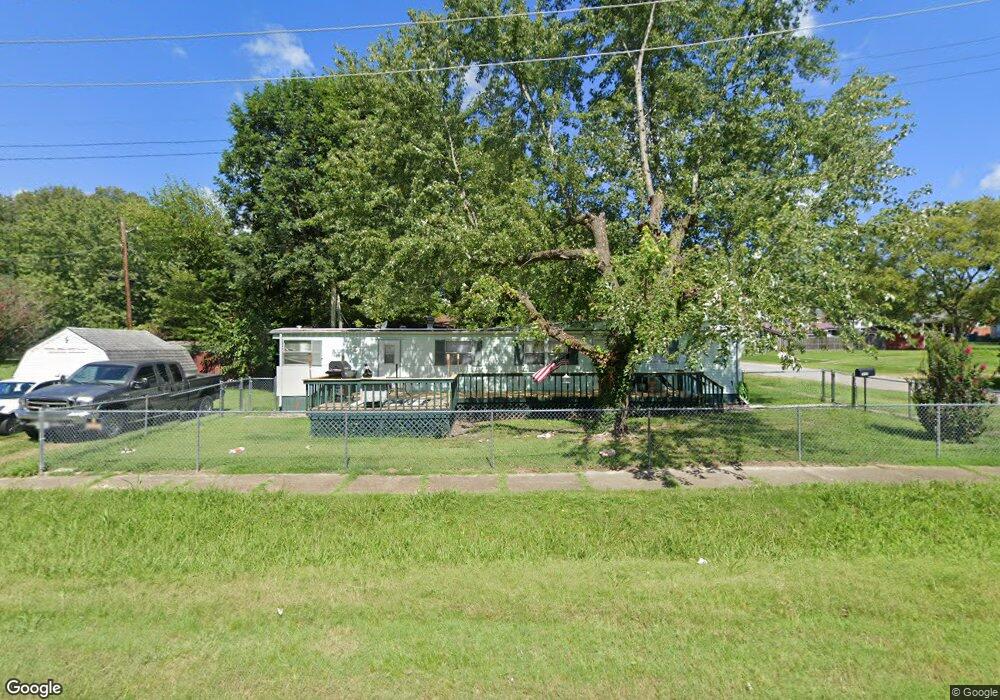
1900 Marshall St Eldorado, IL 62930
Estimated Value: $42,750 - $62,000
Studio
--
Bath
--
Sq Ft
4,922
Sq Ft Lot
About This Home
This home is located at 1900 Marshall St, Eldorado, IL 62930 and is currently estimated at $54,250. 1900 Marshall St is a home with nearby schools including Eldorado Elementary School, Eldorado Middle School, and Eldorado High School.
Ownership History
Date
Name
Owned For
Owner Type
Purchase Details
Closed on
Nov 9, 2022
Sold by
Hoover Richard
Bought by
Makb Rentals Llc
Current Estimated Value
Purchase Details
Closed on
Jun 16, 2022
Sold by
Tracy Owen
Bought by
Hoover Richard and Cummins Sarah
Purchase Details
Closed on
Oct 16, 2007
Sold by
Stein Carolyn
Bought by
Owen Tracy
Purchase Details
Closed on
Jul 24, 2007
Sold by
Stein Carolyn and Baugher Dann
Bought by
Stein Carolyn
Purchase Details
Closed on
Mar 13, 2006
Sold by
Ashley Louise
Bought by
Stein Carolyjhn and Baugher Dann
Create a Home Valuation Report for This Property
The Home Valuation Report is an in-depth analysis detailing your home's value as well as a comparison with similar homes in the area
Home Values in the Area
Average Home Value in this Area
Purchase History
| Date | Buyer | Sale Price | Title Company |
|---|---|---|---|
| Makb Rentals Llc | $5,000 | None Listed On Document | |
| Hoover Richard | $1,500 | None Listed On Document | |
| Owen Tracy | $11,000 | None Available | |
| Stein Carolyn | -- | None Available | |
| Stein Carolyjhn | -- | None Available |
Source: Public Records
Tax History
| Year | Tax Paid | Tax Assessment Tax Assessment Total Assessment is a certain percentage of the fair market value that is determined by local assessors to be the total taxable value of land and additions on the property. | Land | Improvement |
|---|---|---|---|---|
| 2024 | $452 | $4,750 | $1,106 | $3,644 |
| 2023 | $452 | $4,652 | $1,083 | $3,569 |
| 2022 | $191 | $1,897 | $976 | $921 |
| 2021 | $186 | $1,795 | $924 | $871 |
| 2020 | $187 | $1,741 | $896 | $845 |
| 2019 | $196 | $1,920 | $988 | $932 |
| 2018 | $197 | $1,920 | $988 | $932 |
| 2017 | $186 | $1,920 | $988 | $932 |
| 2016 | $2 | $1,776 | $914 | $862 |
| 2015 | -- | $1,776 | $914 | $862 |
| 2014 | $167 | $1,700 | $875 | $825 |
| 2013 | $167 | $1,700 | $875 | $825 |
| 2012 | $167 | $1,700 | $875 | $825 |
Source: Public Records
Map
Nearby Homes
- 1205 Lincoln St
- 1209 Lincoln St
- 1137 Lincoln St
- 1912 Marshall St
- 1213 Lincoln St
- 1812 Marshall St
- 1136 West St
- 1135 Lincoln St
- 1210 Lincoln St
- 1217 Lincoln St
- 1132 Lincoln St
- 1216 West St
- 1127 Lincoln St
- 1128 West St
- 1201 West St
- 1216 Lincoln St
- 1901 Douglas St
- 1128 Lincoln St
- 1125 Lincoln St
- 1909 Douglas St
Your Personal Tour Guide
Ask me questions while you tour the home.