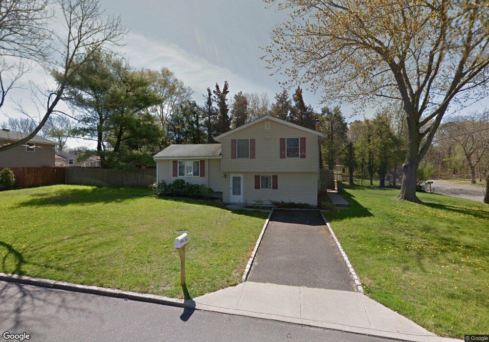
1900 Phillips Dr Medford, NY 11763
Estimated Value: $408,000 - $529,000
3
Beds
1
Bath
1,184
Sq Ft
$412/Sq Ft
Est. Value
About This Home
This home is located at 1900 Phillips Dr, Medford, NY 11763 and is currently estimated at $487,395, approximately $411 per square foot. 1900 Phillips Dr is a home located in Suffolk County with nearby schools including Patchogue-Medford High School and Long Island Baptist Academy.
Ownership History
Date
Name
Owned For
Owner Type
Purchase Details
Closed on
Sep 13, 2002
Sold by
Nielson Joseph J and Nielson Jeannette
Bought by
Options For Community Living Inc
Current Estimated Value
Purchase Details
Closed on
Dec 8, 2000
Sold by
Stiles Mary Jane
Bought by
Nielson Joseph J and Nielson Jeannette
Home Financials for this Owner
Home Financials are based on the most recent Mortgage that was taken out on this home.
Original Mortgage
$100,000
Interest Rate
7%
Create a Home Valuation Report for This Property
The Home Valuation Report is an in-depth analysis detailing your home's value as well as a comparison with similar homes in the area
Home Values in the Area
Average Home Value in this Area
Purchase History
| Date | Buyer | Sale Price | Title Company |
|---|---|---|---|
| Options For Community Living Inc | $244,000 | -- | |
| Nielson Joseph J | $125,000 | -- |
Source: Public Records
Mortgage History
| Date | Status | Borrower | Loan Amount |
|---|---|---|---|
| Previous Owner | Nielson Joseph J | $100,000 |
Source: Public Records
Tax History
| Year | Tax Paid | Tax Assessment Tax Assessment Total Assessment is a certain percentage of the fair market value that is determined by local assessors to be the total taxable value of land and additions on the property. | Land | Improvement |
|---|---|---|---|---|
| 2024 | -- | $2,415 | $200 | $2,215 |
| 2023 | -- | $2,415 | $200 | $2,215 |
| 2022 | $0 | $2,415 | $200 | $2,215 |
| 2021 | $0 | $2,415 | $200 | $2,215 |
| 2020 | $0 | $2,415 | $200 | $2,215 |
| 2019 | $0 | $0 | $0 | $0 |
| 2018 | $0 | $2,415 | $200 | $2,215 |
| 2017 | -- | $2,415 | $200 | $2,215 |
| 2016 | -- | $2,415 | $200 | $2,215 |
| 2015 | -- | $2,415 | $200 | $2,215 |
| 2014 | -- | $2,415 | $200 | $2,215 |
Source: Public Records
Map
Nearby Homes
- 2909 New London Ave
- 2804 Eagle Ave
- 2905 Eagle Ave
- 2907 Rhode Island Ave
- 2914 Connecticut Ave
- 2909 Falcon Ave
- 0 Cedar Ln Unit ONE3556748
- 2903 Sipp Ave
- 2700 Falcon Ave
- 3106 Devon Ave
- 3011 Maine Ave
- 3107 Chestnut Ave
- 3108 Devon Ave
- 3019 Sipp Ave
- 2809 Heather Ave
- 3103 Falcon Ave
- 2617 Kane Ave
- 1703 Fire Ave
- 57 Middle Island Rd
- 3117 Kane Ave
- 2811 New London Ave
- 1901 Phillips Dr
- 2810 Devon Ave
- 1903 Phillips Dr
- 1808 Phillips Dr
- 2810 New London Ave
- 1905 Phillips Dr
- 1809 Phillips Dr
- 2815 Devon Ave
- 1806 Phillips Dr
- 2811 Devon Ave
- 1907 Phillips Dr
- 1807 Phillips Dr
- 2809 Devon Ave
- 1804 Phillips Dr
- 2812 Watch Hill Ave
- 2812 Watchill Ave
- 2903 New London Ave
- 2810 Watchill Ave
- 2807 Devon Ave
Your Personal Tour Guide
Ask me questions while you tour the home.