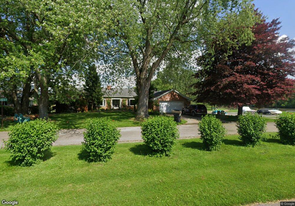
1900 Riverbend Pkwy Fremont, OH 43420
Estimated Value: $180,000 - $229,000
3
Beds
2
Baths
1,361
Sq Ft
$144/Sq Ft
Est. Value
About This Home
This home is located at 1900 Riverbend Pkwy, Fremont, OH 43420 and is currently estimated at $196,201, approximately $144 per square foot. 1900 Riverbend Pkwy is a home located in Sandusky County with nearby schools including Fremont Ross High School, St. Ann Catholic School, and Bishop Hoffman Catholic School - This is St Joe's School now.
Ownership History
Date
Name
Owned For
Owner Type
Purchase Details
Closed on
Oct 14, 1997
Sold by
Detwiler Jon C
Bought by
Wurm Richard B and Cosentino Jody E
Current Estimated Value
Home Financials for this Owner
Home Financials are based on the most recent Mortgage that was taken out on this home.
Original Mortgage
$97,750
Interest Rate
7.7%
Mortgage Type
New Conventional
Purchase Details
Closed on
Jun 30, 1994
Sold by
Beeker Dennis F
Bought by
Detwiler Jon C and Detwiler Melissa M
Home Financials for this Owner
Home Financials are based on the most recent Mortgage that was taken out on this home.
Original Mortgage
$84,000
Interest Rate
6.37%
Mortgage Type
New Conventional
Purchase Details
Closed on
Aug 1, 1984
Bought by
Hirt Reynold J and Hirt Sandra S
Create a Home Valuation Report for This Property
The Home Valuation Report is an in-depth analysis detailing your home's value as well as a comparison with similar homes in the area
Home Values in the Area
Average Home Value in this Area
Purchase History
| Date | Buyer | Sale Price | Title Company |
|---|---|---|---|
| Wurm Richard B | $115,000 | -- | |
| Detwiler Jon C | $105,000 | -- | |
| Hirt Reynold J | $60,000 | -- |
Source: Public Records
Mortgage History
| Date | Status | Borrower | Loan Amount |
|---|---|---|---|
| Closed | Wurm Richard B | $97,750 | |
| Previous Owner | Detwiler Jon C | $84,000 |
Source: Public Records
Tax History Compared to Growth
Tax History
| Year | Tax Paid | Tax Assessment Tax Assessment Total Assessment is a certain percentage of the fair market value that is determined by local assessors to be the total taxable value of land and additions on the property. | Land | Improvement |
|---|---|---|---|---|
| 2024 | $2,083 | $54,050 | $8,720 | $45,330 |
| 2023 | $2,083 | $43,230 | $6,970 | $36,260 |
| 2022 | $1,770 | $43,230 | $6,970 | $36,260 |
| 2021 | $2,231 | $43,230 | $6,970 | $36,260 |
| 2020 | $1,982 | $36,690 | $6,970 | $29,720 |
| 2019 | $2,010 | $36,690 | $6,970 | $29,720 |
| 2018 | $2,013 | $36,690 | $6,970 | $29,720 |
| 2017 | $1,903 | $33,990 | $6,970 | $27,020 |
| 2016 | $1,732 | $33,990 | $6,970 | $27,020 |
| 2015 | $1,712 | $33,990 | $6,970 | $27,020 |
| 2014 | $1,792 | $34,410 | $7,180 | $27,230 |
| 2013 | $1,764 | $34,410 | $7,180 | $27,230 |
Source: Public Records
Map
Nearby Homes
- 1730 Port Clinton Rd Unit 41
- 1730 Port Clinton Rd
- 1730 Port Clinton Rd Unit 33
- 711 Bloom Rd
- 0 Sean Dr
- Outlot A Sean Dr
- 2100 Ohio 53
- 612 2nd St
- 533 Sandusky Ave Unit 535
- 900 Spring St
- 433 Sandusky Ave
- 711 Rawson Ave
- 1441 White Ave
- 340 340 Sandusky Ave
- 1227 White Ave
- 516 N Front St
- 322 4th St
- 224 Sandusky Ave Unit 226
- 427 N Clover St
- 1548 North St
- 1910 Riverbend Pkwy
- 1909 Riverbend Pkwy
- 1914 Riverbend Pkwy
- 1913 Riverbend Pkwy
- 1918 Riverbend Pkwy
- 1921 Riverbend Pkwy
- 1905 Whittaker Dr
- 1926 Riverbend Pkwy
- 1901 Whittaker Dr
- 1915 Whittaker Dr
- 1929 Riverbend Pkwy
- 1899 Port Clinton Rd
- 236 Yacht Club Dr
- 248 Yacht Club Dr
- 224 Yacht Club Dr
- 1912 Whittaker Dr
- 1931 Whittaker Dr
- 1889 Port Clinton Rd
- 214 Yacht Club Dr
- 210 Yacht Club Dr