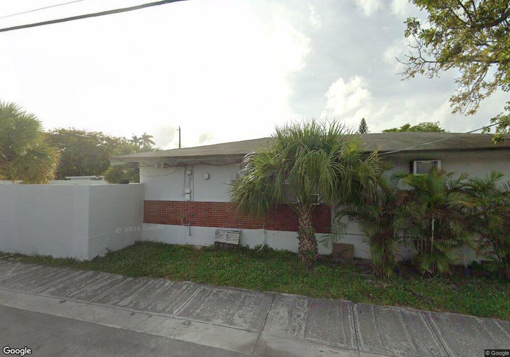
1900 Taylor St Hollywood, FL 33020
Royal Poinciana NeighborhoodEstimated Value: $550,000
2
Beds
2
Baths
1,239
Sq Ft
$444/Sq Ft
Est. Value
About This Home
This home is located at 1900 Taylor St, Hollywood, FL 33020 and is currently priced at $550,000, approximately $443 per square foot. 1900 Taylor St is a home located in Broward County with nearby schools including Dania Elementary School, Olsen Middle School, and South Broward High School.
Ownership History
Date
Name
Owned For
Owner Type
Purchase Details
Closed on
Apr 2, 1998
Sold by
Thomas M Wohl Tr and Barbara W Klein Tr
Bought by
Hollywood Investment Group Inc
Current Estimated Value
Home Financials for this Owner
Home Financials are based on the most recent Mortgage that was taken out on this home.
Original Mortgage
$1,200,000
Outstanding Balance
$224,811
Interest Rate
6.95%
Mortgage Type
Commercial
Create a Home Valuation Report for This Property
The Home Valuation Report is an in-depth analysis detailing your home's value as well as a comparison with similar homes in the area
Home Values in the Area
Average Home Value in this Area
Purchase History
| Date | Buyer | Sale Price | Title Company |
|---|---|---|---|
| Hollywood Investment Group Inc | $1,500,000 | -- |
Source: Public Records
Mortgage History
| Date | Status | Borrower | Loan Amount |
|---|---|---|---|
| Open | Hollywood Investment Group Inc | $1,200,000 |
Source: Public Records
Tax History Compared to Growth
Tax History
| Year | Tax Paid | Tax Assessment Tax Assessment Total Assessment is a certain percentage of the fair market value that is determined by local assessors to be the total taxable value of land and additions on the property. | Land | Improvement |
|---|---|---|---|---|
| 2025 | $3,619 | $132,680 | $37,670 | $95,010 |
| 2024 | $3,612 | $132,680 | $37,670 | $95,010 |
| 2023 | $3,612 | $132,680 | $37,670 | $95,010 |
| 2022 | $7,195 | $308,520 | $64,570 | $243,950 |
| 2021 | $7,188 | $308,520 | $64,570 | $243,950 |
| 2020 | $7,183 | $308,520 | $64,570 | $243,950 |
| 2019 | $7,141 | $308,480 | $64,570 | $243,910 |
| 2018 | $6,908 | $308,480 | $64,570 | $243,910 |
| 2017 | $6,330 | $276,010 | $0 | $0 |
| 2016 | $6,451 | $276,010 | $0 | $0 |
| 2015 | $6,425 | $276,010 | $0 | $0 |
| 2014 | $6,488 | $276,010 | $0 | $0 |
| 2013 | -- | $276,010 | $64,570 | $211,440 |
Source: Public Records
Map
Nearby Homes
- 1817 Taylor St Unit 1614
- 1817 Taylor St Unit 1211
- 1817 Taylor St Unit 1503
- 1817 Taylor St Unit 1207
- 1817 Taylor St Unit 1109
- 1817 Taylor St Unit 1812
- 1817 Taylor St Unit 1806
- 1817 Taylor St Unit 1615
- 1817 Taylor St Unit 1204
- 1817 Taylor St Unit 1602
- 1817 Taylor St Unit 1101
- 1930 Pierce St
- 1830 Radius Dr Unit 810
- 1830 Radius Dr Unit 516
- 1830 Radius Dr Unit 1301
- 1830 Radius Dr Unit 609
- 1830 Radius Dr Unit 308
- 1830 Radius Dr Unit 604
- 1830 Radius Dr Unit 1024
- 1830 Radius Dr Unit 909
- 1909 Tyler St Unit 701
- 1909 Tyler St Unit 505
- 1909 Tyler St Unit 502
- 1912 Taylor St
- 1904 Taylor St
- 1906-1908 1906-1908 Taylor Unit 1908A
- 1906 1908 Taylor
- 1906-1908 Taylor St Unit 1908A
- 1906-1908 Taylor St Unit 1908B
- 1906 Taylor St Unit 1906
- 1906 Taylor St Unit 1908B
- 1906 Taylor St Unit 1908A
- 410 N 19th Ave Unit 410
- 400 N 19th Ave Unit 418
- 400 N 19th Ave Unit 412
- 400 N 19th Ave Unit 406
- 400 N 19th Ave Unit 414
- 400 N 19th Ave Unit 404
- 400 N 19th Ave Unit 424