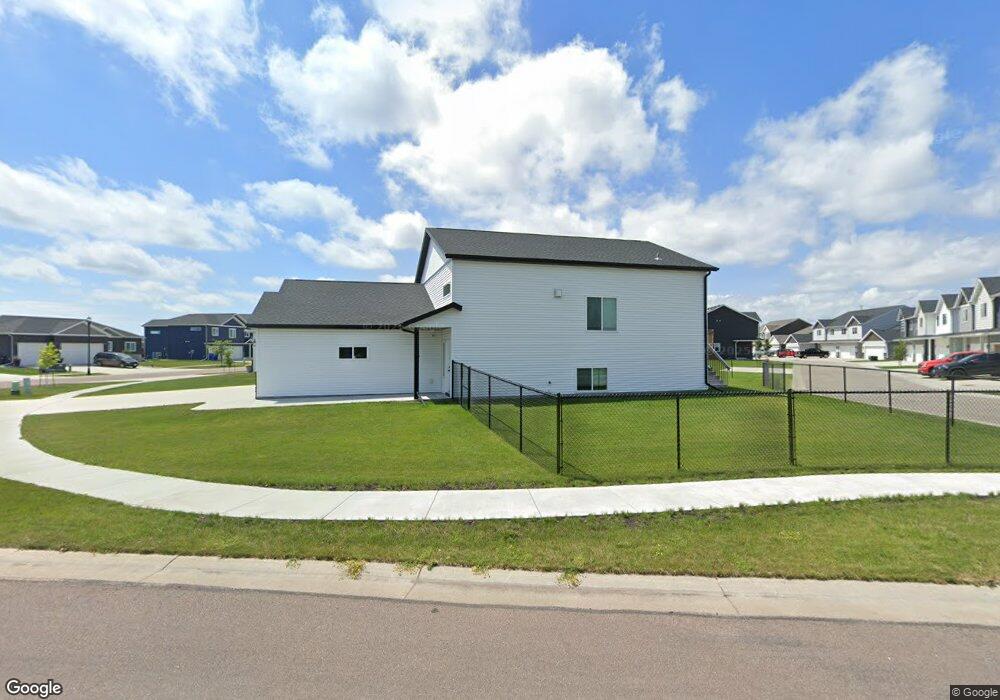
1901 65th Ave S Fargo, ND 58104
Davies NeighborhoodEstimated Value: $410,000 - $433,000
4
Beds
3
Baths
2,608
Sq Ft
$162/Sq Ft
Est. Value
About This Home
This home is located at 1901 65th Ave S, Fargo, ND 58104 and is currently estimated at $421,650, approximately $161 per square foot. 1901 65th Ave S is a home located in Cass County with nearby schools including Bennett Elementary School, Discovery Middle School, and Fargo Davies High School.
Ownership History
Date
Name
Owned For
Owner Type
Purchase Details
Closed on
Oct 27, 2020
Sold by
Jmw Construction Llc
Bought by
Stephenson George Garrett and Stephenson Brittany Leigh
Current Estimated Value
Home Financials for this Owner
Home Financials are based on the most recent Mortgage that was taken out on this home.
Original Mortgage
$272,918
Outstanding Balance
$242,304
Interest Rate
2.8%
Mortgage Type
New Conventional
Estimated Equity
$179,346
Purchase Details
Closed on
Jun 3, 2020
Sold by
Crofton Coves Llc
Bought by
Jmw Construction Llc
Home Financials for this Owner
Home Financials are based on the most recent Mortgage that was taken out on this home.
Original Mortgage
$220,000
Interest Rate
3.3%
Mortgage Type
Construction
Create a Home Valuation Report for This Property
The Home Valuation Report is an in-depth analysis detailing your home's value as well as a comparison with similar homes in the area
Home Values in the Area
Average Home Value in this Area
Purchase History
| Date | Buyer | Sale Price | Title Company |
|---|---|---|---|
| Stephenson George Garrett | $287,287 | Title Company Residential | |
| Jmw Construction Llc | $29,000 | Northern Title Co |
Source: Public Records
Mortgage History
| Date | Status | Borrower | Loan Amount |
|---|---|---|---|
| Open | Stephenson George Garrett | $272,918 | |
| Previous Owner | Jmw Construction Llc | $220,000 |
Source: Public Records
Tax History Compared to Growth
Tax History
| Year | Tax Paid | Tax Assessment Tax Assessment Total Assessment is a certain percentage of the fair market value that is determined by local assessors to be the total taxable value of land and additions on the property. | Land | Improvement |
|---|---|---|---|---|
| 2024 | $8,840 | $199,000 | $34,800 | $164,200 |
| 2023 | $8,983 | $199,000 | $34,800 | $164,200 |
| 2022 | $8,854 | $192,300 | $51,400 | $140,900 |
| 2021 | $6,377 | $102,900 | $51,400 | $51,500 |
| 2020 | $4,580 | $35,900 | $35,900 | $0 |
| 2019 | $4,227 | $22,450 | $22,450 | $0 |
| 2018 | $4,219 | $22,450 | $22,450 | $0 |
| 2017 | $4,116 | $28,750 | $28,750 | $0 |
| 2016 | $4,096 | $28,750 | $28,750 | $0 |
| 2015 | $2,103 | $150 | $150 | $0 |
| 2014 | $383 | $150 | $150 | $0 |
Source: Public Records
Map
Nearby Homes
- 1943 65th Ave S
- 1961 65th Ave S
- 1806 65th Ave S
- 1979 65th Ave S
- 1993 65th Ave S
- 1954 65th Ave S
- 1892 65th Ave S
- 1874 65th Ave S
- 1980 65th Ave S
- 2013 65th Ave S
- 1862 65th Ave S
- 2035 65th Ave S
- 2020 65th Ave S
- 6617 Crofton Ln S
- 2059 65th Ave S
- 6609 Crofton Ln S
- 1989 67th Ave S
- 6623 Crofton Ln S
- 2001 67th Ave S
- 6470 21st St S