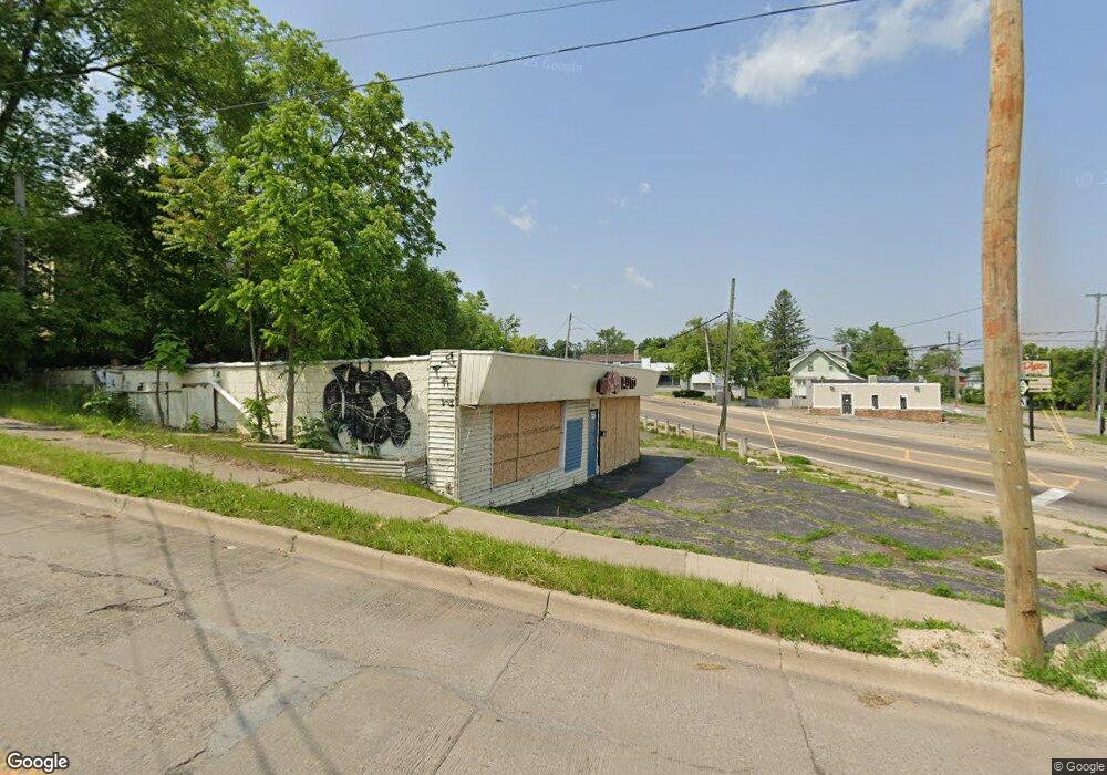
1901 Corunna Rd Flint, MI 48503
Southwest Flint NeighborhoodEstimated Value: $70,966
Studio
--
Bath
2,193
Sq Ft
$32/Sq Ft
Est. Value
About This Home
This home is located at 1901 Corunna Rd, Flint, MI 48503 and is currently estimated at $70,966, approximately $32 per square foot. 1901 Corunna Rd is a home located in Genesee County with nearby schools including Eisenhower School, Flint Southwestern Classical Academy, and St John Vianney Catholic School.
Ownership History
Date
Name
Owned For
Owner Type
Purchase Details
Closed on
Aug 16, 2024
Sold by
Genesee County Land Bank Authority
Bought by
Pro Line Auto Group Llc
Current Estimated Value
Purchase Details
Closed on
Dec 21, 2021
Sold by
Cherry Deborah L
Bought by
Genesee County Land Bank Authority
Purchase Details
Closed on
May 4, 2021
Sold by
Mcfall James and Mcfall Sheila
Bought by
Genesee County Treasurer
Purchase Details
Closed on
Oct 7, 2013
Sold by
Selou Sam D and Selou Remal M
Bought by
Mcfall James and Mcfall Sheila
Purchase Details
Closed on
Aug 5, 2008
Sold by
Selou Sam D and Selou Remal M
Bought by
Mcfall James and Mcfall Sheila
Home Financials for this Owner
Home Financials are based on the most recent Mortgage that was taken out on this home.
Original Mortgage
$30,000
Interest Rate
6.42%
Mortgage Type
Seller Take Back
Create a Home Valuation Report for This Property
The Home Valuation Report is an in-depth analysis detailing your home's value as well as a comparison with similar homes in the area
Home Values in the Area
Average Home Value in this Area
Purchase History
| Date | Buyer | Sale Price | Title Company |
|---|---|---|---|
| Pro Line Auto Group Llc | $11,000 | None Listed On Document | |
| Genesee County Land Bank Authority | -- | None Listed On Document | |
| Genesee County Treasurer | -- | None Available | |
| Mcfall James | $35,000 | None Available | |
| Mcfall James | $35,000 | Greco Title |
Source: Public Records
Mortgage History
| Date | Status | Borrower | Loan Amount |
|---|---|---|---|
| Previous Owner | Mcfall James | $30,000 |
Source: Public Records
Tax History
| Year | Tax Paid | Tax Assessment Tax Assessment Total Assessment is a certain percentage of the fair market value that is determined by local assessors to be the total taxable value of land and additions on the property. | Land | Improvement |
|---|---|---|---|---|
| 2025 | -- | $37,900 | $0 | $0 |
| 2024 | $72 | $0 | $0 | $0 |
| 2023 | $72 | $0 | $0 | $0 |
| 2022 | $0 | $0 | $0 | $0 |
| 2021 | $2,590 | $34,900 | $0 | $0 |
| 2020 | $2,324 | $34,700 | $0 | $0 |
| 2019 | $2,234 | $33,300 | $0 | $0 |
| 2018 | $2,573 | $52,400 | $0 | $0 |
| 2017 | $2,489 | $0 | $0 | $0 |
| 2016 | $2,468 | $0 | $0 | $0 |
| 2015 | -- | $0 | $0 | $0 |
| 2014 | -- | $0 | $0 | $0 |
| 2012 | -- | $37,500 | $0 | $0 |
Source: Public Records
Map
Nearby Homes
- 1114 Christopher St
- 2124 Swayze St
- 2310 Gibson St
- 2410 Corunna Rd
- 2112 Miller Rd
- 2437 Zimmerman St
- 607 Thayer St
- 1820 Chelsea Cir
- 2433 Brown St
- 2464 Gibson St
- 2509 Corunna Rd
- 2537 Swayze St
- 2618 Brown St
- 751 Dupont St
- 2663 W Court St
- 825 Frank St
- 913 Davis St
- 932 Bradley Ave
- 612 Bradley Ave
- 2026 Monteith St
- 914 Pershing St
- 1910 Zimmerman St
- 909 Pershing St
- 915 Pershing St
- 1912 Corunna Rd
- 1919 W Court St
- 925 Pershing St
- 1834 W Court St
- 1002 Pershing St
- 1912 W Court St
- 1819 W Court St
- 1916 W Court St
- 1001 Pershing St
- 419 Pershing St
- 1915 Zimmerman St
- 1920 W Court St
- 1919 Zimmerman St
- 1005 Pershing St
- 1828 Zimmerman St
- 1926 Corunna Rd
Your Personal Tour Guide
Ask me questions while you tour the home.