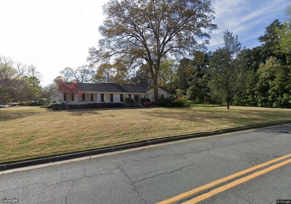
1901 Hilton Ave Columbus, GA 31906
Wynnton Grove NeighborhoodEstimated Value: $440,000 - $543,000
3
Beds
5
Baths
2,783
Sq Ft
$178/Sq Ft
Est. Value
About This Home
This home is located at 1901 Hilton Ave, Columbus, GA 31906 and is currently estimated at $496,308, approximately $178 per square foot. 1901 Hilton Ave is a home located in Muscogee County with nearby schools including Richards Middle School, Hardaway High School, and Wynnton Elementary School.
Ownership History
Date
Name
Owned For
Owner Type
Purchase Details
Closed on
Jun 9, 2017
Sold by
Champion Irene S
Bought by
Richau Randy Paul and Richau Stephanie Linn
Current Estimated Value
Home Financials for this Owner
Home Financials are based on the most recent Mortgage that was taken out on this home.
Original Mortgage
$212,000
Outstanding Balance
$35,487
Interest Rate
4.05%
Mortgage Type
New Conventional
Estimated Equity
$460,821
Create a Home Valuation Report for This Property
The Home Valuation Report is an in-depth analysis detailing your home's value as well as a comparison with similar homes in the area
Home Values in the Area
Average Home Value in this Area
Purchase History
| Date | Buyer | Sale Price | Title Company |
|---|---|---|---|
| Richau Randy Paul | $265,000 | -- |
Source: Public Records
Mortgage History
| Date | Status | Borrower | Loan Amount |
|---|---|---|---|
| Open | Richau Randy Paul | $212,000 |
Source: Public Records
Tax History
| Year | Tax Paid | Tax Assessment Tax Assessment Total Assessment is a certain percentage of the fair market value that is determined by local assessors to be the total taxable value of land and additions on the property. | Land | Improvement |
|---|---|---|---|---|
| 2025 | $3,807 | $141,720 | $24,868 | $116,852 |
| 2024 | $3,806 | $141,720 | $24,868 | $116,852 |
| 2023 | $3,136 | $141,720 | $24,868 | $116,852 |
| 2022 | $3,970 | $110,880 | $24,868 | $86,012 |
| 2021 | $3,963 | $110,448 | $24,868 | $85,580 |
| 2020 | $3,964 | $110,448 | $24,868 | $85,580 |
| 2019 | $3,978 | $110,448 | $24,868 | $85,580 |
| 2018 | $4,343 | $106,000 | $24,280 | $81,720 |
| 2017 | $4,456 | $108,412 | $24,868 | $83,544 |
| 2016 | $3,681 | $102,509 | $15,443 | $87,066 |
| 2015 | $1,474 | $102,509 | $15,443 | $87,066 |
| 2014 | $3,691 | $102,509 | $15,443 | $87,066 |
| 2013 | $3,697 | $102,509 | $15,443 | $87,066 |
Source: Public Records
Map
Nearby Homes
- 2008 Stark Ave
- 1706 Stark Ave
- 1717 Stark Ave
- 1700 Stark Ave
- 2108 Young St
- 1805 Iris Dr
- 2114 Forest Ct
- 1534 Dixon Dr
- 2010 Cherokee Ave
- 1513 Wells Dr
- 2904 Iris Ct
- 2243 14th St
- 1500 Preston Dr
- 2230 Cherokee Ave Unit 10
- 1319 Hilton Ave
- 1712 Marilon Dr
- 2911 Gardenia St
- 2917 Gardenia St
- 2133 13th St
- 2000 Poplar Dr
- 2315 19th St
- 1915 Hilton Ave
- 1821 Hilton Ave
- 1914 Stark Ave
- 1906 Stark Ave
- 2316 19th St
- 1910 Hilton Ave
- 1944 Stark Ave
- 1820 Stark Ave
- 1920 Hilton Ave
- 1814 Stark Ave
- 2000 Stark Ave
- 1739 Hilton Ave
- 1939 Hilton Ave
- 1890 Hilton Ave
- 1722 Stark Ave
- 1901 Stark Ave
- 1720 Stark Ave
- 1941 Stark Ave
- 1907 Powers Ave