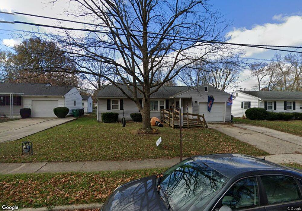
1901 N Metcalf St Lima, OH 45801
Northside Lima NeighborhoodEstimated Value: $154,000 - $182,000
4
Beds
2
Baths
1,136
Sq Ft
$149/Sq Ft
Est. Value
About This Home
This home is located at 1901 N Metcalf St, Lima, OH 45801 and is currently estimated at $168,711, approximately $148 per square foot. 1901 N Metcalf St is a home located in Allen County with nearby schools including Elida Elementary School, Elida Middle School, and Elida High School.
Ownership History
Date
Name
Owned For
Owner Type
Purchase Details
Closed on
Feb 15, 2006
Sold by
Housing Helpers Of Ohio Ltd
Bought by
Miller Robert P and Miller Kristy M
Current Estimated Value
Home Financials for this Owner
Home Financials are based on the most recent Mortgage that was taken out on this home.
Original Mortgage
$74,375
Outstanding Balance
$41,870
Interest Rate
6.2%
Estimated Equity
$126,841
Purchase Details
Closed on
May 19, 2005
Sold by
Ankney Raemie and Ankney Raemie L
Bought by
Housing Helpers Of Ohio Ltd
Purchase Details
Closed on
Mar 14, 1997
Sold by
Raines Johnnie
Bought by
Ankney Darren and Ankney Raemie
Home Financials for this Owner
Home Financials are based on the most recent Mortgage that was taken out on this home.
Original Mortgage
$57,520
Interest Rate
7.95%
Mortgage Type
New Conventional
Purchase Details
Closed on
Feb 1, 1984
Bought by
Raines Johnnie R
Create a Home Valuation Report for This Property
The Home Valuation Report is an in-depth analysis detailing your home's value as well as a comparison with similar homes in the area
Home Values in the Area
Average Home Value in this Area
Purchase History
| Date | Buyer | Sale Price | Title Company |
|---|---|---|---|
| Miller Robert P | $87,500 | None Available | |
| Housing Helpers Of Ohio Ltd | $69,000 | None Available | |
| Ankney Darren | $71,900 | -- | |
| Raines Johnnie R | $50,000 | -- |
Source: Public Records
Mortgage History
| Date | Status | Borrower | Loan Amount |
|---|---|---|---|
| Open | Miller Robert P | $74,375 | |
| Previous Owner | Ankney Darren | $57,520 |
Source: Public Records
Tax History Compared to Growth
Tax History
| Year | Tax Paid | Tax Assessment Tax Assessment Total Assessment is a certain percentage of the fair market value that is determined by local assessors to be the total taxable value of land and additions on the property. | Land | Improvement |
|---|---|---|---|---|
| 2024 | $1,562 | $38,580 | $5,290 | $33,290 |
| 2023 | $1,282 | $28,360 | $3,890 | $24,470 |
| 2022 | $1,301 | $28,360 | $3,890 | $24,470 |
| 2021 | $1,309 | $28,360 | $3,890 | $24,470 |
| 2020 | $1,150 | $23,320 | $3,750 | $19,570 |
| 2019 | $1,150 | $23,320 | $3,750 | $19,570 |
| 2018 | $1,134 | $23,320 | $3,750 | $19,570 |
| 2017 | $1,099 | $23,320 | $3,750 | $19,570 |
| 2016 | $1,097 | $23,320 | $3,750 | $19,570 |
| 2015 | $1,105 | $23,320 | $3,750 | $19,570 |
| 2014 | $1,105 | $22,720 | $3,610 | $19,110 |
| 2013 | $1,072 | $22,720 | $3,610 | $19,110 |
Source: Public Records
Map
Nearby Homes
- 610 W Robb Ave
- 1776 Virginia Ave
- 1720 Brookwood Dr
- 400 W Northern Ave
- 340 W Robb Ave
- 765 W Lane Ave
- 608 W O'Connor Ave
- 207 W Lane Ave
- 1628 Karen St
- 645 W O'Connor Ave
- 128 E Lane Ave
- 1200 N Main St
- 812 W Ashton Ave
- 105 Watt Ave
- 1004 Sherman Ave
- 2351 Burden Dr
- 765 Ewing Ave
- 0 Sherman Ave
- 2371 Mandolin Dr
- 676 Cortlandt Ave