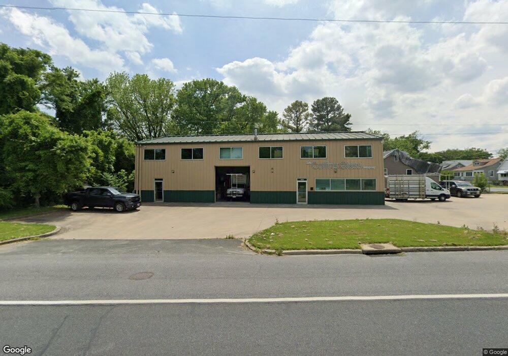
1901 N Point Blvd Baltimore, MD 21222
--
Bed
--
Bath
3,200
Sq Ft
10,803
Sq Ft Lot
About This Home
This home is located at 1901 N Point Blvd, Baltimore, MD 21222. 1901 N Point Blvd is a home located in Baltimore County with nearby schools including Berkshire Elementary School, Holabird Middle School, and Patapsco High & Center for Arts.
Ownership History
Date
Name
Owned For
Owner Type
Purchase Details
Closed on
Aug 21, 2006
Sold by
Stamation George
Bought by
1901 North Point Blvd Llc
Home Financials for this Owner
Home Financials are based on the most recent Mortgage that was taken out on this home.
Original Mortgage
$200,000
Interest Rate
6.83%
Mortgage Type
Commercial
Purchase Details
Closed on
Aug 17, 2006
Sold by
Stamation George
Bought by
1901 North Point Blvd Llc
Home Financials for this Owner
Home Financials are based on the most recent Mortgage that was taken out on this home.
Original Mortgage
$200,000
Interest Rate
6.83%
Mortgage Type
Commercial
Purchase Details
Closed on
Oct 2, 1975
Sold by
White Floyd G
Bought by
Stamation George
Create a Home Valuation Report for This Property
The Home Valuation Report is an in-depth analysis detailing your home's value as well as a comparison with similar homes in the area
Home Values in the Area
Average Home Value in this Area
Purchase History
| Date | Buyer | Sale Price | Title Company |
|---|---|---|---|
| 1901 North Point Blvd Llc | $250,000 | -- | |
| 1901 North Point Blvd Llc | $250,000 | -- | |
| Stamation George | $25,500 | -- |
Source: Public Records
Mortgage History
| Date | Status | Borrower | Loan Amount |
|---|---|---|---|
| Closed | 1901 North Point Blvd Llc | $200,000 | |
| Closed | 1901 North Point Blvd Llc | $200,000 |
Source: Public Records
Tax History Compared to Growth
Tax History
| Year | Tax Paid | Tax Assessment Tax Assessment Total Assessment is a certain percentage of the fair market value that is determined by local assessors to be the total taxable value of land and additions on the property. | Land | Improvement |
|---|---|---|---|---|
| 2025 | $5,678 | $436,667 | -- | -- |
| 2024 | $5,678 | $429,333 | $0 | $0 |
| 2023 | $2,796 | $422,000 | $220,600 | $201,400 |
| 2022 | $4,752 | $422,000 | $220,600 | $201,400 |
| 2021 | $5,508 | $422,000 | $220,600 | $201,400 |
| 2020 | $5,197 | $428,800 | $220,600 | $208,200 |
| 2019 | $5,193 | $428,500 | $0 | $0 |
| 2018 | $5,539 | $428,200 | $0 | $0 |
| 2017 | $5,552 | $427,900 | $0 | $0 |
| 2016 | $5,455 | $425,567 | $0 | $0 |
| 2015 | $5,455 | $423,233 | $0 | $0 |
| 2014 | $5,455 | $420,900 | $0 | $0 |
Source: Public Records
Map
Nearby Homes
- 1205 N Point Rd
- 1229 N Point Rd
- 7525 Lange St
- 7521 Lange St
- 1237 Willow Rd
- 1260 Willow Rd
- 990 Dalton Ave
- 988 Dalton Ave
- 7437 Berkshire Rd
- 1346 Willow Rd
- 2408 Meadow Rd
- 904 Elton Ave
- 2429 Plainfield Rd
- 7432 Manchester Rd
- 7420 Poplar Ave
- 7506 Belmont Ave
- 800 Northpoint Rd
- 217 S Woodwell Rd
- 7412 Belmont Ave
- 12 Robinson Ave
- 7523 Carroll Ave
- 7521 Carroll Ave
- 7528 Carroll Ave
- 7526 Carroll Ave
- 7524 Carroll Ave
- 7522 Carroll Ave
- 7720 Norbush Ave
- 7720 Nordbruch Ave
- 7520 Carroll Ave
- 7509 Carroll Ave
- 7518 Carroll Ave
- 7718 Nordbruch Ave
- 7718 Norbush Ave
- 7516 Carroll Ave
- 7712 Norbush Ave
- 7723 Nordbruch Ave
- 7723 Norbush Ave
- 7721 Nordbruch Ave
- 7514 Carroll Ave
- 7712 Nordbruch Ave