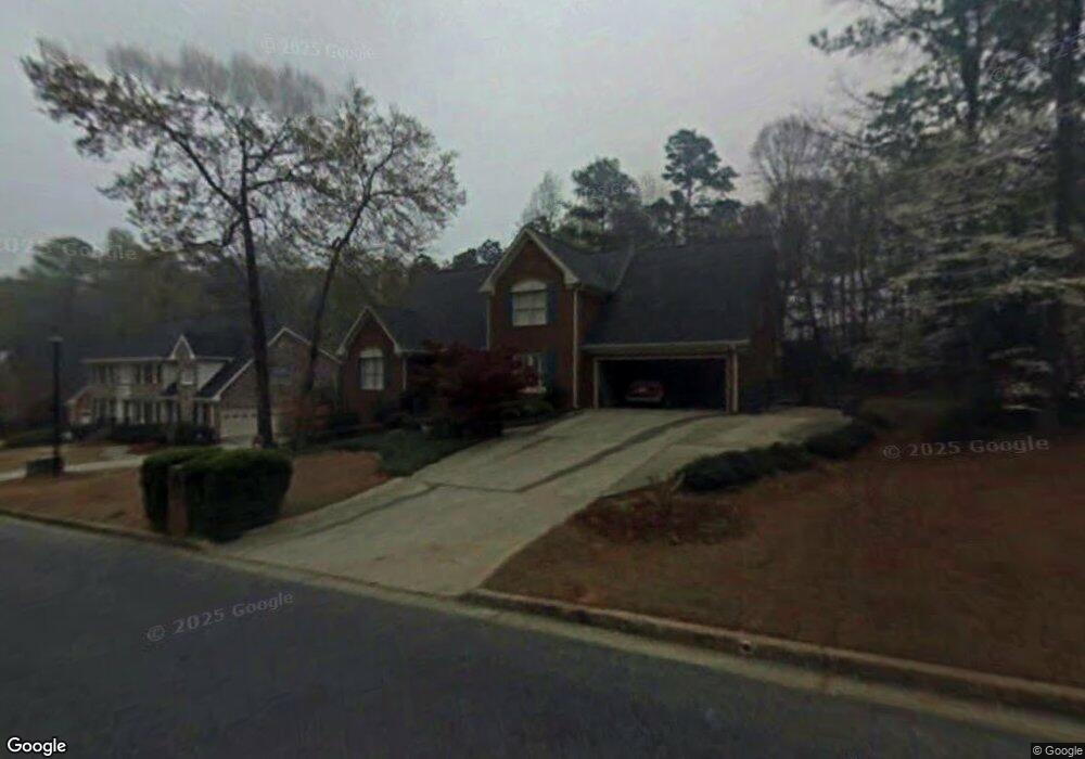
1901 Oak Branch Way Unit 1 Stone Mountain, GA 30087
Estimated Value: $447,000 - $524,000
4
Beds
2
Baths
3,178
Sq Ft
$156/Sq Ft
Est. Value
About This Home
This home is located at 1901 Oak Branch Way Unit 1, Stone Mountain, GA 30087 and is currently estimated at $496,342, approximately $156 per square foot. 1901 Oak Branch Way Unit 1 is a home located in Gwinnett County with nearby schools including Mountain Park Elementary School, Trickum Middle School, and Parkview High School.
Ownership History
Date
Name
Owned For
Owner Type
Purchase Details
Closed on
Sep 10, 2003
Sold by
Pye Russell P
Bought by
Minar Michael S
Current Estimated Value
Home Financials for this Owner
Home Financials are based on the most recent Mortgage that was taken out on this home.
Original Mortgage
$208,000
Outstanding Balance
$83,150
Interest Rate
4.25%
Mortgage Type
New Conventional
Estimated Equity
$413,192
Purchase Details
Closed on
Jul 29, 1998
Sold by
Calder James W and Calder Wilma
Bought by
Burton Patti Sue and Burton Russell
Home Financials for this Owner
Home Financials are based on the most recent Mortgage that was taken out on this home.
Original Mortgage
$211,850
Interest Rate
6.91%
Mortgage Type
New Conventional
Create a Home Valuation Report for This Property
The Home Valuation Report is an in-depth analysis detailing your home's value as well as a comparison with similar homes in the area
Home Values in the Area
Average Home Value in this Area
Purchase History
| Date | Buyer | Sale Price | Title Company |
|---|---|---|---|
| Minar Michael S | $260,000 | -- | |
| Burton Patti Sue | $223,000 | -- |
Source: Public Records
Mortgage History
| Date | Status | Borrower | Loan Amount |
|---|---|---|---|
| Open | Minar Michael S | $208,000 | |
| Previous Owner | Burton Patti Sue | $211,850 |
Source: Public Records
Tax History Compared to Growth
Tax History
| Year | Tax Paid | Tax Assessment Tax Assessment Total Assessment is a certain percentage of the fair market value that is determined by local assessors to be the total taxable value of land and additions on the property. | Land | Improvement |
|---|---|---|---|---|
| 2024 | $6,125 | $215,320 | $36,000 | $179,320 |
| 2023 | $6,125 | $155,360 | $30,800 | $124,560 |
| 2022 | $4,851 | $155,360 | $30,800 | $124,560 |
| 2021 | $4,286 | $124,960 | $22,800 | $102,160 |
| 2020 | $4,314 | $124,960 | $22,800 | $102,160 |
| 2019 | $4,182 | $124,960 | $22,800 | $102,160 |
| 2018 | $4,189 | $124,960 | $22,800 | $102,160 |
| 2016 | $3,791 | $105,720 | $18,400 | $87,320 |
| 2015 | $3,299 | $88,560 | $16,000 | $72,560 |
| 2014 | $3,299 | $88,080 | $16,000 | $72,080 |
Source: Public Records
Map
Nearby Homes
- 1937 Pucketts Dr SW
- 1949 Pucketts Dr SW
- 4907 Habersham Ridge SW
- 1647 Grandeus Ln SW
- 4908 Tarleton Dr SW
- 4742 Valley Dale Dr SW
- 4882 Rock Haven Dr SW
- 5019 Sandstone Ct SW
- 1611 Threepine Place SW Unit 3
- 1765 Pinetree Pass Ln SW
- 4803 Tarleton Dr SW
- 1559 Norwood Dr SW
- 4774 Saint Bernard Dr SW
- 1695 Pitty Pat Ct SW
- 2142 Colonial Oak Way
- 5113 Brownlee Rd
- 4726 Alpine Dr SW
- 1724 Rhonda Ln
- 1911 Oak Branch Way
- 1891 Oak Branch Way
- 1900 Oak Branch Way
- 1921 Oak Branch Way
- 1870 Oak Branch Way Unit 1
- 1910 Oak Branch Way
- 1881 Oak Branch Way Unit 1
- 1931 Oak Branch Way Unit 1
- 1920 Oak Branch Way
- 1871 Oak Branch Way
- 5080 Oak Nut Ct
- 5090 Oak Nut Ct
- 1861 Oak Branch Way
- 1930 Oak Branch Way
- 1941 Oak Branch Way
- 1851 Oak Branch Way
- 5070 Oak Nut Ct
- 1801 Oak Ridge Cir SW
- 0 Oak Branch Way Unit 8692262
- 0 Oak Branch Way Unit 8563719