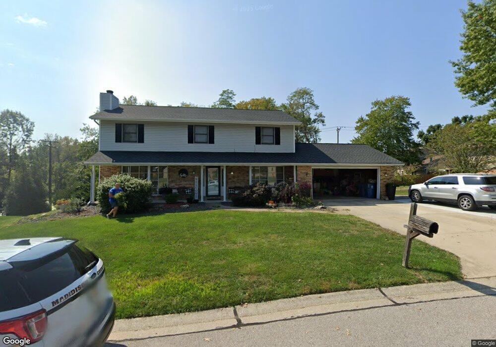
1901 Pinehurst Ct Collinsville, IL 62234
Estimated Value: $301,715 - $400,000
4
Beds
3
Baths
2,021
Sq Ft
$169/Sq Ft
Est. Value
About This Home
This home is located at 1901 Pinehurst Ct, Collinsville, IL 62234 and is currently estimated at $340,679, approximately $168 per square foot. 1901 Pinehurst Ct is a home located in Madison County with nearby schools including John A Renfro Elementary School, Dorris Intermediate School, and Collinsville Middle School.
Ownership History
Date
Name
Owned For
Owner Type
Purchase Details
Closed on
Jun 29, 2007
Sold by
Rogers Michael A and Rogers Terri J
Bought by
Cerna Jose and Cerna Michele
Current Estimated Value
Home Financials for this Owner
Home Financials are based on the most recent Mortgage that was taken out on this home.
Original Mortgage
$185,250
Outstanding Balance
$115,303
Interest Rate
6.42%
Mortgage Type
Purchase Money Mortgage
Estimated Equity
$225,376
Create a Home Valuation Report for This Property
The Home Valuation Report is an in-depth analysis detailing your home's value as well as a comparison with similar homes in the area
Home Values in the Area
Average Home Value in this Area
Purchase History
| Date | Buyer | Sale Price | Title Company |
|---|---|---|---|
| Cerna Jose | $195,000 | First American Title Ins Co |
Source: Public Records
Mortgage History
| Date | Status | Borrower | Loan Amount |
|---|---|---|---|
| Open | Cerna Jose | $185,250 |
Source: Public Records
Tax History Compared to Growth
Tax History
| Year | Tax Paid | Tax Assessment Tax Assessment Total Assessment is a certain percentage of the fair market value that is determined by local assessors to be the total taxable value of land and additions on the property. | Land | Improvement |
|---|---|---|---|---|
| 2024 | $5,363 | $89,890 | $15,210 | $74,680 |
| 2023 | $5,363 | $83,200 | $14,080 | $69,120 |
| 2022 | $5,081 | $76,940 | $13,020 | $63,920 |
| 2021 | $4,578 | $72,280 | $12,230 | $60,050 |
| 2020 | $4,515 | $70,690 | $13,360 | $57,330 |
| 2019 | $4,381 | $68,270 | $12,900 | $55,370 |
| 2018 | $4,270 | $64,670 | $12,220 | $52,450 |
| 2017 | $4,267 | $63,390 | $11,980 | $51,410 |
| 2016 | $4,485 | $63,390 | $11,980 | $51,410 |
| 2015 | $4,676 | $68,470 | $13,380 | $55,090 |
| 2014 | $4,676 | $68,470 | $13,380 | $55,090 |
| 2013 | $4,676 | $68,470 | $13,380 | $55,090 |
Source: Public Records
Map
Nearby Homes
- 1322 Leland St
- 2033 Mapleleaf Dr
- 112 Crestmoor St
- 1301 Gladys St
- 300 Pine Lake Rd Unit 6
- 300 Pine Lake Rd Unit 7
- 1002 California Ave
- 131 E Country Ln
- 892 Lester Ave
- 102 Toni Ct
- 1227 Ridge Ave
- 2 Chelsea Rd
- 6430 Lebanon Rd
- 19 Chelsea Rd
- 1104 State St
- 203 Greenfield Dr
- 625 W Country Ln
- 1210 Constance St
- 1120 Williams St
- 0 N Keebler Ave
- 1019 Pine Lake Rd
- 1020 Pine Lake Rd
- 1903 Pinehurst Ct
- 1976 Banyan Tree Rd
- 1974 Banyan Tree Rd
- 1905 Pinehurst Ct
- 0 Pinehurst Ct
- XXX Pinehurst Ct
- 1972 Banyan Tree Rd
- 0XXX Pinehurst Ct
- 1902 Pinehurst Ct
- 1978 Banyan Tree Rd
- 1907 Pinehurst Ct
- 1970 Banyan Tree Rd
- 1979 Banyan Tree Rd
- 1977 Banyan Tree Rd
- 1981 Banyan Tree Rd
- 1906 Pinehurst Ct
- 1909 Pinehurst Ct
- 1983 Banyan Tree Rd