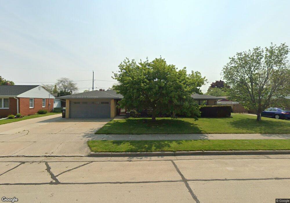
1901 Polaris Ave Racine, WI 53404
Wustum Park NeighborhoodEstimated Value: $265,356 - $351,000
3
Beds
1
Bath
1,562
Sq Ft
$191/Sq Ft
Est. Value
About This Home
This home is located at 1901 Polaris Ave, Racine, WI 53404 and is currently estimated at $298,589, approximately $191 per square foot. 1901 Polaris Ave is a home located in Racine County with nearby schools including Wadewitz Elementary School, Jerstad-Agerholm Middle School, and Horlick High School.
Ownership History
Date
Name
Owned For
Owner Type
Purchase Details
Closed on
Oct 27, 2020
Sold by
Youngs Randall B and Youngs Roberta A
Bought by
Vanlanduyt Darrell and Schroeder Amanda
Current Estimated Value
Home Financials for this Owner
Home Financials are based on the most recent Mortgage that was taken out on this home.
Original Mortgage
$216,015
Outstanding Balance
$192,223
Interest Rate
2.8%
Mortgage Type
FHA
Estimated Equity
$106,366
Create a Home Valuation Report for This Property
The Home Valuation Report is an in-depth analysis detailing your home's value as well as a comparison with similar homes in the area
Home Values in the Area
Average Home Value in this Area
Purchase History
| Date | Buyer | Sale Price | Title Company |
|---|---|---|---|
| Vanlanduyt Darrell | $215,000 | Landmark Title Of Racine Inc |
Source: Public Records
Mortgage History
| Date | Status | Borrower | Loan Amount |
|---|---|---|---|
| Open | Vanlanduyt Darrell | $216,015 |
Source: Public Records
Tax History Compared to Growth
Tax History
| Year | Tax Paid | Tax Assessment Tax Assessment Total Assessment is a certain percentage of the fair market value that is determined by local assessors to be the total taxable value of land and additions on the property. | Land | Improvement |
|---|---|---|---|---|
| 2024 | $5,069 | $219,500 | $27,800 | $191,700 |
| 2023 | $4,694 | $196,000 | $27,800 | $168,200 |
| 2022 | $4,314 | $178,000 | $27,800 | $150,200 |
| 2021 | $4,398 | $162,000 | $27,800 | $134,200 |
| 2020 | $4,377 | $162,000 | $27,800 | $134,200 |
| 2019 | $4,024 | $151,000 | $27,800 | $123,200 |
| 2018 | $3,936 | $131,000 | $27,800 | $103,200 |
| 2017 | $3,888 | $131,000 | $27,800 | $103,200 |
| 2016 | $3,757 | $124,000 | $27,800 | $96,200 |
| 2015 | $3,641 | $118,000 | $27,800 | $90,200 |
| 2014 | $3,641 | $118,000 | $27,800 | $90,200 |
| 2013 | $3,641 | $125,000 | $34,400 | $90,600 |
Source: Public Records
Map
Nearby Homes
- 2009 Rapids Dr
- 1708 Shoop St
- 2100 Carlisle Ave
- 1818 Neptune Ave
- 1626 Rapids Dr
- 2300 Rapids Dr
- 2210 Rapids Dr
- 2123 Carlisle Ave
- 2701 Rapids Dr
- 2400 Romayne Ave
- 2402 Eaton Ln
- 2525 Diane Ave
- 2525 Donna Ave
- 1322 Summit Ave
- 1406 Blake Ave
- 2600 W High St
- 2915 Romayne Ave
- 1228 English St
- 1616 Dr Martin Luther King Dr
- 1337 Kewaunee St
- 1911 Polaris Ave
- 1841 Polaris Ave
- 1900 Mount Pleasant St
- 1904 Mount Pleasant St
- 1840 Mount Pleasant St
- 1917 Polaris Ave
- 1835 Polaris Ave
- 1910 Mount Pleasant St
- 1834 Mount Pleasant St
- 1900 Polaris Ave
- 1904 Polaris Ave
- 1921 Polaris Ave
- 2116 English St
- 1840 Polaris Ave
- 1910 Polaris Ave
- 2100 English St
- 1834 Polaris Ave
- 1916 Polaris Ave
- 1927 Polaris Ave
- 1920 Mount Pleasant St