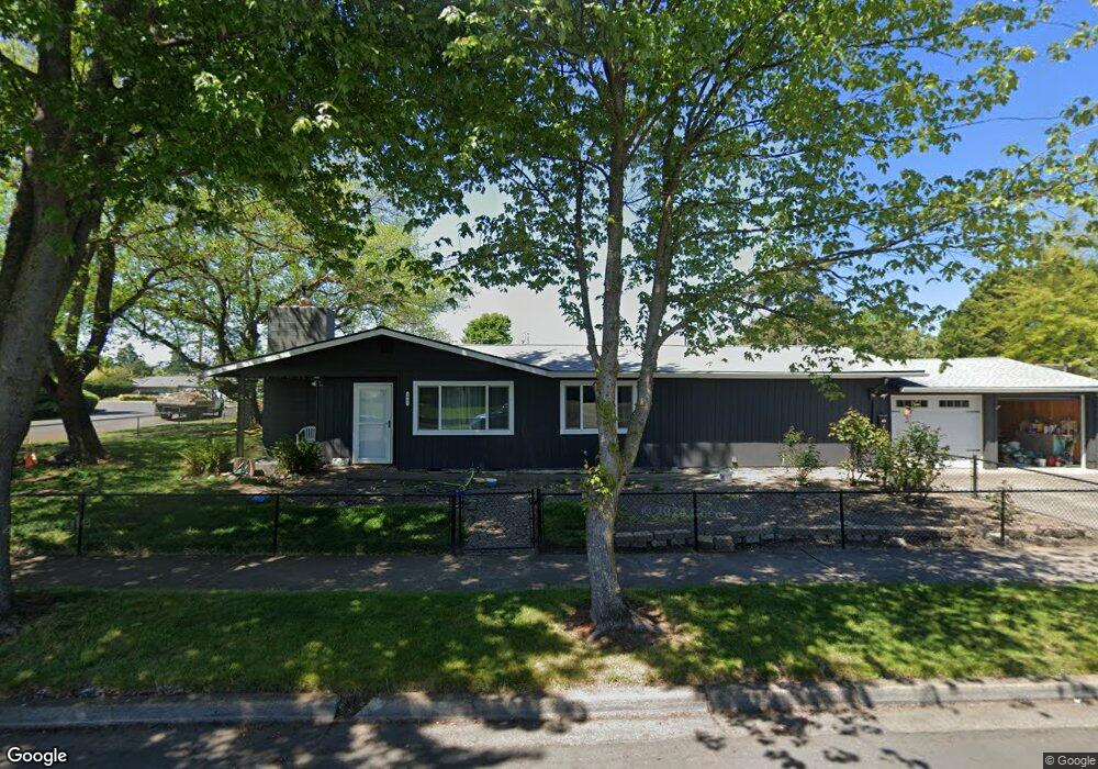
1901 Serenity Dr Medford, OR 97504
Estimated Value: $432,000 - $458,498
4
Beds
3
Baths
2,013
Sq Ft
$219/Sq Ft
Est. Value
About This Home
This home is located at 1901 Serenity Dr, Medford, OR 97504 and is currently estimated at $439,875, approximately $218 per square foot. 1901 Serenity Dr is a home located in Jackson County with nearby schools including Wilson Elementary School, Hedrick Middle School, and North Medford High School.
Ownership History
Date
Name
Owned For
Owner Type
Purchase Details
Closed on
May 24, 2023
Sold by
Weaver Heather
Bought by
Weaver Nicholas and Lewis Joseph
Current Estimated Value
Purchase Details
Closed on
Nov 5, 2018
Sold by
Lewis Joseph Cairns
Bought by
Weaver Heather Leighan and Weaver Nicholas Ryan
Home Financials for this Owner
Home Financials are based on the most recent Mortgage that was taken out on this home.
Original Mortgage
$240,000
Interest Rate
4.9%
Mortgage Type
New Conventional
Purchase Details
Closed on
Aug 7, 2009
Sold by
Lewis Mary K
Bought by
Lewis Joseph Cairns
Home Financials for this Owner
Home Financials are based on the most recent Mortgage that was taken out on this home.
Original Mortgage
$84,452
Interest Rate
5.3%
Mortgage Type
FHA
Create a Home Valuation Report for This Property
The Home Valuation Report is an in-depth analysis detailing your home's value as well as a comparison with similar homes in the area
Home Values in the Area
Average Home Value in this Area
Purchase History
| Date | Buyer | Sale Price | Title Company |
|---|---|---|---|
| Weaver Nicholas | -- | None Listed On Document | |
| Weaver Heather Leighan | $300,000 | First American Title | |
| Lewis Joseph Cairns | $30,000 | First American |
Source: Public Records
Mortgage History
| Date | Status | Borrower | Loan Amount |
|---|---|---|---|
| Previous Owner | Weaver Heather Leighan | $240,000 | |
| Previous Owner | Lewis Joseph Cairns | $84,452 |
Source: Public Records
Tax History Compared to Growth
Tax History
| Year | Tax Paid | Tax Assessment Tax Assessment Total Assessment is a certain percentage of the fair market value that is determined by local assessors to be the total taxable value of land and additions on the property. | Land | Improvement |
|---|---|---|---|---|
| 2025 | $3,875 | $237,390 | $98,900 | $138,490 |
| 2024 | $3,875 | $230,480 | $96,020 | $134,460 |
| 2023 | $3,337 | $223,770 | $93,220 | $130,550 |
| 2022 | $3,256 | $223,770 | $93,220 | $130,550 |
| 2021 | $3,172 | $217,260 | $90,510 | $126,750 |
| 2020 | $3,105 | $210,940 | $87,870 | $123,070 |
| 2019 | $3,032 | $198,840 | $82,840 | $116,000 |
| 2018 | $2,366 | $180,320 | $58,880 | $121,440 |
| 2017 | $2,324 | $180,320 | $58,880 | $121,440 |
| 2016 | $2,339 | $169,980 | $55,500 | $114,480 |
| 2015 | $2,248 | $169,980 | $55,500 | $114,480 |
| 2014 | $2,209 | $160,230 | $52,310 | $107,920 |
Source: Public Records
Map
Nearby Homes
- 1588 Nordic Ct
- 1512 Nordic Ct
- 1744 Concord Way
- 2217 Jubilant Ave
- 3626 Ford Dr
- 2000 Brookhurst St Unit 2
- 2000 Brookhurst St Unit 1
- 1215 Covina Ave
- 1220 Morrow Rd
- 2481 Northcrest Cir
- 1228 Corona Ave
- 1212 Morrow Rd
- 2030 Brookhurst St Unit 28
- 1225 Corona Ave
- 2010 Crater Lake Ave
- 2058 Roberts Rd
- 2076 Roberts Rd Unit TL2000
- 2076 Roberts Rd
- 1441 Larkspur Ave
- 2009 Grandview Ave
- 1841 Serenity Dr
- 1921 Serenity Dr
- 1900 Serenity Dr
- 1833 Serenity Dr
- 2001 Serenity Dr
- 1880 Serenity Dr
- 1680 Easy St
- 1830 Serenity Dr
- 1660 Brookhurst St
- 1681 Brookhurst St
- 1825 Serenity Dr
- 2021 Serenity Dr
- 1680 Brookhurst St
- 1690 Easy St
- 1562 Nordic Ct
- 1576 Nordic Ct
- 1784 Serenity Dr
- 1691 Brookhurst St
- 1817 Serenity Dr
- 2040 Serenity Dr