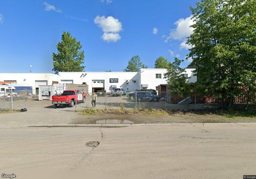
1901 W 48th Ave Anchorage, AK 99517
Spenard NeighborhoodEstimated Value: $1,103,512
--
Bed
--
Bath
7,200
Sq Ft
$153/Sq Ft
Est. Value
About This Home
This home is located at 1901 W 48th Ave, Anchorage, AK 99517 and is currently estimated at $1,103,512, approximately $153 per square foot. 1901 W 48th Ave is a home located in Anchorage Municipality with nearby schools including Northwood Elementary School, Romig Middle School, and West High School.
Ownership History
Date
Name
Owned For
Owner Type
Purchase Details
Closed on
Mar 18, 2015
Sold by
Jacob Gary B
Bought by
1901 Llc
Current Estimated Value
Purchase Details
Closed on
Apr 14, 2004
Sold by
Hen Properties
Bought by
Jacob Gary Brian
Home Financials for this Owner
Home Financials are based on the most recent Mortgage that was taken out on this home.
Original Mortgage
$490,500
Interest Rate
5.57%
Mortgage Type
Commercial
Create a Home Valuation Report for This Property
The Home Valuation Report is an in-depth analysis detailing your home's value as well as a comparison with similar homes in the area
Home Values in the Area
Average Home Value in this Area
Purchase History
| Date | Buyer | Sale Price | Title Company |
|---|---|---|---|
| 1901 Llc | -- | None Available | |
| Jacob Gary Brian | -- | -- |
Source: Public Records
Mortgage History
| Date | Status | Borrower | Loan Amount |
|---|---|---|---|
| Previous Owner | Jacob Gary Brian | $490,500 |
Source: Public Records
Tax History Compared to Growth
Tax History
| Year | Tax Paid | Tax Assessment Tax Assessment Total Assessment is a certain percentage of the fair market value that is determined by local assessors to be the total taxable value of land and additions on the property. | Land | Improvement |
|---|---|---|---|---|
| 2025 | $13,704 | $944,600 | $237,800 | $706,800 |
| 2024 | $13,704 | $848,800 | $237,800 | $611,000 |
| 2023 | $13,816 | $811,300 | $228,800 | $582,500 |
| 2022 | $13,127 | $779,500 | $228,200 | $551,300 |
| 2021 | $14,126 | $783,900 | $223,700 | $560,200 |
| 2020 | $13,253 | $779,600 | $219,400 | $560,200 |
| 2019 | $12,859 | $786,000 | $214,900 | $571,100 |
| 2018 | $740 | $767,000 | $214,900 | $552,100 |
| 2017 | $11,839 | $756,000 | $214,900 | $541,100 |
| 2016 | $10,598 | $741,800 | $214,900 | $526,900 |
| 2015 | $10,598 | $728,000 | $214,900 | $513,100 |
| 2014 | $10,598 | $708,700 | $214,900 | $493,800 |
Source: Public Records
Map
Nearby Homes
- 1808 W 47th Ave
- 2101 W 47th Ave
- 2040 Wenmatt Cir
- 4962 Nottingham Way
- 4300 Hayes St
- 2202 Lincoln Ave
- 4209 Hayes St
- 4309 Garfield St
- 4904 Cambridge Way
- 2105 Mckinley Ave
- 4906 Cambridge Way
- 4309 Wilson St
- NHN Northwood Dr
- 5000 Northwood Dr
- 1808 Cleveland Ave
- 1806 Cleveland Ave
- 4000 Iowa Dr
- 4302 Forrest Rd
- 2808 Iris Dr
- 2815 W International Airport Rd Unit B104
- 1909 W 48th Ave
- 1902 W 47th Ave
- 1307 W 48th Ave
- 1910 W 47th Ave
- 1904 W 47th Ave
- 1906 W 47th Ave
- 1812 W 47th Ave
- 1912 W 47th Ave
- 2001 W 48th Ave
- 4700 Taft St
- 1903 W 47th Ave
- 1901 W 47th Ave
- 1905 W 47th Ave
- 1813 W 47th Ave
- 2003 W 48th Ave
- 1807 W 47th Ave
- 4625 Taft St
- 1809 W 47th Ave
- 2002 W 47th Ave
- 2005 W 48th Ave