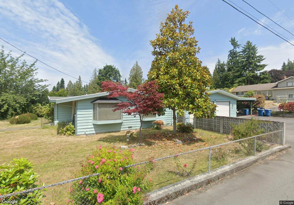
19015 92nd Ave W Edmonds, WA 98020
Perrinville - Seaview NeighborhoodEstimated Value: $901,000 - $1,297,000
3
Beds
2
Baths
1,739
Sq Ft
$617/Sq Ft
Est. Value
About This Home
This home is located at 19015 92nd Ave W, Edmonds, WA 98020 and is currently estimated at $1,073,764, approximately $617 per square foot. 19015 92nd Ave W is a home located in Snohomish County with nearby schools including Seaview Elementary School, Meadowdale Middle School, and Meadowdale High School.
Ownership History
Date
Name
Owned For
Owner Type
Purchase Details
Closed on
Aug 26, 2016
Sold by
Forgie Kathryn
Bought by
Devine Cynthia and Devine Gary
Current Estimated Value
Purchase Details
Closed on
Nov 13, 2014
Sold by
Devine Cynthia and Forgie Kathryn
Bought by
Devine Cynthia and Forgie Kathryn
Home Financials for this Owner
Home Financials are based on the most recent Mortgage that was taken out on this home.
Original Mortgage
$185,000
Interest Rate
4.1%
Mortgage Type
New Conventional
Purchase Details
Closed on
Sep 25, 1997
Sold by
Causer Richard A and Causer Barbara J
Bought by
Miller Richard Linde and Miller Betty Lucille
Create a Home Valuation Report for This Property
The Home Valuation Report is an in-depth analysis detailing your home's value as well as a comparison with similar homes in the area
Home Values in the Area
Average Home Value in this Area
Purchase History
| Date | Buyer | Sale Price | Title Company |
|---|---|---|---|
| Devine Cynthia | -- | None Available | |
| Devine Cynthia | -- | Chicago Title | |
| Devine Cynthia | -- | Chicago | |
| Miller Richard Linde | $197,500 | -- |
Source: Public Records
Mortgage History
| Date | Status | Borrower | Loan Amount |
|---|---|---|---|
| Previous Owner | Devine Cynthia | $185,000 |
Source: Public Records
Tax History Compared to Growth
Tax History
| Year | Tax Paid | Tax Assessment Tax Assessment Total Assessment is a certain percentage of the fair market value that is determined by local assessors to be the total taxable value of land and additions on the property. | Land | Improvement |
|---|---|---|---|---|
| 2025 | $5,501 | $879,300 | $686,000 | $193,300 |
| 2024 | $5,501 | $779,300 | $586,000 | $193,300 |
| 2023 | $5,692 | $835,600 | $621,000 | $214,600 |
| 2022 | $5,118 | $617,900 | $436,000 | $181,900 |
| 2020 | $5,297 | $570,100 | $408,000 | $162,100 |
| 2019 | $4,830 | $524,000 | $365,000 | $159,000 |
| 2018 | $5,120 | $479,900 | $338,000 | $141,900 |
| 2017 | $4,423 | $434,300 | $309,000 | $125,300 |
| 2016 | $4,132 | $402,300 | $282,000 | $120,300 |
| 2015 | $4,128 | $378,400 | $269,000 | $109,400 |
| 2013 | $3,773 | $326,600 | $207,000 | $119,600 |
Source: Public Records
Map
Nearby Homes
- 192 XX Olympic View Dr
- 19523 86th Ave W Unit 523
- 8516 196th St SW Unit 105
- 8516 196th St SW Unit 302
- 8516 196th St SW Unit 311
- 1030 Grandview St
- 1514 9th Ave N
- 1414 9th Ave N Unit 105
- 8427 200th St SW
- 8019 196th St SW Unit C4
- 20126 81st Ave W
- 19718 76th Ave W Unit C
- 8004 203rd Place SW
- 625 Aloha Way
- 7707 203rd St SW
- 609 7th Ave N Unit B204
- 7606 201st St SW Unit G
- 603 7th Ave N Unit A306
- 611 3rd Ave N
- 7702 202nd Place SW
- 19005 92nd Ave W
- 9107 191st Place SW
- 19025 92nd Ave W
- 19009 92nd Ave W Unit A
- 19009 92nd Ave W
- 9108 191st Place SW
- 19018 92nd Ave W
- 9210 190th St SW
- 9024 191st Place SW
- 18919 92nd Ave W
- 19105 92nd Ave W
- 9138 189th Place SW
- 9019 191st Place SW
- 9128 189th Place SW
- 19111 92nd Ave W
- 19102 92nd Ave W
- 18924 92nd Ave W
- 9011 191st Place SW
- 9020 191st Place SW
- 9118 189th Place SW