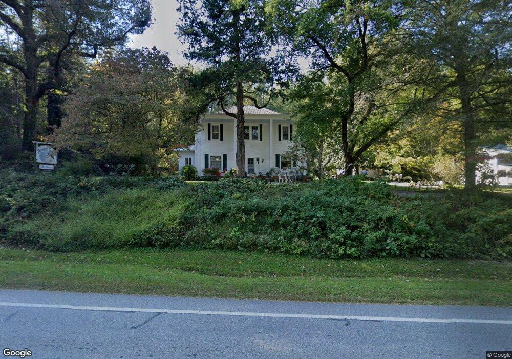
1902 Highway 17 Sautee Nacoochee, GA 30571
Estimated Value: $405,000 - $464,000
4
Beds
2
Baths
2,618
Sq Ft
$165/Sq Ft
Est. Value
About This Home
This home is located at 1902 Highway 17, Sautee Nacoochee, GA 30571 and is currently estimated at $433,050, approximately $165 per square foot. 1902 Highway 17 is a home located in White County with nearby schools including Mount Yonah Elementary School, White County 9th Grade Academy, and White County Middle School.
Ownership History
Date
Name
Owned For
Owner Type
Purchase Details
Closed on
Jan 18, 2013
Sold by
King Betty J
Bought by
King Betty J and King Jack L
Current Estimated Value
Home Financials for this Owner
Home Financials are based on the most recent Mortgage that was taken out on this home.
Original Mortgage
$240,000
Outstanding Balance
$107,262
Interest Rate
3.39%
Mortgage Type
New Conventional
Estimated Equity
$325,788
Create a Home Valuation Report for This Property
The Home Valuation Report is an in-depth analysis detailing your home's value as well as a comparison with similar homes in the area
Home Values in the Area
Average Home Value in this Area
Purchase History
| Date | Buyer | Sale Price | Title Company |
|---|---|---|---|
| King Betty J | -- | -- |
Source: Public Records
Mortgage History
| Date | Status | Borrower | Loan Amount |
|---|---|---|---|
| Open | King Betty J | $240,000 |
Source: Public Records
Tax History Compared to Growth
Tax History
| Year | Tax Paid | Tax Assessment Tax Assessment Total Assessment is a certain percentage of the fair market value that is determined by local assessors to be the total taxable value of land and additions on the property. | Land | Improvement |
|---|---|---|---|---|
| 2025 | $716 | $117,636 | $43,980 | $73,656 |
| 2024 | $716 | $112,140 | $38,484 | $73,656 |
| 2023 | $439 | $108,104 | $37,568 | $70,536 |
| 2022 | $610 | $85,340 | $23,968 | $61,372 |
| 2021 | $630 | $70,892 | $20,868 | $50,024 |
| 2020 | $566 | $67,660 | $20,868 | $46,792 |
| 2019 | $605 | $67,660 | $20,868 | $46,792 |
| 2018 | $581 | $65,460 | $18,668 | $46,792 |
| 2017 | $516 | $61,920 | $18,668 | $43,252 |
| 2016 | $516 | $61,920 | $18,668 | $43,252 |
| 2015 | $399 | $145,590 | $18,668 | $39,568 |
| 2014 | $1,164 | $138,500 | $0 | $0 |
Source: Public Records
Map
Nearby Homes
- 289 Rabun Rd
- LOT 14 & 6 Bean Creek
- 825 Sautee Woods Trail
- 0 Hurricane Ridge Rd Unit 10595418
- 1168 Highland Rd
- 141 Enota Dr
- 1526 Highway 255 N
- 1076 Little Hawk Rd
- 6X Laurelwood
- 230 N Lake Dr
- 73 Brentwood Ct
- 144 Fussen Strasse
- 24 Wolf Howl Trail
- 231 Laurelwood
- 315 N Lake Dr
- 3040 Panorama Dr
- 74 Fussen Strasse
- 253 Starlight Dr
- 664 Gold Valley Rd
- 854 Edelweiss Strasse Unit 301
- 1856 Highway 17
- 33 Garland Bristol Rd
- 59 Garland Bristol Rd
- 1825 Highway 17
- 1977 Georgia 17
- 111 Garland Bristol Rd
- 1791 Highway 17
- 1304 Georgia 17
- 2180 Highway 17
- 1677 Highway 17
- 63 Barneys Dr
- 150 Hemlock
- 63 Bern Vista
- 254 Hemlock
- 2176 Highway 17
- 252 Garland Bristol Rd
- 117 Hemlock
- 1607 Highway 17
- 2178 Georgia 17
- 266 Hemlock