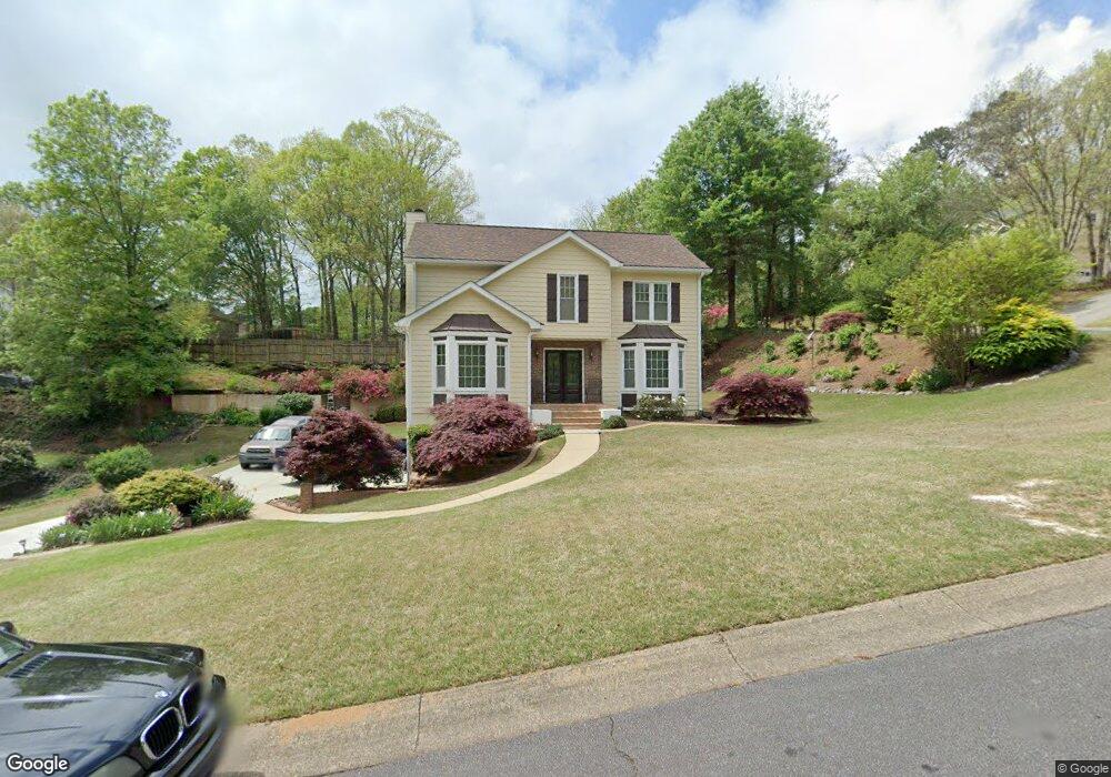
1902 Nantucket Dr Unit 1 Woodstock, GA 30189
Oak Grove NeighborhoodEstimated Value: $422,000 - $448,764
3
Beds
3
Baths
3,008
Sq Ft
$145/Sq Ft
Est. Value
About This Home
This home is located at 1902 Nantucket Dr Unit 1, Woodstock, GA 30189 and is currently estimated at $435,382, approximately $144 per square foot. 1902 Nantucket Dr Unit 1 is a home located in Cherokee County with nearby schools including Carmel Elementary School, Woodstock Middle School, and Woodstock High School.
Ownership History
Date
Name
Owned For
Owner Type
Purchase Details
Closed on
Sep 23, 2011
Sold by
Thomas Marilou Theresa
Bought by
Thomas Timothy Allen
Current Estimated Value
Purchase Details
Closed on
Jul 18, 1997
Sold by
Associates Relocation Mgmt Co
Bought by
Thomas Timothy A and Thomas Marilou T
Home Financials for this Owner
Home Financials are based on the most recent Mortgage that was taken out on this home.
Original Mortgage
$132,850
Interest Rate
7.7%
Mortgage Type
VA
Create a Home Valuation Report for This Property
The Home Valuation Report is an in-depth analysis detailing your home's value as well as a comparison with similar homes in the area
Home Values in the Area
Average Home Value in this Area
Purchase History
| Date | Buyer | Sale Price | Title Company |
|---|---|---|---|
| Thomas Timothy Allen | $129,000 | -- | |
| Thomas Timothy A | $129,000 | -- |
Source: Public Records
Mortgage History
| Date | Status | Borrower | Loan Amount |
|---|---|---|---|
| Previous Owner | Thomas Timothy A | $132,850 |
Source: Public Records
Tax History Compared to Growth
Tax History
| Year | Tax Paid | Tax Assessment Tax Assessment Total Assessment is a certain percentage of the fair market value that is determined by local assessors to be the total taxable value of land and additions on the property. | Land | Improvement |
|---|---|---|---|---|
| 2024 | $707 | $143,652 | $32,000 | $111,652 |
| 2023 | $535 | $133,172 | $32,000 | $101,172 |
| 2022 | $644 | $113,172 | $24,000 | $89,172 |
| 2021 | $619 | $91,692 | $16,800 | $74,892 |
| 2020 | $616 | $90,132 | $16,800 | $73,332 |
| 2019 | $578 | $80,160 | $16,800 | $63,360 |
| 2018 | $574 | $76,480 | $16,800 | $59,680 |
| 2017 | $571 | $179,800 | $16,800 | $55,120 |
| 2016 | $1,775 | $161,300 | $14,400 | $50,120 |
| 2015 | $1,755 | $157,300 | $14,400 | $48,520 |
| 2014 | $1,682 | $149,200 | $14,000 | $45,680 |
Source: Public Records
Map
Nearby Homes
- 1056 Boston Ridge
- 1904 Nantucket Dr
- 1906 Nantucket Dr
- 1049 Boston Ridge
- 1054 Boston Ridge Unit 1
- 1901 Nantucket Dr
- 1051 Boston Ridge
- 1047 Boston Ridge Unit 1
- 1903 Nantucket Dr
- 1908 Nantucket Dr
- 1053 Boston Ridge
- 1045 Boston Ridge
- 0 Nantucket Dr Unit 3242595
- 0 Nantucket Dr Unit 3207475
- 0 Nantucket Dr Unit 8824647
- 0 Nantucket Dr Unit 8254709
- 0 Nantucket Dr Unit 8239396
- 0 Nantucket Dr Unit 8222845
- 0 Nantucket Dr
- 1052 Boston Ridge Unit 1