
Seller's Agent in 2020
Malinda Pollock
Coldwell Banker Walden & Kirkland
(229) 869-2282
13 in this area
136 Total Sales
Estimated Value: $218,985 - $237,000
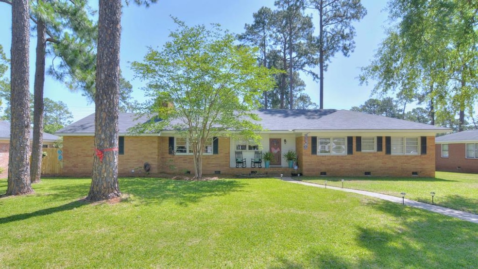
Great home in Lake Park! There is a lot of space in this 4BR/2BA gem! Walk through the front door and foyer that opens to a beautiful, bright living area with sliding glass doors that overlook a covered patio and large backyard. The updated kitchen has custom built cabinets and a bar for 4 people that overlooks the cozy den with wood burning fireplace. There is a formal dining room as well. A huge laundry room/mud room has cabinets and a sink with plenty of room for a spare fridge and freezer with access to the double carport. A long hall leads to 4 bedrooms and 2 renovated baths- original hardwood floors throughout! Come see and fall in love!!! There is so much to offer at this price!
Last Agent to Sell the Property
Coldwell Banker Walden & Kirkland Brokerage Phone: 2294368811 License #383824 Listed on: 07/13/2020
| Date | Buyer | Sale Price | Title Company |
|---|---|---|---|
| Mays Monica B | $169,900 | -- | |
| Brown Terrie S | -- | -- | |
| Brown Richard H | $121,000 | -- | |
| Johnson Anita Jean | -- | -- |
| Date | Status | Borrower | Loan Amount |
|---|---|---|---|
| Open | Mays Monica B | $164,803 |
| Date | Event | Price | List to Sale | Price per Sq Ft |
|---|---|---|---|---|
| 08/17/2020 08/17/20 | Sold | $169,900 | -- | $86 / Sq Ft |
| 07/13/2020 07/13/20 | Pending | -- | -- | -- |
| Year | Tax Paid | Tax Assessment Tax Assessment Total Assessment is a certain percentage of the fair market value that is determined by local assessors to be the total taxable value of land and additions on the property. | Land | Improvement |
|---|---|---|---|---|
| 2024 | $2,729 | $59,200 | $9,240 | $49,960 |
| 2023 | $2,758 | $59,200 | $9,240 | $49,960 |
| 2022 | $2,768 | $59,200 | $9,240 | $49,960 |
| 2021 | $2,567 | $59,200 | $9,240 | $49,960 |
| 2020 | $2,039 | $48,920 | $9,240 | $39,680 |
| 2019 | $2,047 | $48,920 | $9,240 | $39,680 |
| 2018 | $2,055 | $48,920 | $9,240 | $39,680 |
| 2017 | $1,915 | $48,920 | $9,240 | $39,680 |
| 2016 | $1,916 | $48,920 | $9,240 | $39,680 |
| 2015 | $1,921 | $48,920 | $9,240 | $39,680 |
| 2014 | $1,991 | $51,240 | $11,560 | $39,680 |
Seller's Agent in 2020
Malinda Pollock
Coldwell Banker Walden & Kirkland
(229) 869-2282
13 in this area
136 Total Sales
J
Buyer's Agent in 2020
Jamal Reynolds
Crowning Point Enterprise, LLC
(229) 255-7105
37 Total Sales
Source: Albany Board of REALTORS®
MLS Number: 145157
APN: 0000P-00017-011