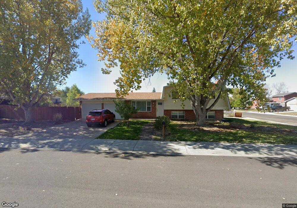
1902 S 17th St Laramie, WY 82070
Estimated Value: $349,000 - $400,000
3
Beds
4
Baths
1,004
Sq Ft
$373/Sq Ft
Est. Value
About This Home
This home is located at 1902 S 17th St, Laramie, WY 82070 and is currently estimated at $374,411, approximately $372 per square foot. 1902 S 17th St is a home located in Albany County with nearby schools including Beitel Elementary School, Laramie Middle School, and Laramie High School.
Ownership History
Date
Name
Owned For
Owner Type
Purchase Details
Closed on
Apr 3, 2008
Sold by
Waldinger Robert J and Waldinger Gloria J
Bought by
Barrows Benjamin P
Current Estimated Value
Home Financials for this Owner
Home Financials are based on the most recent Mortgage that was taken out on this home.
Original Mortgage
$112,500
Outstanding Balance
$71,783
Interest Rate
6.11%
Mortgage Type
New Conventional
Estimated Equity
$302,628
Create a Home Valuation Report for This Property
The Home Valuation Report is an in-depth analysis detailing your home's value as well as a comparison with similar homes in the area
Home Values in the Area
Average Home Value in this Area
Purchase History
| Date | Buyer | Sale Price | Title Company |
|---|---|---|---|
| Barrows Benjamin P | -- | -- |
Source: Public Records
Mortgage History
| Date | Status | Borrower | Loan Amount |
|---|---|---|---|
| Open | Barrows Benjamin P | $112,500 |
Source: Public Records
Tax History Compared to Growth
Tax History
| Year | Tax Paid | Tax Assessment Tax Assessment Total Assessment is a certain percentage of the fair market value that is determined by local assessors to be the total taxable value of land and additions on the property. | Land | Improvement |
|---|---|---|---|---|
| 2025 | $2,355 | $21,763 | $3,850 | $17,913 |
| 2024 | $2,355 | $32,265 | $4,936 | $27,329 |
| 2023 | $2,279 | $31,214 | $4,936 | $26,278 |
| 2022 | $1,979 | $27,108 | $4,936 | $22,172 |
| 2021 | $1,767 | $24,208 | $4,094 | $20,114 |
| 2020 | $1,597 | $21,874 | $3,640 | $18,234 |
| 2019 | $1,474 | $20,195 | $3,640 | $16,555 |
| 2018 | $1,408 | $19,293 | $3,640 | $15,653 |
| 2017 | $1,417 | $19,416 | $3,640 | $15,776 |
| 2016 | $1,405 | $19,247 | $3,640 | $15,607 |
| 2015 | $1,357 | $18,589 | $3,640 | $14,949 |
| 2014 | $1,312 | $17,970 | $0 | $0 |
Source: Public Records
Map
Nearby Homes
- 1714 Symons St
- 1613 Barratt St
- 1722 Barratt St
- 1534 Palmer Dr Unit 4
- 1727 E Palmer Dr
- 1412 S 17th St Unit A
- 1303 Person St
- 1425 Fetterman Dr
- 1821 Spring Creek Dr
- Lot37Blk2 Boswell Dr
- Lot38Blk2 Boswell Dr
- Lot19Blk 4 Boswell Dr
- Blk7 Lot2 Boswell Dr
- 2608 E Overland Rd
- 906 S 15th St
- 1027 Boswell Dr
- 2527 Park Ave
- 1206 S 11th St
- 1509 E Park Ave
- 29 Star Struck Ln
- 1618 Symons St
- 1922 S 17th St
- 1901 S 17th St
- 1617 Bill Nye Ave
- 1614 Symons St
- 1921 S 17th St
- 1822 S 17th St
- 1617 Symons St
- 1706 Symons St
- 1821 S 17th St
- 1610 Symons St
- 1613 Symons St
- 1705 Bill Nye Ave
- 1609 Bill Nye Ave
- 1710 Symons St
- 1705 Symons St
- 1609 Symons St
- 1802 S 17th St
- 1606 Symons St
- 1709 Bill Nye Ave