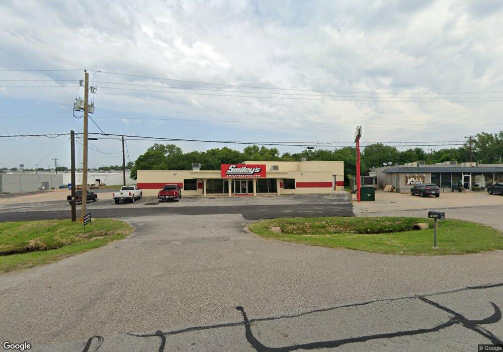
1902 Texoma Pkwy Unit B Sherman, TX 75090
Estimated Value: $730,217
--
Bed
--
Bath
3,500
Sq Ft
$209/Sq Ft
Est. Value
About This Home
This home is located at 1902 Texoma Pkwy Unit B, Sherman, TX 75090 and is currently estimated at $730,217, approximately $208 per square foot. 1902 Texoma Pkwy Unit B is a home located in Grayson County with nearby schools including Percy W. Neblett Elementary School, Dillingham Intermediate School, and Piner Middle School.
Ownership History
Date
Name
Owned For
Owner Type
Purchase Details
Closed on
Feb 23, 2022
Sold by
Roberts Family Partners Ltd
Bought by
Bcl Real Estate Llc
Current Estimated Value
Purchase Details
Closed on
Jun 27, 2013
Sold by
1902 Texoma Parkway Inc
Bought by
Investment Property Exchange Services In
Create a Home Valuation Report for This Property
The Home Valuation Report is an in-depth analysis detailing your home's value as well as a comparison with similar homes in the area
Home Values in the Area
Average Home Value in this Area
Purchase History
| Date | Buyer | Sale Price | Title Company |
|---|---|---|---|
| Bcl Real Estate Llc | -- | Red River Title | |
| Investment Property Exchange Services In | -- | Title Resources Llc |
Source: Public Records
Mortgage History
| Date | Status | Borrower | Loan Amount |
|---|---|---|---|
| Closed | Bcl Real Estate Llc | $0 |
Source: Public Records
Tax History Compared to Growth
Tax History
| Year | Tax Paid | Tax Assessment Tax Assessment Total Assessment is a certain percentage of the fair market value that is determined by local assessors to be the total taxable value of land and additions on the property. | Land | Improvement |
|---|---|---|---|---|
| 2025 | $17,321 | $800,000 | $195,631 | $604,369 |
| 2024 | $17,321 | $789,730 | $0 | $0 |
| 2023 | $14,449 | $658,108 | $167,539 | $490,569 |
| 2022 | $15,424 | $658,108 | $167,539 | $490,569 |
| 2021 | $9,284 | $370,404 | $90,369 | $280,035 |
| 2020 | $10,200 | $388,641 | $90,369 | $298,272 |
| 2019 | $11,296 | $419,083 | $90,369 | $328,714 |
| 2018 | $11,917 | $475,000 | $130,460 | $344,540 |
| 2017 | $11,824 | $475,000 | $130,460 | $344,540 |
| 2016 | $11,987 | $481,552 | $166,260 | $315,292 |
| 2015 | $11,963 | $481,552 | $166,260 | $315,292 |
| 2014 | $7,777 | $313,018 | $166,260 | $146,758 |
Source: Public Records
Map
Nearby Homes
- 2012 Texoma Pkwy
- 15.125 acres E Peyton St
- 000 N Masters St
- 1705 E Hilton St
- 1516 E Peyton St
- 2606 Bennett Ave
- 812 E McGee St
- 914 Boone Dr
- 604 N Frisco St
- 705 E Lamberth Rd
- 1416 N Cleveland Ave
- 13 E Lewis St
- 1 E Lewis St
- 5 E Lewis St
- 14 E Lewis St
- 1215 N Grand Ave
- 1915 E Cole Ave
- 1511 N Brents Ave
- 1721 N Hoard Ave
- 1007 N Cleveland Ave
- 1902 Texoma Pkwy
- 1908 Texoma Pkwy
- 1916 Texoma Pkwy
- Lot 2 Cottonwood Dr
- 913 Cottonwood Dr
- 913 E Cottonwood Rd
- 2001 N Loy Lake Rd
- 902 Cottonwood Dr
- 2011 Texoma Pkwy Unit 7
- 2011 Texoma Pkwy Unit 5
- 2011 Texoma Pkwy Unit 370
- 2011 Texoma Pkwy
- 1909 Texoma Pkwy Unit C
- 1909 Texoma Pkwy Unit 4
- 1911 N Loy Lake Rd
- 2027 Texoma Pkwy
- 2113 N Loy Lake Rd Unit RD
- 2113 N Loy Lake Rd
- 2007 Texoma Pkwy Unit 200
- 2007 Texoma Pkwy Unit 370