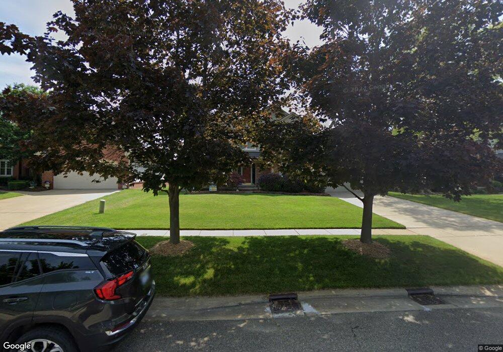
1902 Twin Sun Cir Walled Lake, MI 48390
Estimated Value: $438,573 - $524,000
4
Beds
3
Baths
2,254
Sq Ft
$216/Sq Ft
Est. Value
About This Home
This home is located at 1902 Twin Sun Cir, Walled Lake, MI 48390 and is currently estimated at $487,643, approximately $216 per square foot. 1902 Twin Sun Cir is a home located in Oakland County with nearby schools including Loon Lake Elementary School, Sarah G. Banks Middle School, and Walled Lake Central High School.
Ownership History
Date
Name
Owned For
Owner Type
Purchase Details
Closed on
Feb 23, 2015
Sold by
Mcculloch Joseph Edward
Bought by
Mcculloch Laura Ann
Current Estimated Value
Purchase Details
Closed on
Feb 4, 2000
Sold by
Energy Saver Homes Inc
Bought by
Mcculloch Joseph E
Home Financials for this Owner
Home Financials are based on the most recent Mortgage that was taken out on this home.
Original Mortgage
$206,550
Outstanding Balance
$68,529
Interest Rate
8.21%
Estimated Equity
$419,114
Purchase Details
Closed on
Jan 31, 2000
Sold by
Sierra Development Inc
Bought by
Mcculloch Joseph E
Home Financials for this Owner
Home Financials are based on the most recent Mortgage that was taken out on this home.
Original Mortgage
$206,550
Outstanding Balance
$68,529
Interest Rate
8.21%
Estimated Equity
$419,114
Create a Home Valuation Report for This Property
The Home Valuation Report is an in-depth analysis detailing your home's value as well as a comparison with similar homes in the area
Home Values in the Area
Average Home Value in this Area
Purchase History
| Date | Buyer | Sale Price | Title Company |
|---|---|---|---|
| Mcculloch Laura Ann | -- | None Available | |
| Mcculloch Joseph E | $258,220 | -- | |
| Mcculloch Joseph E | -- | -- |
Source: Public Records
Mortgage History
| Date | Status | Borrower | Loan Amount |
|---|---|---|---|
| Open | Mcculloch Joseph E | $206,550 |
Source: Public Records
Tax History Compared to Growth
Tax History
| Year | Tax Paid | Tax Assessment Tax Assessment Total Assessment is a certain percentage of the fair market value that is determined by local assessors to be the total taxable value of land and additions on the property. | Land | Improvement |
|---|---|---|---|---|
| 2024 | $2,419 | $203,870 | $0 | $0 |
| 2023 | $2,281 | $186,390 | $0 | $0 |
| 2022 | $3,551 | $165,570 | $0 | $0 |
| 2021 | $3,486 | $156,390 | $0 | $0 |
| 2020 | $2,254 | $156,880 | $0 | $0 |
| 2019 | $3,324 | $150,120 | $0 | $0 |
| 2018 | $3,300 | $145,160 | $0 | $0 |
| 2017 | $3,252 | $145,160 | $0 | $0 |
| 2016 | $3,211 | $139,360 | $0 | $0 |
| 2015 | -- | $132,960 | $0 | $0 |
| 2014 | -- | $114,930 | $0 | $0 |
| 2011 | -- | $93,040 | $0 | $0 |
Source: Public Records
Map
Nearby Homes
- 1860 Twin Sun Cir
- 1431 Lee Wood Ridge Rd
- 2000 Twin Sun Cir
- 1561 Waters Edge Ct
- 1599 Chanticlair Cir
- 1736 Pine Forest Dr
- 1338 Andover Cir
- 1128 Andover Cir Unit 88
- 1104 Andover Cir Unit 92
- 1179 Andover Cir Unit 48
- 1500 Rustic Ln
- 1625 Mc Coy St
- 27202 Chesapeake Cir Unit 320
- 24202 Chesapeake Cir Unit 287
- 2349 Fairbury
- 2240 W Nalone
- 853 Adelaide Dr
- 988 Calpernia
- 770 Brushwood Dr
- 826 Wolverine Dr
- 1898 Twin Sun Cir
- 1906 Twin Sun Cir
- 1910 Twin Sun Cir
- 1920 Twin Sun Cir
- 1876 Twin Sun Cir
- 1901 Twin Sun Cir
- 1905 Twin Sun Cir
- 1897 Twin Sun Cir
- 1909 Twin Sun Cir
- 1930 Twin Sun Cir
- 1864 Twin Sun Cir
- 1893 Twin Sun Cir
- 1893 Twin Sun Cir
- 1913 Twin Sun Cir
- 1940 Twin Sun Cir
- 1856 Twin Sun Cir
- 1889 Twin Sun Cir
- 1944 Twin Sun Cir
- 1917 Twin Sun Cir
- 1948 Twin Sun Cir