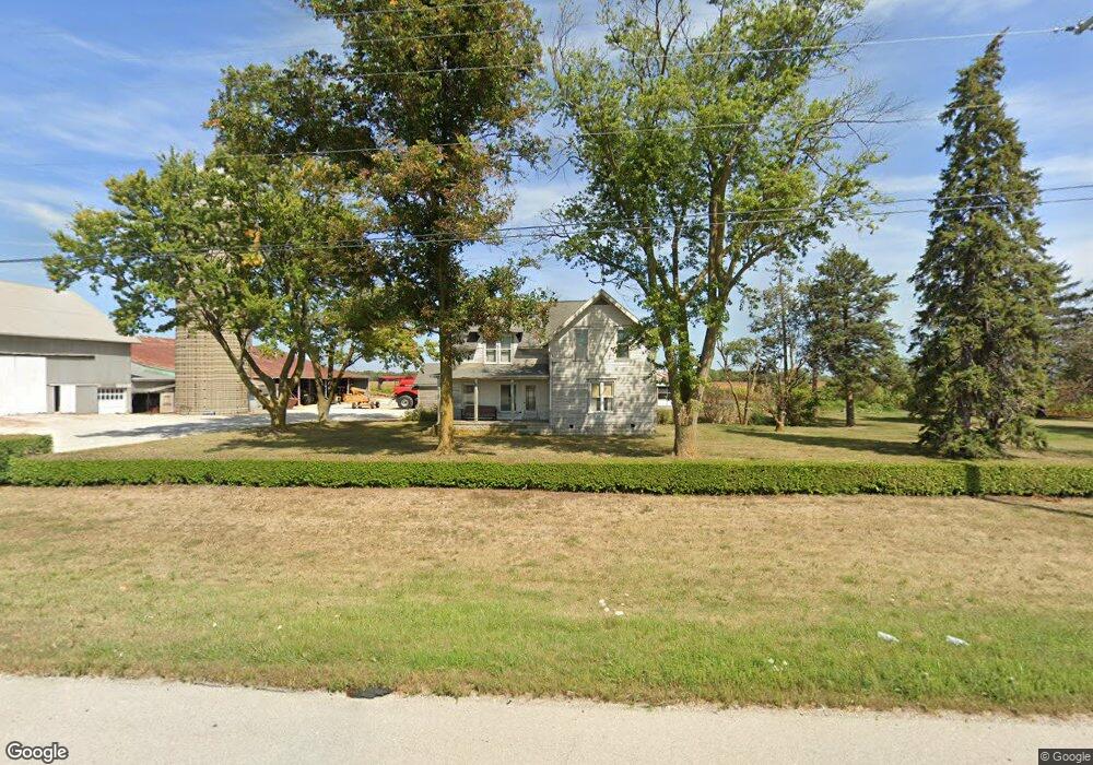
1902 W Main St Woodville, OH 43469
Estimated Value: $414,000 - $794,160
3
Beds
1
Bath
2,264
Sq Ft
$267/Sq Ft
Est. Value
About This Home
This home is located at 1902 W Main St, Woodville, OH 43469 and is currently estimated at $604,080, approximately $266 per square foot. 1902 W Main St is a home located in Sandusky County with nearby schools including Woodmore Elementary School, Woodmore Middle School, and Solomon Lutheran School.
Ownership History
Date
Name
Owned For
Owner Type
Purchase Details
Closed on
Dec 14, 2018
Sold by
Ef Distribution 1Llc/& Distribution 2 Llc
Bought by
Ef Distribution 2 Llc & Distributi
Current Estimated Value
Purchase Details
Closed on
Nov 5, 2018
Sold by
Emch Farms
Bought by
Ef Distribution 1Llc/ & Distributio
Purchase Details
Closed on
Feb 1, 1994
Bought by
Emch Farms
Create a Home Valuation Report for This Property
The Home Valuation Report is an in-depth analysis detailing your home's value as well as a comparison with similar homes in the area
Home Values in the Area
Average Home Value in this Area
Purchase History
| Date | Buyer | Sale Price | Title Company |
|---|---|---|---|
| Ef Distribution 2 Llc & Distributi | -- | -- | |
| Ef Distribution 1Llc/ & Distributio | -- | -- | |
| Emch Farms | -- | -- |
Source: Public Records
Tax History Compared to Growth
Tax History
| Year | Tax Paid | Tax Assessment Tax Assessment Total Assessment is a certain percentage of the fair market value that is determined by local assessors to be the total taxable value of land and additions on the property. | Land | Improvement |
|---|---|---|---|---|
| 2024 | $6,725 | $243,150 | $192,190 | $50,960 |
| 2023 | $6,725 | $177,490 | $140,280 | $37,210 |
| 2022 | $4,856 | $177,490 | $140,280 | $37,210 |
| 2021 | $4,882 | $177,490 | $140,280 | $37,210 |
| 2020 | $6,311 | $172,280 | $125,340 | $46,940 |
| 2019 | $6,401 | $172,280 | $125,340 | $46,940 |
| 2018 | $6,653 | $171,330 | $124,390 | $46,940 |
| 2017 | $7,100 | $157,960 | $117,150 | $40,810 |
| 2016 | $6,832 | $157,960 | $117,150 | $40,810 |
| 2015 | $7,191 | $157,960 | $117,150 | $40,810 |
| 2014 | $5,023 | $129,990 | $93,310 | $36,680 |
| 2013 | $4,910 | $129,990 | $93,310 | $36,680 |
Source: Public Records
Map
Nearby Homes
- 0 Recker Rd
- 20180 Us Highway 23
- 571 Parklane Dr
- 421 Parklane Dr
- 739 Riverside Dr
- 612 W Main St
- 219 Lime St
- 212 S Perry St
- 2067 Devils Hole Rd
- 415 Fort Findlay Rd
- 110 E 1st St
- 712 Lueke Ave Unit 572 p
- 0 Pemberville Rd
- 3291 Middleton Pike
- 24764 Bradner Rd
- 416 Castle Cove
- 510 Wilson St
- 210 School St
- 3698 Truman Rd
- 4396 Dowling Rd
- 1970 W Main St
- 1854 W Main St
- 2030 W Main St
- 2030 W Main St Unit W
- 2000 W Main St Unit 2030
- 2079 W Main St
- 1724 W Main St
- 4676 County Road 16
- 4632 County Road 16
- 1675 W Main St
- 4631 County Road 16
- 0 Joseph Rd Unit 5022275
- 0 Joseph Rd Unit 5084347
- 0 Joseph Rd Unit 5108198
- 0 Joseph Rd Unit 4526051
- 0 Joseph Rd Unit 4523467
- 0 Joseph Rd Unit 4525881
- 0 Joseph Rd Unit 2015015
- 0 Joseph Rd Unit 4506599
- 0 Joseph Rd Unit 201288