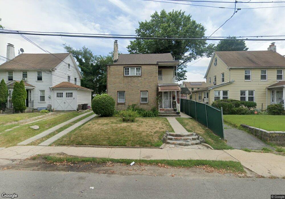
19020 102nd Ave Hollis, NY 11423
Hollis NeighborhoodEstimated Value: $851,242 - $1,021,000
--
Bed
--
Bath
2,100
Sq Ft
$464/Sq Ft
Est. Value
About This Home
This home is located at 19020 102nd Ave, Hollis, NY 11423 and is currently estimated at $975,061, approximately $464 per square foot. 19020 102nd Ave is a home located in Queens County with nearby schools including P.S. 118 Lorraine Hansberry, I.S. 192 The Linden, and Wellspring Elementary & Middle.
Ownership History
Date
Name
Owned For
Owner Type
Purchase Details
Closed on
Nov 3, 1995
Sold by
East Coast Development Corp
Bought by
Brown June
Current Estimated Value
Home Financials for this Owner
Home Financials are based on the most recent Mortgage that was taken out on this home.
Original Mortgage
$194,275
Outstanding Balance
$2,673
Interest Rate
7.43%
Mortgage Type
FHA
Estimated Equity
$972,388
Create a Home Valuation Report for This Property
The Home Valuation Report is an in-depth analysis detailing your home's value as well as a comparison with similar homes in the area
Home Values in the Area
Average Home Value in this Area
Purchase History
| Date | Buyer | Sale Price | Title Company |
|---|---|---|---|
| Brown June | $200,000 | Commonwealth Land Title Ins |
Source: Public Records
Mortgage History
| Date | Status | Borrower | Loan Amount |
|---|---|---|---|
| Open | Brown June | $194,275 |
Source: Public Records
Tax History Compared to Growth
Tax History
| Year | Tax Paid | Tax Assessment Tax Assessment Total Assessment is a certain percentage of the fair market value that is determined by local assessors to be the total taxable value of land and additions on the property. | Land | Improvement |
|---|---|---|---|---|
| 2025 | $7,462 | $39,381 | $12,851 | $26,530 |
| 2024 | $6,345 | $37,152 | $11,392 | $25,760 |
| 2023 | $7,327 | $36,480 | $12,443 | $24,037 |
| 2022 | $6,870 | $45,120 | $15,840 | $29,280 |
| 2021 | $7,243 | $39,600 | $15,840 | $23,760 |
| 2020 | $6,947 | $41,520 | $15,840 | $25,680 |
| 2019 | $6,477 | $43,740 | $15,840 | $27,900 |
| 2018 | $6,197 | $30,400 | $15,644 | $14,756 |
| 2017 | $5,846 | $28,680 | $15,840 | $12,840 |
| 2016 | $5,795 | $28,680 | $15,840 | $12,840 |
| 2015 | $3,253 | $27,348 | $17,122 | $10,226 |
| 2014 | $3,253 | $25,800 | $17,580 | $8,220 |
Source: Public Records
Map
Nearby Homes
- 190-30 103rd Ave
- 10220 189th St
- 10211 187th St
- 102-35 187th St
- 104-11 188th St
- 104-40 194th St
- 194-10 Hollis Ave
- 10532 192nd St
- 19027 109th Rd
- 188-14 Woodhull Ave
- 10533 Farmers Blvd
- 19611 100th Ave
- 19319 109th Rd
- 193-21 109th Rd
- 185-05 Henderson Ave
- 188-09 Jamaica Ave
- 19511 Woodhull Ave
- 9141 195th St
- 19515 Woodhull Ave
- 184-15 Henderson Ave
- 190-20 102nd Ave
- 19024 102nd Ave Unit 2/F
- 19012 102nd Ave
- 19024 102nd Ave
- 190-30 102nd Ave
- 19017 103rd Ave
- 19021 103rd Ave
- 19030 102nd Ave
- 190-6 102nd Ave
- 19013 103rd Ave
- 19025 103rd Ave
- 19006 102nd Ave
- 19006 102nd Ave Unit 1R
- 10207 Farmers Blvd
- 19002 102nd Ave
- 10211 Farmers Blvd
- 190-24 102nd Ave Unit 1/F
- 190-21 103 Ave
- 190-21 103rd Ave
- 190-21 103rd Ave