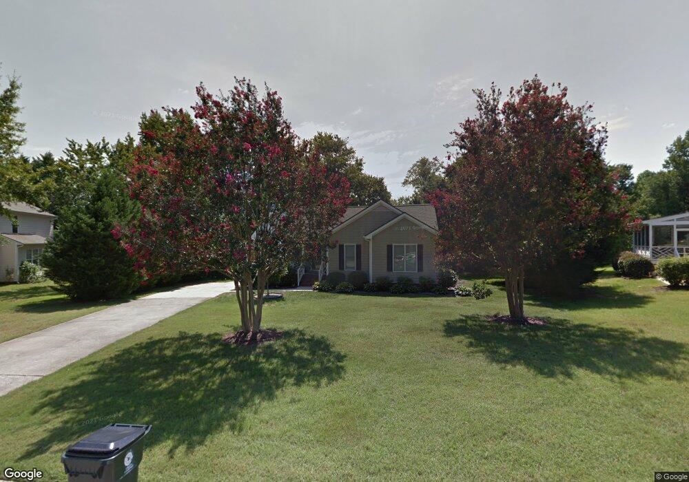
1903 Battlewood Rd Apex, NC 27523
West Cary NeighborhoodEstimated Value: $446,785 - $504,000
3
Beds
2
Baths
1,296
Sq Ft
$365/Sq Ft
Est. Value
About This Home
This home is located at 1903 Battlewood Rd, Apex, NC 27523 and is currently estimated at $473,446, approximately $365 per square foot. 1903 Battlewood Rd is a home located in Wake County with nearby schools including Salem Elementary, Salem Middle, and Green Hope High.
Ownership History
Date
Name
Owned For
Owner Type
Purchase Details
Closed on
Dec 20, 2021
Sold by
Mcdaniel Kathleen R
Bought by
Mcdaniel Kathleen R
Current Estimated Value
Home Financials for this Owner
Home Financials are based on the most recent Mortgage that was taken out on this home.
Original Mortgage
$226,000
Outstanding Balance
$207,496
Interest Rate
2.98%
Mortgage Type
New Conventional
Estimated Equity
$265,950
Purchase Details
Closed on
Jun 28, 2019
Sold by
Merida Christopher and Merida Sarah B
Bought by
Mcdaniel Kathleen R
Home Financials for this Owner
Home Financials are based on the most recent Mortgage that was taken out on this home.
Original Mortgage
$230,400
Interest Rate
4%
Mortgage Type
New Conventional
Purchase Details
Closed on
Jul 19, 2017
Sold by
Emory Brad and Emory Brooks
Bought by
Merida Christopher and Merida Sarah B
Home Financials for this Owner
Home Financials are based on the most recent Mortgage that was taken out on this home.
Original Mortgage
$242,250
Interest Rate
3.89%
Mortgage Type
New Conventional
Purchase Details
Closed on
Jul 30, 2007
Sold by
Close Kelly L
Bought by
Emory Brad and Emory Brooks
Home Financials for this Owner
Home Financials are based on the most recent Mortgage that was taken out on this home.
Original Mortgage
$120,000
Interest Rate
6.71%
Mortgage Type
Purchase Money Mortgage
Purchase Details
Closed on
Mar 2, 2005
Sold by
Madden Anne Marie
Bought by
Close Kelly L
Home Financials for this Owner
Home Financials are based on the most recent Mortgage that was taken out on this home.
Original Mortgage
$137,925
Interest Rate
5.61%
Mortgage Type
Fannie Mae Freddie Mac
Purchase Details
Closed on
Mar 22, 2002
Sold by
Blanchard Joseph Neil and Blanchard Rhonda Norris
Bought by
Madden Anne Marie
Home Financials for this Owner
Home Financials are based on the most recent Mortgage that was taken out on this home.
Original Mortgage
$145,000
Interest Rate
6.85%
Create a Home Valuation Report for This Property
The Home Valuation Report is an in-depth analysis detailing your home's value as well as a comparison with similar homes in the area
Home Values in the Area
Average Home Value in this Area
Purchase History
| Date | Buyer | Sale Price | Title Company |
|---|---|---|---|
| Mcdaniel Kathleen R | $500 | None Available | |
| Mcdaniel Kathleen R | $288,000 | None Available | |
| Mcdaniel Kathleen R | $288,000 | None Listed On Document | |
| Merida Christopher | $255,000 | None Available | |
| Emory Brad | $179,000 | None Available | |
| Close Kelly L | $153,500 | -- | |
| Madden Anne Marie | $145,000 | -- |
Source: Public Records
Mortgage History
| Date | Status | Borrower | Loan Amount |
|---|---|---|---|
| Open | Mcdaniel Kathleen R | $226,000 | |
| Previous Owner | Mcdaniel Kathleen R | $230,400 | |
| Previous Owner | Merida Christopher | $242,250 | |
| Previous Owner | Emory Brad | $120,000 | |
| Previous Owner | Close Kelly L | $137,925 | |
| Previous Owner | Madden Anne Marie | $145,000 |
Source: Public Records
Tax History Compared to Growth
Tax History
| Year | Tax Paid | Tax Assessment Tax Assessment Total Assessment is a certain percentage of the fair market value that is determined by local assessors to be the total taxable value of land and additions on the property. | Land | Improvement |
|---|---|---|---|---|
| 2025 | $3,443 | $392,029 | $200,000 | $192,029 |
| 2024 | $3,366 | $392,029 | $200,000 | $192,029 |
| 2023 | $3,049 | $276,098 | $120,000 | $156,098 |
| 2022 | $2,862 | $276,098 | $120,000 | $156,098 |
| 2021 | $2,753 | $276,098 | $120,000 | $156,098 |
| 2020 | $2,726 | $276,098 | $120,000 | $156,098 |
| 2019 | $2,201 | $192,074 | $84,000 | $108,074 |
| 2018 | $2,074 | $192,074 | $84,000 | $108,074 |
| 2017 | $0 | $192,074 | $84,000 | $108,074 |
| 2016 | $1,903 | $192,074 | $84,000 | $108,074 |
| 2015 | $1,849 | $182,055 | $74,000 | $108,055 |
| 2014 | $1,782 | $182,055 | $74,000 | $108,055 |
Source: Public Records
Map
Nearby Homes
- 2013 Keokuk Ct
- 700 Oak Ridge Dr
- 721 Oak Ridge Dr
- 708 Oak Ridge Dr
- 705 Oak Ridge Dr
- 720 Oak Ridge Dr
- 709 Oak Ridge Dr
- 712 Oak Ridge Dr
- 713 Oak Ridge Dr
- 1808 Beaudet Ln
- 2021 Patapsco Dr
- 320 Sutton Glen Dr
- 114 Calebra Way
- 106 Daleshire Dr
- 2201 Dial Dr
- 7736 Roberts Rd
- 2300 Walden Creek Dr
- 105 Catchpenny Ct
- 6716 Valley Woods Ln
- 1622 Shepherds Glade Dr
- 2001 Keokuk Ct
- 1809 Castleburg Dr
- 2003 Keokuk Ct
- 1807 Castleburg Dr
- 504 Pointe Grove Ln
- 1909 Keokuk Ct
- 1901 Castleburg Dr
- 1805 Castleburg Dr
- 508 Pointe Grove Ln
- 508 Pointe Grove Ln Unit Lot 32-Spec
- 500 Pointe Grove Ln Unit Lot 34- Presale
- 2005 Keokuk Ct
- 2002 Keokuk Ct
- 512 Pointe Grove Ln Unit 31
- 1803 Castleburg Dr
- 1907 Keokuk Ct
- 1903 Castleburg Dr
- 2007 Keokuk Ct
- 501 Pointe Grove Ln
- 501 Pointe Grove Ln Unit Lot 35-Presale