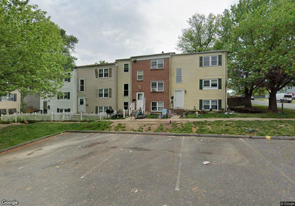
1903 Brookside Dr Edgewood, MD 21040
Estimated Value: $150,000 - $203,000
Studio
3
Baths
1,226
Sq Ft
$139/Sq Ft
Est. Value
About This Home
This home is located at 1903 Brookside Dr, Edgewood, MD 21040 and is currently estimated at $170,249, approximately $138 per square foot. 1903 Brookside Dr is a home located in Harford County with nearby schools including William Paca/Old Post Road Elementary School, Edgewood Middle School, and Edgewood High School.
Ownership History
Date
Name
Owned For
Owner Type
Purchase Details
Closed on
Jun 13, 2007
Sold by
Harvey Ronald E
Bought by
Myers Marlene L
Current Estimated Value
Home Financials for this Owner
Home Financials are based on the most recent Mortgage that was taken out on this home.
Original Mortgage
$60,000
Interest Rate
5.93%
Mortgage Type
Stand Alone Refi Refinance Of Original Loan
Purchase Details
Closed on
Oct 25, 2005
Sold by
Harvey Ronald E
Bought by
Myers Marlene L
Home Financials for this Owner
Home Financials are based on the most recent Mortgage that was taken out on this home.
Original Mortgage
$60,000
Interest Rate
5.93%
Mortgage Type
New Conventional
Purchase Details
Closed on
Aug 12, 1983
Sold by
Andree Marie Bonge
Bought by
Harvey Ronald E
Home Financials for this Owner
Home Financials are based on the most recent Mortgage that was taken out on this home.
Original Mortgage
$40,550
Interest Rate
13.84%
Create a Home Valuation Report for This Property
The Home Valuation Report is an in-depth analysis detailing your home's value as well as a comparison with similar homes in the area
Home Values in the Area
Average Home Value in this Area
Purchase History
| Date | Buyer | Sale Price | Title Company |
|---|---|---|---|
| Myers Marlene L | -- | -- | |
| Myers Marlene L | -- | -- | |
| Harvey Ronald E | $44,000 | -- |
Source: Public Records
Mortgage History
| Date | Status | Borrower | Loan Amount |
|---|---|---|---|
| Closed | Myers Marlene L | $60,000 | |
| Previous Owner | Myers Marlene L | $60,000 | |
| Previous Owner | Harvey Ronald E | $40,550 |
Source: Public Records
Tax History
| Year | Tax Paid | Tax Assessment Tax Assessment Total Assessment is a certain percentage of the fair market value that is determined by local assessors to be the total taxable value of land and additions on the property. | Land | Improvement |
|---|---|---|---|---|
| 2025 | $894 | $102,767 | $0 | $0 |
| 2024 | $894 | $82,033 | $0 | $0 |
| 2023 | $668 | $61,300 | $25,000 | $36,300 |
| 2022 | $622 | $57,033 | $0 | $0 |
| 2021 | $560 | $52,767 | $0 | $0 |
| 2020 | $560 | $48,500 | $14,000 | $34,500 |
| 2019 | $560 | $48,500 | $14,000 | $34,500 |
| 2018 | $555 | $48,500 | $14,000 | $34,500 |
| 2017 | $656 | $57,400 | $0 | $0 |
| 2016 | -- | $57,400 | $0 | $0 |
| 2015 | $1,112 | $57,400 | $0 | $0 |
| 2014 | $1,112 | $100,700 | $0 | $0 |
Source: Public Records
Map
Nearby Homes
- 1860 Eloise Ln
- 1002 Magnolia Woods Ct Unit E
- 1770 Judy Way
- 1811 Eloise Ln
- 1807 Sandee Ct
- 1954 Sidnee Dr
- 1907 Harewood Rd
- 1708 Fountain Rock Way Unit C
- 1944 Chipper Dr
- 1921 Harewood Rd
- 1309 Clover Valley Way Unit J
- 1892 Emily Dr
- 1918 Bayberry Rd
- 0 Emily Dr Unit 1873
- 819 Windstream Way Unit D
- 1305 Clover Valley Way Unit D
- 207 Tulip Ct
- 814 Windstream Way Unit A
- 2019 Kenny Ct
- 1826 Hanson Rd
- 1905 Brookside Dr
- 1901 Brookside Dr
- 1907 Brookside Dr
- 1885 Brookside Dr
- 1887 Brookside Dr
- 1883 Brookside Dr
- 1881 Brookside Dr
- 1911 Brookside Dr
- 1909 Brookside Dr
- 1879 Brookside Dr
- 1913 Brookside Dr
- 1915 Brookside Dr
- 1877 Brookside Dr
- 1917 Brookside Dr
- 1873 Brookside Dr
- 1919 Brookside Dr
- 1897 Grempler Way
- 1851 Simons Ct
- 1921 Brookside Dr
- 1871 Brookside Dr
Your Personal Tour Guide
Ask me questions while you tour the home.