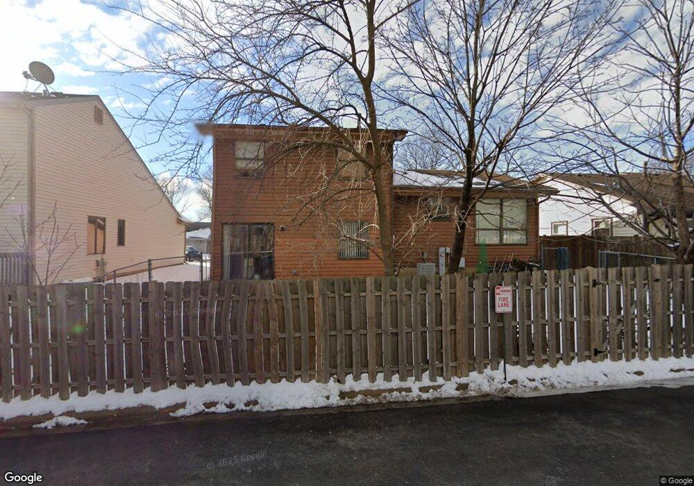
1903 Brookside Ln Hoffman Estates, IL 60169
South Hoffman Estates NeighborhoodEstimated Value: $375,571 - $422,000
3
Beds
3
Baths
1,560
Sq Ft
$255/Sq Ft
Est. Value
About This Home
This home is located at 1903 Brookside Ln, Hoffman Estates, IL 60169 and is currently estimated at $397,893, approximately $255 per square foot. 1903 Brookside Ln is a home located in Cook County with nearby schools including Neil Armstrong Elementary School, Dwight D Eisenhower Junior High School, and Hoffman Estates High School.
Ownership History
Date
Name
Owned For
Owner Type
Purchase Details
Closed on
Jul 5, 1994
Sold by
Immordino Annabel
Bought by
Columbia National Bank Of Chicago
Current Estimated Value
Home Financials for this Owner
Home Financials are based on the most recent Mortgage that was taken out on this home.
Original Mortgage
$50,000
Interest Rate
8.58%
Purchase Details
Closed on
May 26, 1994
Sold by
Shuster Bruce D and Shuster Jenny P
Bought by
Immordino Annabel
Home Financials for this Owner
Home Financials are based on the most recent Mortgage that was taken out on this home.
Original Mortgage
$50,000
Interest Rate
8.58%
Create a Home Valuation Report for This Property
The Home Valuation Report is an in-depth analysis detailing your home's value as well as a comparison with similar homes in the area
Home Values in the Area
Average Home Value in this Area
Purchase History
| Date | Buyer | Sale Price | Title Company |
|---|---|---|---|
| Columbia National Bank Of Chicago | -- | -- | |
| Immordino Annabel | $125,000 | -- |
Source: Public Records
Mortgage History
| Date | Status | Borrower | Loan Amount |
|---|---|---|---|
| Previous Owner | Immordino Annabel | $50,000 |
Source: Public Records
Tax History
| Year | Tax Paid | Tax Assessment Tax Assessment Total Assessment is a certain percentage of the fair market value that is determined by local assessors to be the total taxable value of land and additions on the property. | Land | Improvement |
|---|---|---|---|---|
| 2025 | $1,660 | $36,001 | $5,022 | $30,979 |
| 2024 | $1,660 | $29,000 | $4,565 | $24,435 |
| 2023 | $1,657 | $29,000 | $4,565 | $24,435 |
| 2022 | $1,657 | $29,000 | $4,565 | $24,435 |
| 2021 | $1,821 | $23,896 | $7,189 | $16,707 |
| 2020 | $1,656 | $23,896 | $7,189 | $16,707 |
| 2019 | $1,638 | $26,552 | $7,189 | $19,363 |
| 2018 | $1,828 | $25,399 | $6,276 | $19,123 |
| 2017 | $1,764 | $25,399 | $6,276 | $19,123 |
| 2016 | $2,372 | $25,399 | $6,276 | $19,123 |
| 2015 | $2,686 | $22,761 | $5,478 | $17,283 |
| 2014 | $2,584 | $22,761 | $5,478 | $17,283 |
| 2013 | $2,577 | $22,761 | $5,478 | $17,283 |
Source: Public Records
Map
Nearby Homes
- 1880 Bonnie Ln Unit 116
- 1880 Bonnie Ln Unit 112
- 1475 Rebecca Dr Unit 213
- 1500 Robin Cir Unit 314
- 1776 Bristol Walk Unit 1776
- 1760 Bristol Walk Unit F
- 1769 Sessions Walk Unit C
- 1797 Queensbury Cir Unit 5764
- 1722 Fayette Walk Unit E
- 1840 Huntington Blvd Unit BW511
- 1840 Huntington Blvd Unit 203
- 1800 Monterey Ct
- 1792 Williamsburg Dr
- 1836 Stockton Dr Unit 3312
- 1450 Meyer Rd
- 2080 Sutherland Place Unit 1
- 2222 Seaver Ln
- 2021 Kensington Ln Unit 3004
- 2027 Kensington Ln Unit 3001
- 2025 Kensington Ln Unit 3002
- 1901 Brookside Ln
- 1905 Brookside Ln
- 1899 Brookside Ln Unit 4
- 1907 Brookside Ln
- 1800 Bonnie Ln Unit 223
- 1800 Bonnie Ln Unit 304
- 1902 Brookside Ln
- 1904 Brookside Ln
- 1900 Brookside Ln
- 1909 Brookside Ln
- 1897 Brookside Ln Unit 4
- 1895 Brookside Ln Unit 4
- 1591 Brookside Dr
- 1593 Brookside Dr
- 1596 Brookside Dr
- 1911 Brookside Ln
- 1924 Brookside Ln
- 1880 Bonnie Ln Unit 403
- 1880 Bonnie Ln Unit 218
- 1880 Bonnie Ln Unit 211
Your Personal Tour Guide
Ask me questions while you tour the home.