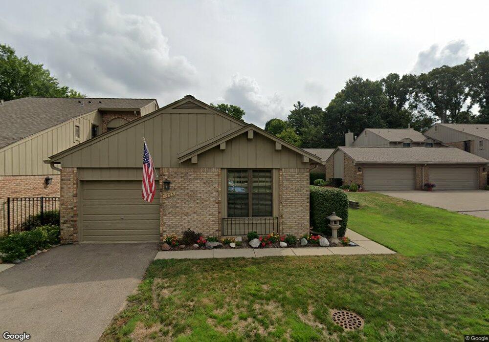
1903 Burning Bush Ct Unit 167 Rochester Hills, MI 48309
Estimated Value: $282,262 - $303,000
2
Beds
2
Baths
1,452
Sq Ft
$201/Sq Ft
Est. Value
About This Home
This home is located at 1903 Burning Bush Ct Unit 167, Rochester Hills, MI 48309 and is currently estimated at $292,316, approximately $201 per square foot. 1903 Burning Bush Ct Unit 167 is a home located in Oakland County with nearby schools including Deerfield Elementary School, Avondale Middle School, and Avondale High School.
Ownership History
Date
Name
Owned For
Owner Type
Purchase Details
Closed on
Aug 1, 2011
Sold by
Allen Arleen Mae Yerant
Bought by
Wagner William F and Wagner Sandra R
Current Estimated Value
Purchase Details
Closed on
Sep 21, 2007
Sold by
Whiting Charles E
Bought by
Whiting Charles E and Yerant Allen Arleen Mae
Purchase Details
Closed on
Apr 6, 2005
Sold by
Whiting Charles E and Charles E Whiting Revocable Tr
Bought by
Whiting Charles E and Allen Arleen Yerant
Purchase Details
Closed on
Nov 21, 2002
Sold by
Saber James F and James F Saber Revocable Trust
Bought by
Charles E Whiting Revocable Living Trust
Create a Home Valuation Report for This Property
The Home Valuation Report is an in-depth analysis detailing your home's value as well as a comparison with similar homes in the area
Home Values in the Area
Average Home Value in this Area
Purchase History
| Date | Buyer | Sale Price | Title Company |
|---|---|---|---|
| Wagner William F | $139,000 | None Available | |
| Whiting Charles E | -- | None Available | |
| Whiting Charles E | -- | None Available | |
| Whiting Charles E | -- | -- | |
| Charles E Whiting Revocable Living Trust | $190,000 | First American Title |
Source: Public Records
Tax History Compared to Growth
Tax History
| Year | Tax Paid | Tax Assessment Tax Assessment Total Assessment is a certain percentage of the fair market value that is determined by local assessors to be the total taxable value of land and additions on the property. | Land | Improvement |
|---|---|---|---|---|
| 2022 | $1,146 | $99,910 | $0 | $0 |
| 2018 | $1,744 | $85,400 | $0 | $0 |
| 2017 | $1,711 | $85,680 | $0 | $0 |
| 2015 | -- | $67,240 | $0 | $0 |
| 2014 | -- | $58,370 | $0 | $0 |
| 2011 | -- | $47,220 | $0 | $0 |
Source: Public Records
Map
Nearby Homes
- 1891 Meadow Dale Ct Unit 5
- 1594 Streamwood Ct Unit 2
- 1946 White Birch Ct
- 2137 Crystal Dr Unit S2
- 2191 Rochelle Park Dr Unit 63
- 1976 Hutchins Dr
- 1751 Trafalgar Square
- 2126 Kennedy Dr
- 2142 Kennedy Dr
- 2289 Rochelle Park Dr Unit AA123
- 2032 Breckenridge Ct Unit 9
- 2031 Breckenridge Ct Unit 4
- 2028 Breckenridge Ct Unit 10
- 2020 Breckenridge Ct
- 2044 Breckenridge Ct
- 1597 Northumberland Dr
- 1585 Kingsmere Cir
- 2579 Dearborn Ave
- 2607 Dearborn Ave
- 211 Peregrine St
- 1899 Burning Bush Ct Unit 66, 168
- 1899 Burning Bush Ct Unit 66
- 1899 Burning Bush Ct Unit 168
- 1891 Burning Bush Ct
- 1895 Burning Bush Ct
- 1895 Burning Bush Ct Unit 169
- 1915 Burning Bush Ct Unit 65, 165
- 1915 Burning Bush Ct Unit 165
- 1911 Burning Bush Ct Unit 65, 166
- 1911 Burning Bush Ct
- 1911 Burning Bush Ct Unit 166
- 1919 Burning Bush Ct
- 1923 Burning Bush Ct
- 1892 Christy Ct
- 1888 Christy Ct
- 1880 Christy Ct
- 1884 Christy Ct
- 1890 Burning Bush Ct Unit 151
- 1894 Burning Bush Ct Unit Bldg-Unit
- 1894 Burning Bush Ct