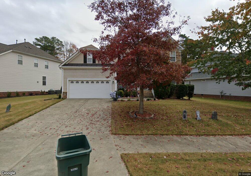
1903 Carnation Dr Durham, NC 27703
South Durham NeighborhoodEstimated Value: $461,000 - $536,000
4
Beds
3
Baths
2,883
Sq Ft
$175/Sq Ft
Est. Value
About This Home
This home is located at 1903 Carnation Dr, Durham, NC 27703 and is currently estimated at $504,316, approximately $174 per square foot. 1903 Carnation Dr is a home located in Durham County with nearby schools including Bethesda Elementary School, John W Neal Middle School, and Southern School of Energy & Sustainability.
Ownership History
Date
Name
Owned For
Owner Type
Purchase Details
Closed on
Jan 31, 2018
Sold by
Schmidt Jack and Schmidt Karen
Bought by
Schmidt Jack and Schmidt Karen
Current Estimated Value
Purchase Details
Closed on
Jun 21, 2006
Sold by
Martin Edward J
Bought by
Schmidt Jack and Schmidt Karen
Home Financials for this Owner
Home Financials are based on the most recent Mortgage that was taken out on this home.
Original Mortgage
$211,200
Outstanding Balance
$123,960
Interest Rate
6.54%
Mortgage Type
Purchase Money Mortgage
Estimated Equity
$380,356
Purchase Details
Closed on
Mar 19, 2004
Sold by
Centex Homes
Bought by
Martin Edward J
Home Financials for this Owner
Home Financials are based on the most recent Mortgage that was taken out on this home.
Original Mortgage
$100,000
Interest Rate
4.75%
Mortgage Type
Purchase Money Mortgage
Create a Home Valuation Report for This Property
The Home Valuation Report is an in-depth analysis detailing your home's value as well as a comparison with similar homes in the area
Home Values in the Area
Average Home Value in this Area
Purchase History
| Date | Buyer | Sale Price | Title Company |
|---|---|---|---|
| Schmidt Jack | -- | None Available | |
| Schmidt Jack | $264,000 | None Available | |
| Martin Edward J | $251,500 | -- |
Source: Public Records
Mortgage History
| Date | Status | Borrower | Loan Amount |
|---|---|---|---|
| Open | Schmidt Jack | $211,200 | |
| Previous Owner | Martin Edward J | $100,000 |
Source: Public Records
Tax History
| Year | Tax Paid | Tax Assessment Tax Assessment Total Assessment is a certain percentage of the fair market value that is determined by local assessors to be the total taxable value of land and additions on the property. | Land | Improvement |
|---|---|---|---|---|
| 2025 | $5,360 | $540,712 | $124,950 | $415,762 |
| 2024 | $4,024 | $288,504 | $53,595 | $234,909 |
| 2023 | $3,779 | $288,504 | $53,595 | $234,909 |
| 2022 | $3,693 | $288,504 | $53,595 | $234,909 |
| 2021 | $3,675 | $288,504 | $53,595 | $234,909 |
| 2020 | $3,589 | $288,504 | $53,595 | $234,909 |
| 2019 | $3,589 | $308,873 | $53,595 | $255,278 |
| 2018 | $3,643 | $268,536 | $41,685 | $226,851 |
| 2017 | $3,616 | $268,536 | $41,685 | $226,851 |
| 2016 | $3,494 | $292,861 | $41,685 | $251,176 |
| 2015 | $3,779 | $273,016 | $46,115 | $226,901 |
| 2014 | $3,779 | $273,016 | $46,115 | $226,901 |
Source: Public Records
Map
Nearby Homes
- 2216 Jollay St
- 3503 Long Ridge Rd
- 2701 Skybrook Ln
- 111 Lang St
- 913 Wood Chapel Ln
- 909 Wood Chapel Ln
- 4613 Angier Ave
- 5024 Dragonfly Dr
- 1018 Flyfish Ave
- 4512 Brimmer St
- 2709 Hamilton Green Dr
- 1200 Bluewater Way
- 1941 Hinesley Dr
- 1946 Hinesley Dr
- 1937 Hinesley Dr
- 1931 Hinesley Dr
- 1935 Hinesley Dr
- 1929 Hinesley Dr
- 1939 Hinesley Dr
- 4213 Congleton Place
- 1901 Carnation Dr
- 1905 Carnation Dr
- 15 Laurel Leaf Ct
- 1 Mayflower Ct
- 1907 Carnation Dr
- 1817 Carnation Dr
- 1904 Carnation Dr
- 14 Laurel Leaf Ct
- 13 Laurel Leaf Ct
- 1909 Carnation Dr
- 1906 Carnation Dr
- 1815 Carnation Dr
- 2 Mayflower Ct
- 3 Mayflower Ct
- 1908 Carnation Dr
- 1910 Carnation Dr
- 12 Laurel Leaf Ct
- 1911 Carnation Dr
- 1813 Carnation Dr
- 4 Mayflower Ct
Your Personal Tour Guide
Ask me questions while you tour the home.