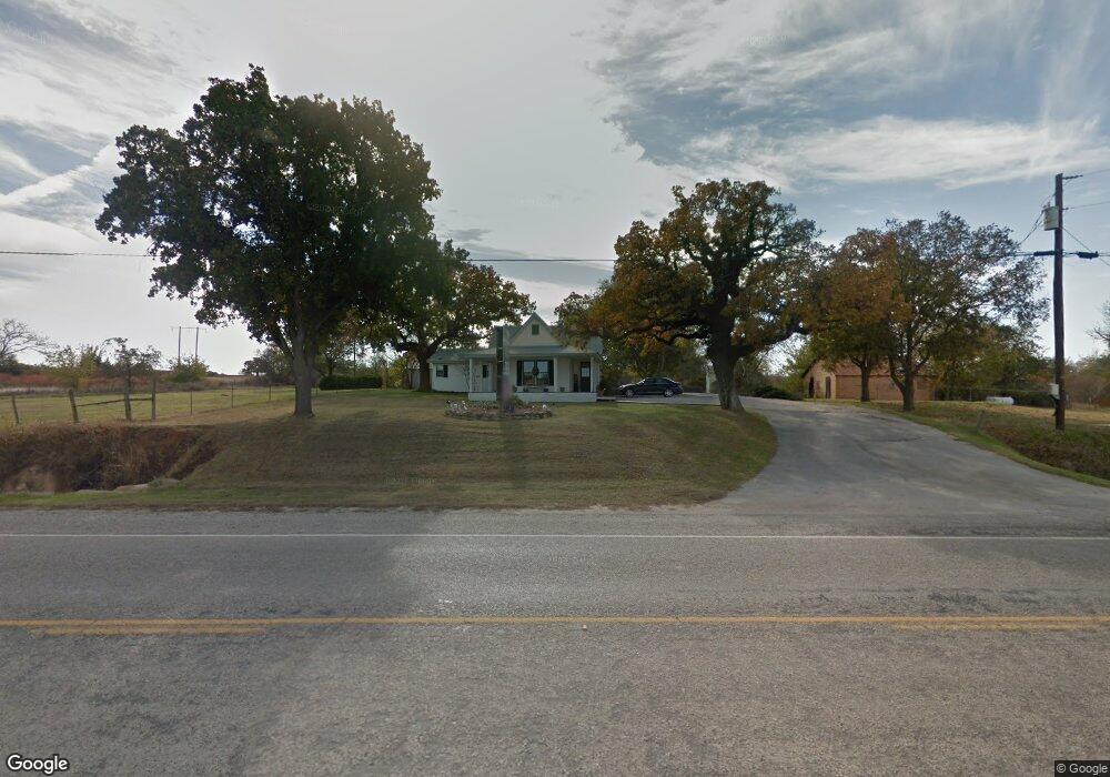
1903 W Business 380 Decatur, TX 76234
Estimated Value: $501,503
--
Bed
1
Bath
1,440
Sq Ft
$348/Sq Ft
Est. Value
About This Home
This home is located at 1903 W Business 380, Decatur, TX 76234 and is currently priced at $501,503, approximately $348 per square foot. 1903 W Business 380 is a home located in Wise County with nearby schools including Decatur High School and Victory Christian Academy.
Ownership History
Date
Name
Owned For
Owner Type
Purchase Details
Closed on
Oct 1, 1998
Bought by
Rogers Sherry Juanita
Current Estimated Value
Purchase Details
Closed on
Dec 6, 1993
Bought by
Rogers Sherry Juanita
Purchase Details
Closed on
Nov 16, 1992
Bought by
Rogers Sherry Juanita
Purchase Details
Closed on
Mar 11, 1992
Bought by
Rogers Sherry Juanita
Purchase Details
Closed on
Jan 1, 1901
Bought by
Rogers Sherry Juanita
Create a Home Valuation Report for This Property
The Home Valuation Report is an in-depth analysis detailing your home's value as well as a comparison with similar homes in the area
Home Values in the Area
Average Home Value in this Area
Purchase History
| Date | Buyer | Sale Price | Title Company |
|---|---|---|---|
| Rogers Sherry Juanita | -- | -- | |
| Rogers Sherry Juanita | -- | -- | |
| Rogers Sherry Juanita | -- | -- | |
| Rogers Sherry Juanita | -- | -- | |
| Rogers Sherry Juanita | -- | -- |
Source: Public Records
Tax History Compared to Growth
Tax History
| Year | Tax Paid | Tax Assessment Tax Assessment Total Assessment is a certain percentage of the fair market value that is determined by local assessors to be the total taxable value of land and additions on the property. | Land | Improvement |
|---|---|---|---|---|
| 2025 | $4,482 | $424,692 | $210,832 | $213,860 |
| 2024 | $4,482 | $367,966 | $158,124 | $209,842 |
| 2023 | $4,449 | $368,250 | $158,124 | $210,126 |
| 2022 | $3,882 | $252,961 | $158,124 | $94,837 |
| 2021 | $3,782 | $235,940 | $158,120 | $77,820 |
| 2020 | $3,801 | $235,580 | $158,120 | $77,460 |
| 2019 | $3,144 | $182,980 | $105,420 | $77,560 |
| 2018 | $3,195 | $179,980 | $105,420 | $74,560 |
| 2017 | $2,856 | $160,920 | $105,420 | $55,500 |
| 2016 | $2,841 | $160,030 | $105,420 | $54,610 |
| 2015 | -- | $160,030 | $105,420 | $54,610 |
| 2014 | -- | $153,790 | $105,420 | $48,370 |
Source: Public Records
Map
Nearby Homes
- 1405 Rodden Dr
- 400 S Vick St
- 808 Sage Dr
- 1234 Rockwater Dr
- 1216 Marsha Ln
- 1232 Marsha Ln
- 1215 Rockwater Dr
- 1 Vista Dr
- 1224 Patti Ln
- LEXINGTON Plan at Vista Park
- OXFORD Plan at Vista Park
- NATCHEZ Plan at Vista Park
- KENNEDY Plan at Vista Park
- MACON Plan at Vista Park
- STARKVILLE Plan at Vista Park
- SOUTHHAVEN Plan at Vista Park
- 1202 W Thompson St Unit Land
- 1240 Marsha Ln
- W W Rose Ave
- 0 N Hwy 287 Unit 25379920
- 225 W Side Dr Unit 200
- 1907 W Business 380
- 225 Westside Bus 380 Unit 300
- 1904 W Bus 380
- 1900 W Business 380
- 200 W Side Dr
- 220 W Side Dr
- 1803 Oakmeadow Dr
- 1715 Oakmeadow Dr
- 1713 Oakmeadow Dr
- 1804 Oakmeadow Dr
- 1711 Oakmeadow Dr
- 1802 Oakmeadow Dr
- 1709 Oakmeadow Dr
- 1800 Oakmeadow Dr
- 406 S Valcik Dr
- 404 S Valcik Dr
- 1710 Oakmeadow Dr
- 1705 Oakmeadow Dr
- 208 Meadowbrook Ln