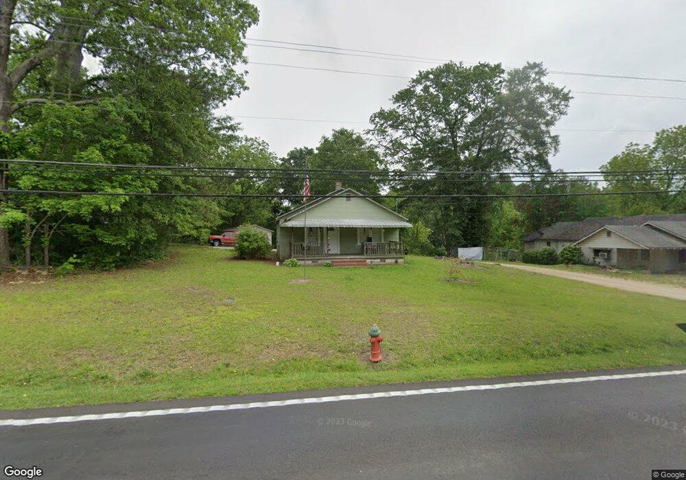
1903 W Currahee St Toccoa, GA 30577
Estimated Value: $96,000 - $213,000
2
Beds
1
Bath
1,196
Sq Ft
$126/Sq Ft
Est. Value
About This Home
This home is located at 1903 W Currahee St, Toccoa, GA 30577 and is currently estimated at $151,215, approximately $126 per square foot. 1903 W Currahee St is a home with nearby schools including Stephens County High School.
Ownership History
Date
Name
Owned For
Owner Type
Purchase Details
Closed on
Aug 15, 2000
Sold by
Fogle Jeff and Fogle John D
Bought by
Fogle John D and Fogle Bonita S
Current Estimated Value
Purchase Details
Closed on
Aug 14, 2000
Sold by
Fogle John Samuel
Bought by
Fogle Jeff and Fogle John D
Purchase Details
Closed on
Apr 21, 2000
Sold by
Fogle Mary Francis
Bought by
Fogle John S
Purchase Details
Closed on
Jul 7, 1997
Sold by
Fogle Mary Francis
Bought by
Fogle John S
Purchase Details
Closed on
Oct 14, 1974
Sold by
Farmer Luther
Bought by
Fogle John S and Fogle Mary F
Purchase Details
Closed on
Jul 19, 1947
Sold by
Farmer Seaborn
Bought by
Farmer Luther
Purchase Details
Closed on
Apr 20, 1940
Sold by
Messer Farmer J and Messer Meeks
Bought by
Farmer Seaborn
Purchase Details
Closed on
Mar 30, 1940
Sold by
Smith Flemon Estate
Bought by
Farmer Farmer J and Farmer Meeks M
Create a Home Valuation Report for This Property
The Home Valuation Report is an in-depth analysis detailing your home's value as well as a comparison with similar homes in the area
Purchase History
We collect this data history from publicly available records. To have your information removed, we recommend requesting removal directly through your county’s website.
| Date | Buyer | Sale Price | Title Company |
|---|---|---|---|
| Fogle John D | $19,000 | -- | |
| Fogle Jeff | -- | -- | |
| Fogle John S | -- | -- | |
| Fogle John S | -- | -- | |
| Fogle John S | $18,000 | -- | |
| Farmer Luther | $3,800 | -- | |
| Farmer Seaborn | -- | -- | |
| Farmer Farmer J | -- | -- |
Source: Public Records
Tax History
| Year | Tax Paid | Tax Assessment Tax Assessment Total Assessment is a certain percentage of the fair market value that is determined by local assessors to be the total taxable value of land and additions on the property. | Land | Improvement |
|---|---|---|---|---|
| 2025 | $882 | $32,146 | $3,482 | $28,664 |
| 2024 | $670 | $21,989 | $3,482 | $18,507 |
| 2023 | $626 | $20,563 | $3,482 | $17,081 |
| 2022 | $516 | $17,346 | $3,482 | $13,864 |
| 2021 | $504 | $16,103 | $3,482 | $12,621 |
| 2020 | $506 | $16,016 | $3,482 | $12,534 |
| 2019 | $508 | $16,016 | $3,482 | $12,534 |
| 2018 | $508 | $16,016 | $3,482 | $12,534 |
| 2017 | $516 | $16,016 | $3,482 | $12,534 |
| 2016 | $516 | $16,259 | $3,481 | $12,778 |
| 2015 | $539 | $16,217 | $3,481 | $12,736 |
| 2014 | $548 | $16,218 | $3,482 | $12,736 |
| 2013 | -- | $16,481 | $3,481 | $13,000 |
Source: Public Records
Map
Nearby Homes
- 2003 W Currahee St
- 258 Persimmon St
- 168 Yearwood St
- 238 Currahee Cir
- 109 Vernon Rd
- 354 S Pine St
- 84 Lovell Cir
- 514 S Broad St
- 42 Busha St
- 3120 W Currahee St
- 150 Elberton St
- 98 Wood St
- 1037 S Pond St
- 288 S Broad St
- 44 Bell St
- 574 S Sage St
- 481 W Currahee St
- 151 Richardson St
- 93 Hickory Cir
- 500 S Pond St
- 1923 W Currahee St
- 1879 W Currahee St
- 1953 W Currahee St
- 1894 W Currahee St
- 1908 W Currahee St
- 1892 W Currahee St
- 1942 W Currahee St
- 1942 W Currahee St Unit 4028
- 1875 W Currahee St
- 1874 W Currahee St
- 1847 W Currahee St
- 1967 W Currahee St
- 1964 W Currahee St
- 1821 W Currahee St
- 1982 W Currahee St
- 2003 W Currahee St
- 1992 W Currahee St
- 7 Yorkshire Dr
- 1813 W Currahee St Unit 35
- 45 Rumsey Row Dr
Your Personal Tour Guide
Ask me questions while you tour the home.