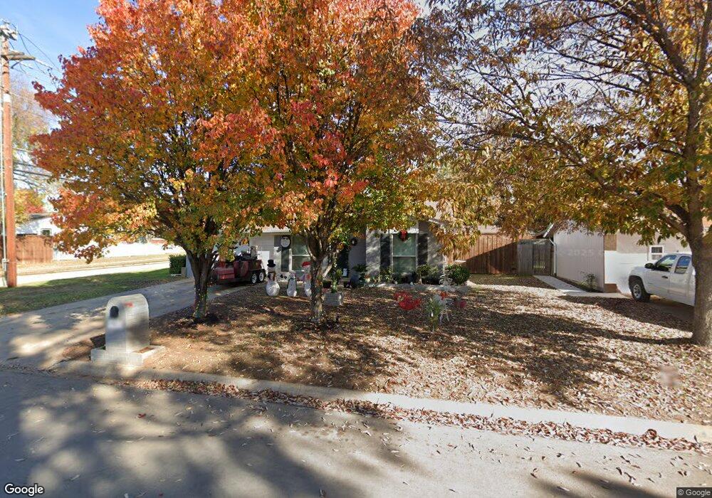
1903 Westwood Dr Denton, TX 76205
Denia NeighborhoodEstimated Value: $257,826 - $297,000
3
Beds
1
Bath
1,080
Sq Ft
$257/Sq Ft
Est. Value
About This Home
This home is located at 1903 Westwood Dr, Denton, TX 76205 and is currently estimated at $277,707, approximately $257 per square foot. 1903 Westwood Dr is a home located in Denton County with nearby schools including Borman Elementary School, McMath Middle School, and Denton High School.
Ownership History
Date
Name
Owned For
Owner Type
Purchase Details
Closed on
Sep 17, 2004
Sold by
Briner Richard M and Briner Carolyn M
Bought by
Escamilla Jose M and Maldonado Estela
Current Estimated Value
Home Financials for this Owner
Home Financials are based on the most recent Mortgage that was taken out on this home.
Original Mortgage
$89,300
Outstanding Balance
$43,557
Interest Rate
5.86%
Mortgage Type
Purchase Money Mortgage
Estimated Equity
$234,150
Purchase Details
Closed on
Apr 10, 2002
Sold by
Briner Richard M and Briner Carolyn M
Bought by
Briner Richard M and Briner Carolyn M
Create a Home Valuation Report for This Property
The Home Valuation Report is an in-depth analysis detailing your home's value as well as a comparison with similar homes in the area
Home Values in the Area
Average Home Value in this Area
Purchase History
| Date | Buyer | Sale Price | Title Company |
|---|---|---|---|
| Escamilla Jose M | -- | -- | |
| Briner Richard M | -- | -- | |
| Briner Richard M | -- | -- |
Source: Public Records
Mortgage History
| Date | Status | Borrower | Loan Amount |
|---|---|---|---|
| Open | Escamilla Jose M | $89,300 |
Source: Public Records
Tax History Compared to Growth
Tax History
| Year | Tax Paid | Tax Assessment Tax Assessment Total Assessment is a certain percentage of the fair market value that is determined by local assessors to be the total taxable value of land and additions on the property. | Land | Improvement |
|---|---|---|---|---|
| 2025 | $2,864 | $223,604 | $62,128 | $161,476 |
| 2024 | $4,060 | $210,338 | $0 | $0 |
| 2023 | $2,454 | $191,216 | $62,128 | $182,872 |
| 2022 | $3,690 | $173,833 | $62,128 | $154,662 |
| 2021 | $3,513 | $158,030 | $41,419 | $116,611 |
| 2020 | $3,488 | $152,595 | $41,419 | $111,587 |
| 2019 | $3,310 | $138,723 | $41,419 | $112,526 |
| 2018 | $3,046 | $126,112 | $41,419 | $84,693 |
| 2017 | $2,840 | $114,918 | $39,348 | $79,652 |
| 2016 | $2,582 | $104,471 | $27,000 | $77,471 |
| 2015 | $2,214 | $99,377 | $27,000 | $72,377 |
| 2014 | $2,214 | $99,090 | $31,500 | $67,590 |
| 2013 | -- | $97,552 | $31,500 | $66,052 |
Source: Public Records
Map
Nearby Homes
- 1523 Oakwood Dr
- 1619 Mccormick St
- 1211 Lindsey St
- 631 Acme St
- 2302 Mercedes Rd
- 2314 Leslie St
- 2421 Mercedes Rd
- 2305 Bernard St
- 2216 Redwing Dr
- 1618 Kendolph Dr
- 1024 Greenlee St
- 2216 Ruff Rd
- 2321 Ruff Rd
- 2605 Mccormick St
- 2609 Mccormick St
- 2617 Mccormick St
- 2304 Blackcap St
- 2700 Mccormick St
- 2621 Mccormick St
- 2513 Goldfinch Dr
- 1907 Westwood Dr
- 1814 Mercedes Rd
- 1902 Mercedes Rd
- 1911 Westwood Dr
- 1906 Mercedes Rd
- 1815 Westwood Dr
- 1910 Mercedes Rd
- 1810 Mercedes Rd
- 1906 Westwood Dr
- 1815 Mercedes Rd
- 1915 Westwood Dr
- 1807 Westwood Dr
- 1914 Mercedes Rd
- 1811 Mercedes Rd
- 1806 Mercedes Rd
- 1914 Westwood Dr
- 1919 Westwood Dr
- 1805 Westwood Dr
- 1918 Mercedes Rd
- 1807 Mercedes Rd