Estimated Value: $236,000 - $259,000
--
Bed
1
Bath
1,152
Sq Ft
$215/Sq Ft
Est. Value
About This Home
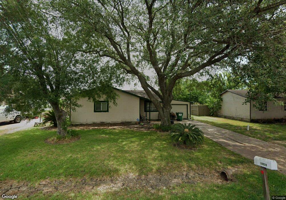
This home is located at 19039 County Road 669d, Alvin, TX 77511 and is currently estimated at $247,184, approximately $214 per square foot. 19039 County Road 669d is a home located in Brazoria County with nearby schools including Mark Twain Elementary School, G.W. Harby Junior High School, and Alvin High School.
Ownership History
Date
Name
Owned For
Owner Type
Purchase Details
Closed on
Dec 27, 2000
Sold by
Carrera Ruben
Bought by
Ross Melinda G
Current Estimated Value
Home Financials for this Owner
Home Financials are based on the most recent Mortgage that was taken out on this home.
Original Mortgage
$72,191
Outstanding Balance
$27,003
Interest Rate
7.73%
Mortgage Type
FHA
Estimated Equity
$220,181
Purchase Details
Closed on
Mar 12, 1997
Sold by
Schlabra Michael R and Schlabra Patricia L
Bought by
Carrera Ruben
Home Financials for this Owner
Home Financials are based on the most recent Mortgage that was taken out on this home.
Original Mortgage
$49,300
Interest Rate
7.89%
Create a Home Valuation Report for This Property
The Home Valuation Report is an in-depth analysis detailing your home's value as well as a comparison with similar homes in the area
Home Values in the Area
Average Home Value in this Area
Purchase History
| Date | Buyer | Sale Price | Title Company |
|---|---|---|---|
| Ross Melinda G | -- | Alamo Title Company | |
| Carrera Ruben | -- | -- |
Source: Public Records
Mortgage History
| Date | Status | Borrower | Loan Amount |
|---|---|---|---|
| Open | Ross Melinda G | $72,191 | |
| Previous Owner | Carrera Ruben | $49,300 | |
| Closed | Ross Melinda G | $2,165 |
Source: Public Records
Tax History Compared to Growth
Tax History
| Year | Tax Paid | Tax Assessment Tax Assessment Total Assessment is a certain percentage of the fair market value that is determined by local assessors to be the total taxable value of land and additions on the property. | Land | Improvement |
|---|---|---|---|---|
| 2025 | $1,455 | $136,730 | $8,900 | $127,830 |
| 2023 | $1,455 | $137,440 | $17,790 | $258,960 |
| 2022 | $2,647 | $124,945 | $8,900 | $121,580 |
| 2021 | $2,521 | $118,900 | $8,900 | $110,000 |
| 2020 | $2,318 | $103,260 | $7,870 | $95,390 |
| 2019 | $2,179 | $94,300 | $6,840 | $87,460 |
| 2018 | $2,031 | $87,670 | $6,840 | $80,830 |
| 2017 | $2,056 | $87,670 | $6,840 | $80,830 |
| 2016 | $2,056 | $87,670 | $6,840 | $80,830 |
| 2014 | $1,661 | $83,630 | $6,840 | $76,790 |
Source: Public Records
Map
Nearby Homes
- 19168 County Road 669e Stoneforest
- 0 County Road 128
- 7506 Bluebonnet St
- 00 Cr 175
- 18502 Wells Ct
- 8030 Over St Unit C176A
- 18111 Roy Long Rd
- 8042 Over St
- 17501 County Road 116
- 7829 James St Unit CR117
- COUNTRY RD 143 County Road 112
- 8835 Escondido St
- 7225 Libby Ln
- 7223 Libby Ln
- 1616 County Road 393
- 3415 Herbert Dr
- 7206 Williams Rd
- 6408 Green Clover Ln
- 5225 Cypress Rose Dr
- 5236 Cypress Rose Dr
- 19027 County Road 669d
- 19049 County Road 669d
- 19050 County Road 669e
- 7762 Cr669b
- 19032 County Rd 669e
- 19032 Stoneforest Road County Rd 669e
- 7762 County Road 669b Unit 669B
- 7762 Stonebridge Rd
- 19032 County Road 669e Unit 669E
- 19060 County Road 669e
- 19038 County Road 669d
- 19098 County Rd
- 19024 County Road 669d
- 19048 County Road 669d
- 19089 County Road 669e
- 19020 County Road 669d
- 19014 Stoneforest Rd
- 19069 County Road 669d
- 19070 County Road 669d
- 19078 Stoneforest Rd