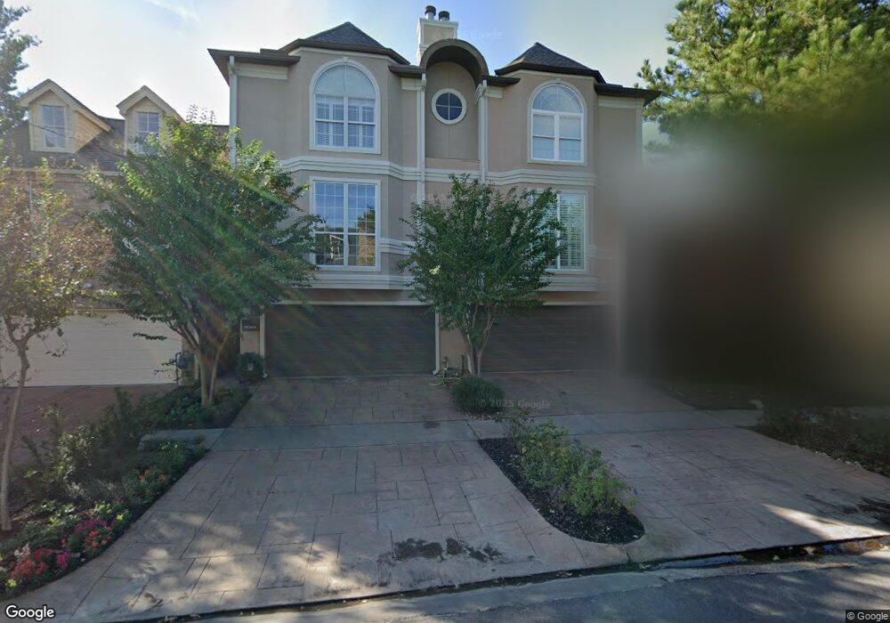
1904 Brun St Unit B Houston, TX 77019
Montrose NeighborhoodEstimated Value: $653,506 - $847,000
3
Beds
4
Baths
3,347
Sq Ft
$235/Sq Ft
Est. Value
About This Home
This home is located at 1904 Brun St Unit B, Houston, TX 77019 and is currently estimated at $786,377, approximately $234 per square foot. 1904 Brun St Unit B is a home located in Harris County with nearby schools including Baker Montessori, Lanier Middle School, and Lamar High School.
Ownership History
Date
Name
Owned For
Owner Type
Purchase Details
Closed on
Dec 17, 2019
Sold by
Floyd Enterprise Llc
Bought by
Gendron Brian and Pagnani Gendron Alayna
Current Estimated Value
Home Financials for this Owner
Home Financials are based on the most recent Mortgage that was taken out on this home.
Original Mortgage
$472,000
Outstanding Balance
$416,136
Interest Rate
3.6%
Mortgage Type
New Conventional
Estimated Equity
$370,241
Purchase Details
Closed on
Feb 21, 2013
Sold by
Hughes Mark B
Bought by
Hassing James R and Wang Yanhong
Home Financials for this Owner
Home Financials are based on the most recent Mortgage that was taken out on this home.
Original Mortgage
$290,000
Interest Rate
2.12%
Mortgage Type
Adjustable Rate Mortgage/ARM
Purchase Details
Closed on
Aug 25, 2003
Sold by
Ortiz James and Ortiz Helaine J
Bought by
Hughes Mark B
Home Financials for this Owner
Home Financials are based on the most recent Mortgage that was taken out on this home.
Original Mortgage
$318,800
Interest Rate
4.25%
Mortgage Type
Purchase Money Mortgage
Purchase Details
Closed on
Jun 26, 1998
Sold by
Tucci James M and Lamoreaux Judith A
Bought by
Ortiz James and Ortiz Helaine J
Home Financials for this Owner
Home Financials are based on the most recent Mortgage that was taken out on this home.
Original Mortgage
$265,600
Interest Rate
7.13%
Purchase Details
Closed on
May 15, 1997
Sold by
B B K Construction Inc
Bought by
Trest Walter Gregory and Wilson Reah Lea
Home Financials for this Owner
Home Financials are based on the most recent Mortgage that was taken out on this home.
Original Mortgage
$241,303
Interest Rate
8.16%
Purchase Details
Closed on
Apr 1, 1997
Sold by
B B K Construction Inc
Bought by
Tucci James M and Lamoreaux Judith A
Home Financials for this Owner
Home Financials are based on the most recent Mortgage that was taken out on this home.
Original Mortgage
$241,303
Interest Rate
8.16%
Create a Home Valuation Report for This Property
The Home Valuation Report is an in-depth analysis detailing your home's value as well as a comparison with similar homes in the area
Home Values in the Area
Average Home Value in this Area
Purchase History
| Date | Buyer | Sale Price | Title Company |
|---|---|---|---|
| Gendron Brian | -- | Ctt | |
| Hassing James R | -- | None Available | |
| Hughes Mark B | -- | -- | |
| Ortiz James | -- | Charter Title Company | |
| Trest Walter Gregory | -- | Regency Title | |
| Tucci James M | -- | Regency Title |
Source: Public Records
Mortgage History
| Date | Status | Borrower | Loan Amount |
|---|---|---|---|
| Open | Gendron Brian | $472,000 | |
| Previous Owner | Hassing James R | $290,000 | |
| Previous Owner | Hughes Mark B | $318,800 | |
| Previous Owner | Ortiz James | $265,600 | |
| Previous Owner | Trest Walter Gregory | $241,303 | |
| Previous Owner | Tucci James M | $214,000 | |
| Closed | Tucci James M | $47,652 |
Source: Public Records
Tax History Compared to Growth
Tax History
| Year | Tax Paid | Tax Assessment Tax Assessment Total Assessment is a certain percentage of the fair market value that is determined by local assessors to be the total taxable value of land and additions on the property. | Land | Improvement |
|---|---|---|---|---|
| 2025 | $5,217 | $728,501 | $257,400 | $471,101 |
| 2024 | $5,217 | $600,000 | $257,400 | $342,600 |
| 2023 | $5,217 | $687,641 | $257,400 | $430,241 |
| 2022 | $13,336 | $622,840 | $257,400 | $365,440 |
| 2021 | $12,833 | $550,600 | $245,700 | $304,900 |
| 2020 | $12,805 | $528,775 | $245,700 | $283,075 |
| 2019 | $14,133 | $558,536 | $143,600 | $414,936 |
| 2018 | $10,704 | $541,000 | $143,600 | $397,400 |
| 2017 | $14,609 | $550,556 | $143,600 | $406,956 |
| 2016 | $15,061 | $567,563 | $143,600 | $423,963 |
| 2015 | $11,755 | $634,657 | $143,600 | $491,057 |
| 2014 | $11,755 | $577,315 | $125,650 | $451,665 |
Source: Public Records
Map
Nearby Homes
- 1909 Brun St Unit 17
- 1909 Brun St Unit 16
- 2026 Welch St
- 1904 Hazard St
- 2008 Hazard St
- 1810 Hazard St Unit A
- 1910 Huldy St Unit A
- 1712 Mcduffie St
- 2027 Huldy St
- 1711 Huldy St Unit A
- 2112 Mcduffie St
- 1956 Vermont St
- 2103 Hazard St
- 2113 Huldy St
- 1822 Morse St Unit A
- 2115 Huldy St
- 2100 Welch St Unit C113
- 2100 Welch St Unit C101
- 2117 Huldy St
- 2119 Huldy St