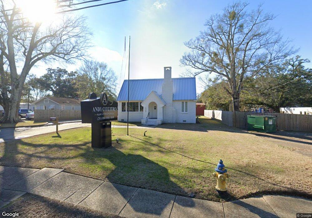
1904 Dauphin Island Pkwy Mobile, AL 36605
Neshota NeighborhoodEstimated Value: $405,115
2
Beds
1
Bath
2,821
Sq Ft
$144/Sq Ft
Est. Value
About This Home
This home is located at 1904 Dauphin Island Pkwy, Mobile, AL 36605 and is currently estimated at $405,115, approximately $143 per square foot. 1904 Dauphin Island Pkwy is a home located in Mobile County with nearby schools including Dr. Robert W. Gilliard Elementary School, Ben C Rain High School, and Revelation Christian School.
Ownership History
Date
Name
Owned For
Owner Type
Purchase Details
Closed on
Nov 15, 2023
Sold by
Andrew T Citrin Llc
Bought by
Ocean Plaza Llc
Current Estimated Value
Purchase Details
Closed on
May 1, 2020
Sold by
Barnard Ansley Head
Bought by
Andrew T Citrin Llc
Purchase Details
Closed on
Apr 21, 2020
Sold by
Barnard Eaton G
Bought by
Barnard Ansley Head
Purchase Details
Closed on
Dec 10, 2008
Sold by
Barnard Eaton G
Bought by
Three Tree Investments Llc
Purchase Details
Closed on
Jul 13, 2000
Sold by
Duhe Bryan G and Duhe Eaton G
Bought by
Barnard Eaton G
Home Financials for this Owner
Home Financials are based on the most recent Mortgage that was taken out on this home.
Original Mortgage
$45,000
Interest Rate
8.23%
Mortgage Type
Commercial
Create a Home Valuation Report for This Property
The Home Valuation Report is an in-depth analysis detailing your home's value as well as a comparison with similar homes in the area
Home Values in the Area
Average Home Value in this Area
Purchase History
| Date | Buyer | Sale Price | Title Company |
|---|---|---|---|
| Ocean Plaza Llc | $365,000 | None Listed On Document | |
| Andrew T Citrin Llc | $200,000 | Slt | |
| Barnard Ansley Head | -- | None Available | |
| Three Tree Investments Llc | $120,000 | None Available | |
| Barnard Eaton G | $45,500 | Surety Land Title Inc |
Source: Public Records
Mortgage History
| Date | Status | Borrower | Loan Amount |
|---|---|---|---|
| Previous Owner | Barnard Eaton G | $45,000 |
Source: Public Records
Tax History Compared to Growth
Tax History
| Year | Tax Paid | Tax Assessment Tax Assessment Total Assessment is a certain percentage of the fair market value that is determined by local assessors to be the total taxable value of land and additions on the property. | Land | Improvement |
|---|---|---|---|---|
| 2024 | $6,062 | $93,920 | $8,400 | $85,520 |
| 2023 | $3,118 | $68,860 | $8,400 | $60,460 |
| 2022 | $2,973 | $46,820 | $5,860 | $40,960 |
| 2021 | $2,736 | $61,240 | $3,500 | $57,740 |
| 2020 | $2,736 | $61,500 | $3,500 | $58,000 |
| 2019 | $2,605 | $41,020 | $3,500 | $37,520 |
| 2018 | $2,614 | $41,160 | $0 | $0 |
| 2017 | $2,672 | $42,080 | $0 | $0 |
| 2016 | $2,644 | $41,640 | $0 | $0 |
| 2013 | $1,735 | $26,780 | $0 | $0 |
Source: Public Records
Map
Nearby Homes
- 1924 Ryders Ln
- 2059 Magnolia Ln
- 2066 Forest Ln
- 2130 Barron Place
- 2204 David Dr
- 2256 W Hillwood Dr
- 1706 Bass Dr
- 1620 W Martin Dr
- 2366 Dauphin Island Pkwy
- 2366 Dauphin Island Pkwy Unit 7
- 2123 Old Military Rd
- 221 Riverbend Dr Unit 221
- 326 Riverbend Dr Unit 326
- 319 Riverbend Dr Unit 319
- 113 Riverbend Dr
- 301 Riverbend Dr
- 201 Riverbend Dr
- 332 Riverbend Dr
- 1476 Boudousquie St
- 1619 Wormeley Dr
- 1908 Dauphin Island Pkwy
- 2003 Forrest Ln
- 1913 Roys Ln
- 1905 Roys Ln
- 2007 Forrest Ln
- 1914 Dauphin Island Pkwy
- 1915 Roys Ln
- 1900 Roys Ln
- 2009 Bakers Ln
- 1906 Roys Ln
- 1923 Roys Ln
- 2009 Forrest Ln
- 1916 Dauphin Island Pkwy
- 1908 Roys Ln
- 1916 Roys Ln
- 1911 Ryders Ln
- 2015 Forrest Ln
- 1926 Roys Ln
- 1915 Ryders Ln
- 2015 Forest Ln