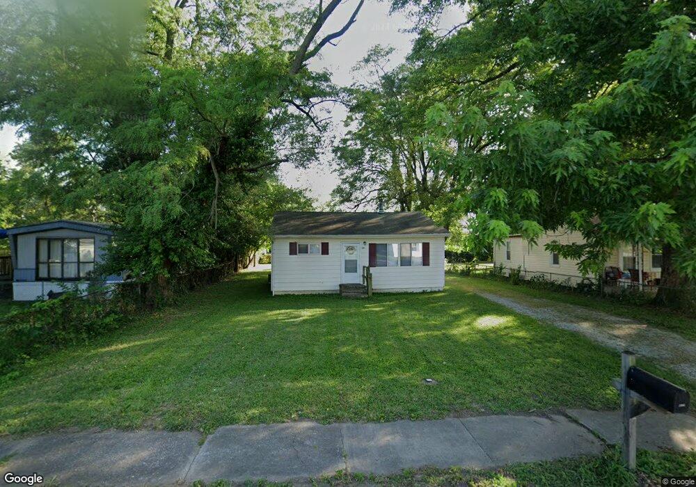
1904 Doris Ave East Saint Louis, IL 62206
Estimated Value: $69,405 - $75,000
2
Beds
1
Bath
841
Sq Ft
$87/Sq Ft
Est. Value
About This Home
This home is located at 1904 Doris Ave, East Saint Louis, IL 62206 and is currently estimated at $72,851, approximately $86 per square foot. 1904 Doris Ave is a home located in St. Clair County.
Ownership History
Date
Name
Owned For
Owner Type
Purchase Details
Closed on
Jan 23, 2009
Sold by
S & J Of Waterloo Properties Llc
Bought by
Doris Land Trust 1904
Current Estimated Value
Purchase Details
Closed on
May 16, 2008
Sold by
Serkin Thomas S and Serkin Thomas
Bought by
S&J Of Waterloo Properties Llc
Home Financials for this Owner
Home Financials are based on the most recent Mortgage that was taken out on this home.
Original Mortgage
$180,000
Interest Rate
6.87%
Mortgage Type
Purchase Money Mortgage
Create a Home Valuation Report for This Property
The Home Valuation Report is an in-depth analysis detailing your home's value as well as a comparison with similar homes in the area
Home Values in the Area
Average Home Value in this Area
Purchase History
| Date | Buyer | Sale Price | Title Company |
|---|---|---|---|
| Doris Land Trust 1904 | -- | Town & Country | |
| S&J Of Waterloo Properties Llc | $225,000 | Accent Title Inc |
Source: Public Records
Mortgage History
| Date | Status | Borrower | Loan Amount |
|---|---|---|---|
| Previous Owner | S&J Of Waterloo Properties Llc | $180,000 |
Source: Public Records
Tax History Compared to Growth
Tax History
| Year | Tax Paid | Tax Assessment Tax Assessment Total Assessment is a certain percentage of the fair market value that is determined by local assessors to be the total taxable value of land and additions on the property. | Land | Improvement |
|---|---|---|---|---|
| 2024 | $1,596 | $8,392 | $1,272 | $7,120 |
| 2023 | $1,441 | $7,585 | $1,150 | $6,435 |
| 2022 | $1,319 | $6,648 | $1,008 | $5,640 |
| 2021 | $1,353 | $6,299 | $955 | $5,344 |
| 2020 | $1,559 | $6,690 | $999 | $5,691 |
| 2019 | $1,561 | $6,690 | $999 | $5,691 |
| 2018 | $1,554 | $6,788 | $1,014 | $5,774 |
| 2017 | $1,539 | $6,625 | $990 | $5,635 |
| 2016 | $1,611 | $6,565 | $988 | $5,577 |
| 2014 | $1,328 | $6,493 | $977 | $5,516 |
| 2013 | $880 | $6,090 | $916 | $5,174 |
Source: Public Records
Map
Nearby Homes
- 2025 Sandy Ridge Rd
- 2005 Louise Ave
- 2016 Lynn St
- 1426 Richard Dr
- 1713 Loretta Ave
- 1402 Richard Dr
- 1713 Theodore Ln
- 1723 Theodore Ln
- 1700 Theodore Ln
- 2014 Florence St
- 20 Leonard Dr
- 2 Margie Dr
- 1326 Saint Zita Ln
- 1997 Oak Tree Ln
- 111 Lazarcheff Dr
- 118 Saint Christopher Dr
- 1128 Saint Benedict Dr
- 214 Saint John Dr
- 1307 Saint Zita Ln
- 1710 Parklane Dr
- 1908 Doris Ave
- 1900 Doris Ave
- 1912 Doris Ave
- 1901 Sandy Ridge Rd
- 1909 Sandy Ridge Rd
- 1905 Doris Ave
- 1901 Doris Ave
- 1901 Doris Ave
- 1916 Doris Ave
- 1854 Doris Ave
- 1909 Doris Ave
- 1851 Sandy Ridge Rd
- 1913 Doris Ave
- 1922 Doris Ave
- 1919 Doris Ave
- 1846 Doris Ave
- 1853 Doris Ave
- 1921 Sandy Ridge Rd
- 1924 Doris Ave
- 1921 Doris Ave