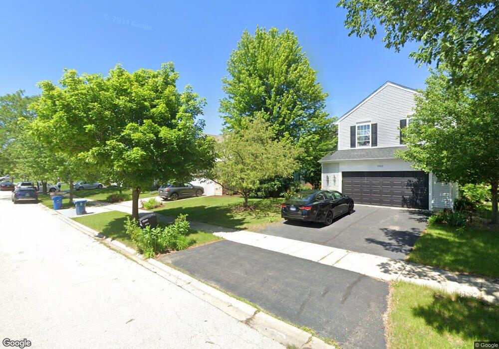
1904 Eastwick Ln Aurora, IL 60503
Far Southeast NeighborhoodEstimated Value: $482,499 - $506,000
4
Beds
3
Baths
2,393
Sq Ft
$206/Sq Ft
Est. Value
About This Home
This home is located at 1904 Eastwick Ln, Aurora, IL 60503 and is currently estimated at $493,375, approximately $206 per square foot. 1904 Eastwick Ln is a home located in Kendall County with nearby schools including The Wheatlands Elementary School, Bednarcik Jr. High School, and Oswego East High School.
Ownership History
Date
Name
Owned For
Owner Type
Purchase Details
Closed on
Dec 14, 1999
Sold by
Drh Cambridge Homes Inc
Bought by
Diner David and Elise Diner E
Current Estimated Value
Home Financials for this Owner
Home Financials are based on the most recent Mortgage that was taken out on this home.
Original Mortgage
$220,800
Outstanding Balance
$68,286
Interest Rate
7.7%
Estimated Equity
$425,089
Create a Home Valuation Report for This Property
The Home Valuation Report is an in-depth analysis detailing your home's value as well as a comparison with similar homes in the area
Home Values in the Area
Average Home Value in this Area
Purchase History
| Date | Buyer | Sale Price | Title Company |
|---|---|---|---|
| Diner David | $232,500 | Chicago Title Insurance Co |
Source: Public Records
Mortgage History
| Date | Status | Borrower | Loan Amount |
|---|---|---|---|
| Open | Diner David | $220,800 |
Source: Public Records
Tax History Compared to Growth
Tax History
| Year | Tax Paid | Tax Assessment Tax Assessment Total Assessment is a certain percentage of the fair market value that is determined by local assessors to be the total taxable value of land and additions on the property. | Land | Improvement |
|---|---|---|---|---|
| 2024 | $11,156 | $131,570 | $28,223 | $103,347 |
| 2023 | $10,246 | $117,473 | $25,199 | $92,274 |
| 2022 | $10,246 | $107,773 | $23,118 | $84,655 |
| 2021 | $9,617 | $97,975 | $21,016 | $76,959 |
| 2020 | $9,528 | $96,054 | $20,604 | $75,450 |
| 2019 | $9,552 | $94,214 | $20,604 | $73,610 |
| 2018 | $9,164 | $90,958 | $19,892 | $71,066 |
| 2017 | $8,884 | $83,833 | $18,334 | $65,499 |
| 2016 | $8,515 | $79,462 | $17,378 | $62,084 |
| 2015 | $8,775 | $75,678 | $16,550 | $59,128 |
| 2014 | -- | $71,394 | $15,613 | $55,781 |
| 2013 | -- | $72,115 | $15,771 | $56,344 |
Source: Public Records
Map
Nearby Homes
- 1739 Baler Ave
- 1745 Baler Ave
- 1751 Baler Ave
- 1757 Baler Ave
- 1764 Stable Ln
- 1776 Stable Ln
- 2060 Lyndhurst Ln
- 1870 Canyon Creek Dr
- 1830 Canyon Creek Dr
- 1880 Canyon Creek Dr
- Bellamy Plan at Wheatland Crossing
- Henley Plan at Wheatland Crossing
- Ashton Plan at Wheatland Crossing
- Coventry Plan at Wheatland Crossing
- 2084 Canyon Creek Ct
- 1611 Fredericksburg Ln Unit 1
- 1855 Keating Dr
- 1622 Captiva Dr
- 1871 Keating Dr
- 1875 Keating Dr
- 1912 Eastwick Ln
- 1896 Eastwick Ln
- 1920 Eastwick Ln
- 1888 Eastwick Ln
- 1901 Eastwick Ln Unit 1
- 1909 Eastwick Ln Unit 1
- 1928 Eastwick Ln
- 1880 Eastwick Ln Unit 1
- 1893 Eastwick Ln Unit 1
- 1917 Eastwick Ln
- 1925 Eastwick Ln Unit 1
- 1885 Eastwick Ln Unit 1
- 1936 Eastwick Ln
- 1872 Eastwick Ln
- 1934 Conway Ln
- 1942 Conway Ln Unit 1
- 1933 Eastwick Ln
- 1926 Conway Ln
- 1877 Eastwick Ln Unit 1
- 1950 Conway Ln