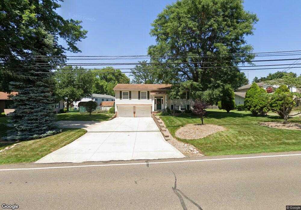
1904 Locust St S Canal Fulton, OH 44614
Estimated Value: $227,000 - $279,000
3
Beds
2
Baths
1,222
Sq Ft
$209/Sq Ft
Est. Value
About This Home
This home is located at 1904 Locust St S, Canal Fulton, OH 44614 and is currently estimated at $255,162, approximately $208 per square foot. 1904 Locust St S is a home located in Stark County with nearby schools including W.S. Stinson Elementary School, Northwest Primary School, and Northwest Middle School.
Ownership History
Date
Name
Owned For
Owner Type
Purchase Details
Closed on
Mar 11, 2014
Sold by
Panaciulli Michael J and Panaciulli Julie
Bought by
Panaciulli Michael J and Panaciulli Julie
Current Estimated Value
Purchase Details
Closed on
Oct 30, 1992
Create a Home Valuation Report for This Property
The Home Valuation Report is an in-depth analysis detailing your home's value as well as a comparison with similar homes in the area
Home Values in the Area
Average Home Value in this Area
Purchase History
| Date | Buyer | Sale Price | Title Company |
|---|---|---|---|
| Panaciulli Michael J | -- | None Available | |
| -- | -- | -- |
Source: Public Records
Tax History Compared to Growth
Tax History
| Year | Tax Paid | Tax Assessment Tax Assessment Total Assessment is a certain percentage of the fair market value that is determined by local assessors to be the total taxable value of land and additions on the property. | Land | Improvement |
|---|---|---|---|---|
| 2025 | -- | $70,180 | $21,140 | $49,040 |
| 2024 | -- | $70,180 | $21,140 | $49,040 |
| 2023 | $2,217 | $57,750 | $14,280 | $43,470 |
| 2022 | $2,237 | $57,750 | $14,280 | $43,470 |
| 2021 | $2,244 | $57,750 | $14,280 | $43,470 |
| 2020 | $1,868 | $45,220 | $11,060 | $34,160 |
| 2019 | $1,889 | $45,220 | $11,060 | $34,160 |
| 2018 | $1,934 | $45,220 | $11,060 | $34,160 |
| 2017 | $1,820 | $40,780 | $9,870 | $30,910 |
| 2016 | $1,840 | $40,780 | $9,870 | $30,910 |
| 2015 | $1,804 | $40,780 | $9,870 | $30,910 |
| 2014 | $1,626 | $34,310 | $8,300 | $26,010 |
| 2013 | $821 | $34,310 | $8,300 | $26,010 |
Source: Public Records
Map
Nearby Homes
- 1719 Bruce St
- 1808 Pauli St
- 12347 Stover Farm Dr NW
- 782 Beverly Ave
- 2101 Livingston Dr
- 764 Chris Cir
- 707 Parkview Ave
- 919 Baffin Dr
- 915 Shackleton Dr
- 872 Sandlewood Dr NW
- 921 Cabot Dr
- S/L 32 Lakewood Dr E
- S/L 27 Lakewood Dr E
- 539 E Lakewood Dr
- 537 E Lakewood Dr
- 542 E Lakewood Dr
- 765 Longview Ave
- 0 V L Milhaven Ave NW
- Ballenger w/ Basement Plan at Heritage Village
- Allegheny w/ Basement Plan at Heritage Village
- 1860 Locust St S
- 1924 Locust St S
- 439 Colonial Ave
- 459 Colonial Ave
- 1731 Herbert Cir
- 1869 Locust St S
- 1940 Locust St S
- 1865 Locust St S
- 1828 Locust St S
- 1861 Locust St S
- 1827 Locust St S
- 1732 Herbert Cir
- 432 Colonial Ave
- 1968 Locust St S
- 442 Colonial Ave
- 7015 Millfield Rd NW
- 460 Colonial Ave
- 6989 Millfield Rd NW
- 1812 Locust St S
- 515 Colonial Ave